Twin Lakes Ne Topo Map Nebraska
To zoom in, hover over the map of Twin Lakes Ne
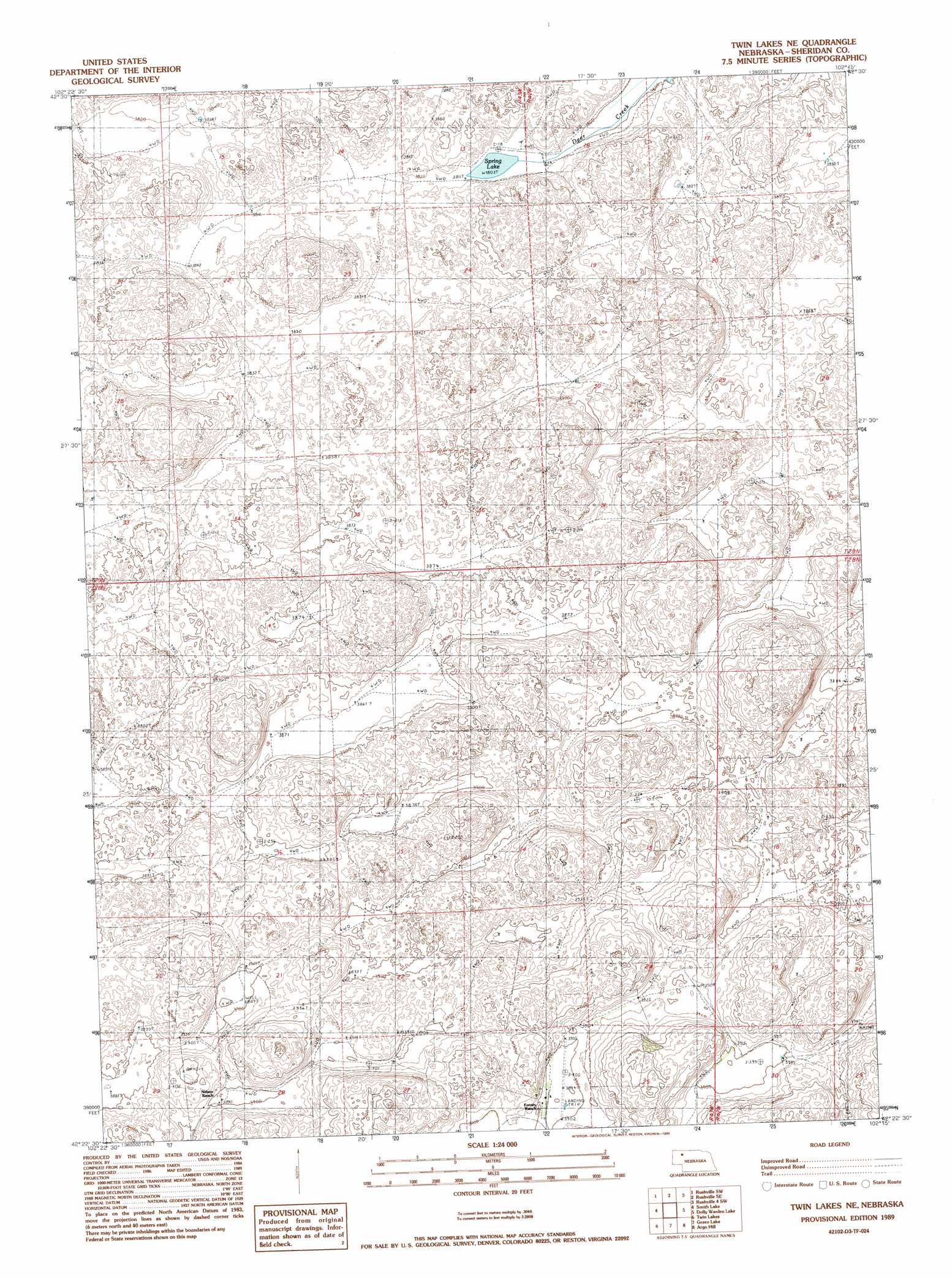
USGS Topo Quad 42102d3 - 1:24,000 scale
| Topo Map Name: | Twin Lakes Ne |
| USGS Topo Quad ID: | 42102d3 |
| Print Size: | ca. 21 1/4" wide x 27" high |
| Southeast Coordinates: | 42.375° N latitude / 102.25° W longitude |
| Map Center Coordinates: | 42.4375° N latitude / 102.3125° W longitude |
| U.S. State: | NE |
| Filename: | O42102D3.jpg |
| Download Map JPG Image: | Twin Lakes Ne topo map 1:24,000 scale |
| Map Type: | Topographic |
| Topo Series: | 7.5´ |
| Map Scale: | 1:24,000 |
| Source of Map Images: | United States Geological Survey (USGS) |
| Alternate Map Versions: |
Twin Lakes NE NE 1989, updated 1989 Download PDF Buy paper map Twin Lakes NE NE 2011 Download PDF Buy paper map Twin Lakes NE NE 2014 Download PDF Buy paper map |
1:24,000 Topo Quads surrounding Twin Lakes Ne
Hay Springs Ne |
Rushville |
Rushville Ne |
Rushville 4 Nw |
Rushville 4 Ne |
Hay Springs Se |
Rushville Sw |
Rushville Se |
Rushville 4 Sw |
Rushville 4 Se |
Skunk Lake Ne |
Smith Lake |
Twin Lakes Ne |
Dolly Warden Lake |
Billys Lake |
Skunk Lake |
Twin Lakes |
Green Lake |
Argo Hill |
Wolford Valley |
Krause Lake East |
Peter Long Lake |
White Lake |
Arnold Lake |
Lowe Valley |
> Back to 42102a1 at 1:100,000 scale
> Back to 42102a1 at 1:250,000 scale
> Back to U.S. Topo Maps home
Twin Lakes Ne topo map: Gazetteer
Twin Lakes Ne: Airports
Forney Ranch Landing Strip elevation 1189m 3900′Twin Lakes Ne: Lakes
Spring Lake elevation 1160m 3805′Twin Lakes Ne digital topo map on disk
Buy this Twin Lakes Ne topo map showing relief, roads, GPS coordinates and other geographical features, as a high-resolution digital map file on DVD:
Eastern Wyoming & Western South Dakota
Buy digital topo maps: Eastern Wyoming & Western South Dakota