Skunk Lake Ne Topo Map Nebraska
To zoom in, hover over the map of Skunk Lake Ne
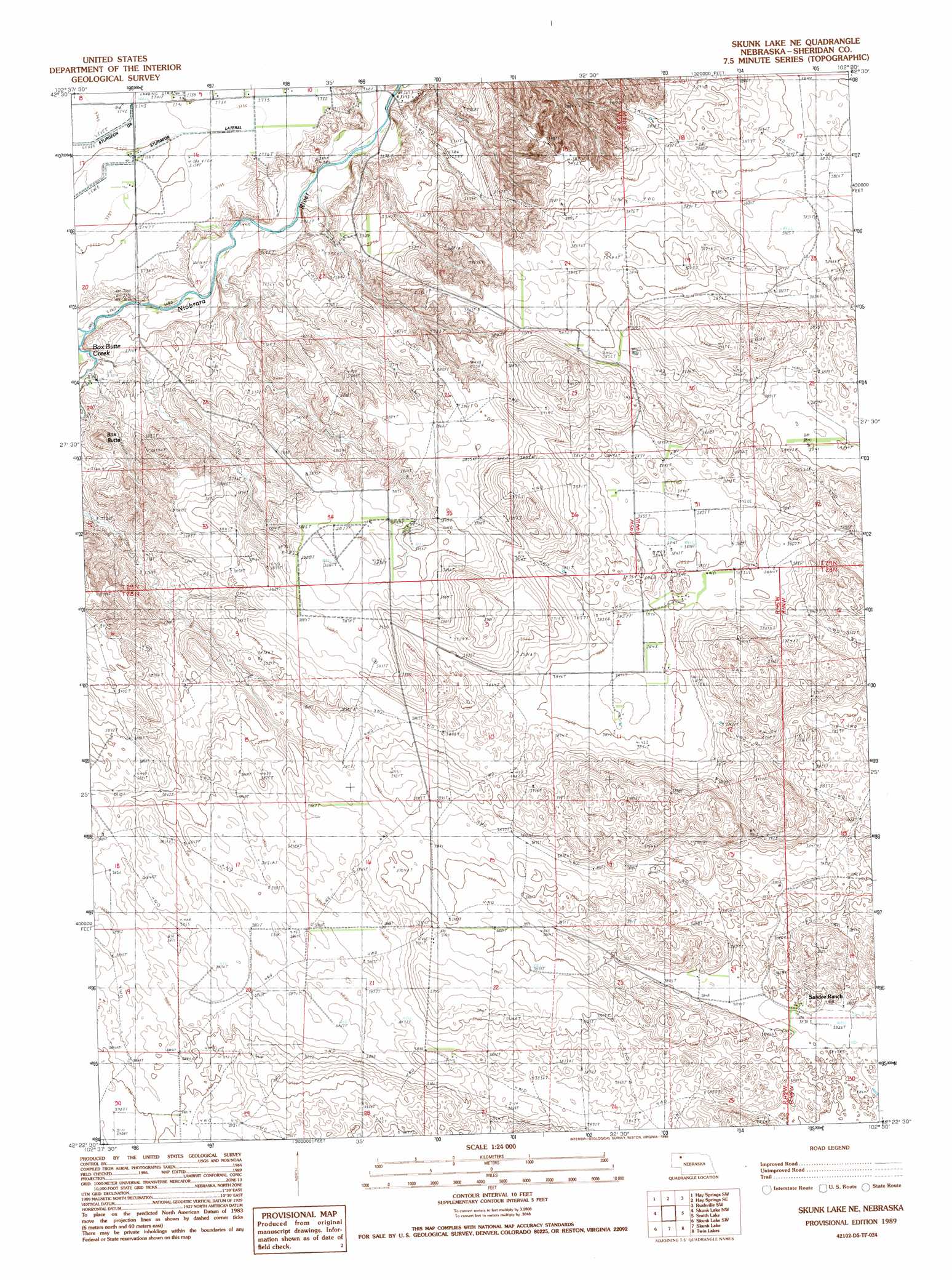
USGS Topo Quad 42102d5 - 1:24,000 scale
| Topo Map Name: | Skunk Lake Ne |
| USGS Topo Quad ID: | 42102d5 |
| Print Size: | ca. 21 1/4" wide x 27" high |
| Southeast Coordinates: | 42.375° N latitude / 102.5° W longitude |
| Map Center Coordinates: | 42.4375° N latitude / 102.5625° W longitude |
| U.S. State: | NE |
| Filename: | O42102D5.jpg |
| Download Map JPG Image: | Skunk Lake Ne topo map 1:24,000 scale |
| Map Type: | Topographic |
| Topo Series: | 7.5´ |
| Map Scale: | 1:24,000 |
| Source of Map Images: | United States Geological Survey (USGS) |
| Alternate Map Versions: |
Skunk Lake NE NE 1989, updated 1989 Download PDF Buy paper map Skunk Lake NE NE 2011 Download PDF Buy paper map Skunk Lake NE NE 2014 Download PDF Buy paper map |
1:24,000 Topo Quads surrounding Skunk Lake Ne
Chadron 3 Ne |
Hay Springs |
Hay Springs Ne |
Rushville |
Rushville Ne |
Chadron 3 Se |
Hay Springs Sw |
Hay Springs Se |
Rushville Sw |
Rushville Se |
Box Butte Ne |
Skunk Lake Nw |
Skunk Lake Ne |
Smith Lake |
Twin Lakes Ne |
Box Butte |
Skunk Lake Sw |
Skunk Lake |
Twin Lakes |
Green Lake |
Berea Creek East |
Krause Lake West |
Krause Lake East |
Peter Long Lake |
White Lake |
> Back to 42102a1 at 1:100,000 scale
> Back to 42102a1 at 1:250,000 scale
> Back to U.S. Topo Maps home
Skunk Lake Ne topo map: Gazetteer
Skunk Lake Ne: Airports
Orr Ranch Airport elevation 1187m 3894′Skunk Lake Ne: Populated Places
Hilton (historical) elevation 1175m 3854′Skunk Lake Ne: Post Offices
Cilicia Post Office (historical) elevation 1191m 3907′Hilton Post Office (historical) elevation 1175m 3854′
Skunk Lake Ne: Summits
Box Butte elevation 1171m 3841′Skunk Lake Ne digital topo map on disk
Buy this Skunk Lake Ne topo map showing relief, roads, GPS coordinates and other geographical features, as a high-resolution digital map file on DVD:
Eastern Wyoming & Western South Dakota
Buy digital topo maps: Eastern Wyoming & Western South Dakota