Chadron 3 Nw Topo Map Nebraska
To zoom in, hover over the map of Chadron 3 Nw
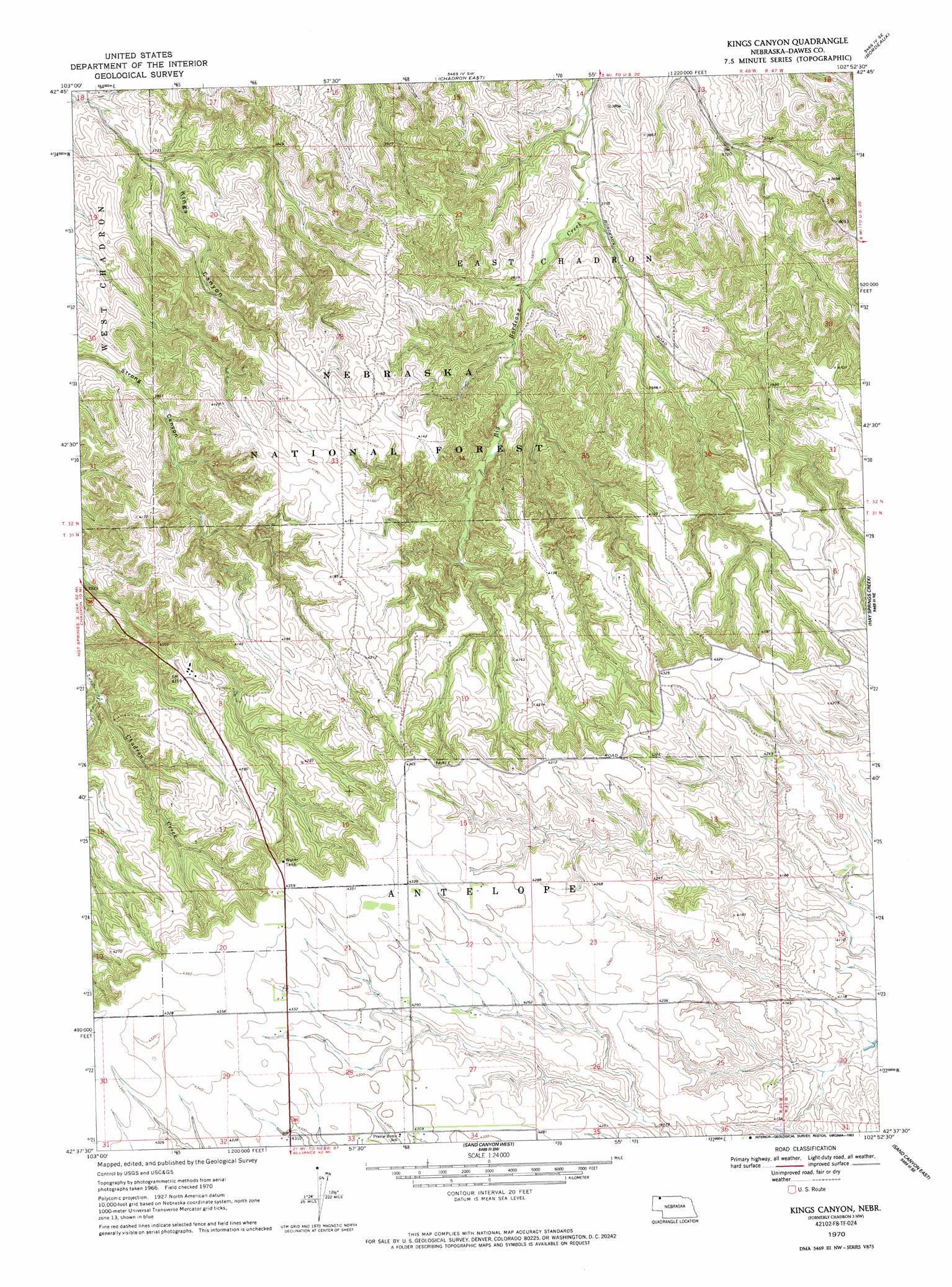
USGS Topo Quad 42102f8 - 1:24,000 scale
| Topo Map Name: | Chadron 3 Nw |
| USGS Topo Quad ID: | 42102f8 |
| Print Size: | ca. 21 1/4" wide x 27" high |
| Southeast Coordinates: | 42.625° N latitude / 102.875° W longitude |
| Map Center Coordinates: | 42.6875° N latitude / 102.9375° W longitude |
| U.S. State: | NE |
| Filename: | O42102F8.jpg |
| Download Map JPG Image: | Chadron 3 Nw topo map 1:24,000 scale |
| Map Type: | Topographic |
| Topo Series: | 7.5´ |
| Map Scale: | 1:24,000 |
| Source of Map Images: | United States Geological Survey (USGS) |
| Alternate Map Versions: |
Chadron 3 NW NE 1970, updated 1972 Download PDF Buy paper map Kings Canyon NE 1970, updated 1993 Download PDF Buy paper map Kings Canyon NE 2011 Download PDF Buy paper map Kings Canyon NE 2014 Download PDF Buy paper map |
| FStopo: | US Forest Service topo Kings Canyon is available: Download FStopo PDF Download FStopo TIF |
1:24,000 Topo Quads surrounding Chadron 3 Nw
Wayside |
Bohemian Creek |
Isinglass Buttes |
Chadron Ne |
Beaver Wall |
Trunk Butte |
Chadron West |
Chadron East |
Bordeaux |
Whiteclay Sw |
Chimney Butte |
Coffee Mill Butte |
Chadron 3 Nw |
Chadron 3 Ne |
Hay Springs |
Coffee Mill Butte Sw |
Coffee Mill Butte Se |
Chadron 3 Sw |
Chadron 3 Se |
Hay Springs Sw |
Box Butte Reservoir West |
Box Butte Reservoir East |
Box Butte Nw |
Box Butte Ne |
Skunk Lake Nw |
> Back to 42102e1 at 1:100,000 scale
> Back to 42102a1 at 1:250,000 scale
> Back to U.S. Topo Maps home
Chadron 3 Nw digital topo map on disk
Buy this Chadron 3 Nw topo map showing relief, roads, GPS coordinates and other geographical features, as a high-resolution digital map file on DVD:
Eastern Wyoming & Western South Dakota
Buy digital topo maps: Eastern Wyoming & Western South Dakota