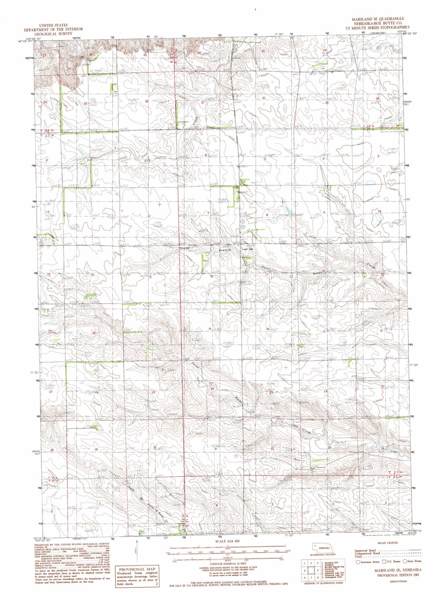
Marsland Se Topo Map Nebraska
To zoom in, hover over the map of Marsland Se
USGS Topo Quad 42103c3 - 1:24,000 scale
| Topo Map Name: | Marsland Se |
| USGS Topo Quad ID: | 42103c3 |
| Print Size: | ca. 21 1/4" wide x 27" high |
| Southeast Coordinates: | 42.25° N latitude / 103.25° W longitude |
| Map Center Coordinates: | 42.3125° N latitude / 103.3125° W longitude |
| U.S. State: | NE |
| Filename: | O42103C3.jpg |
| Download Map JPG Image: | Marsland Se topo map 1:24,000 scale |
| Map Type: | Topographic |
| Topo Series: | 7.5´ |
| Map Scale: | 1:24,000 |
| Source of Map Images: | United States Geological Survey (USGS) |
| Alternate Map Versions: |
Marsland SE NE 1983, updated 1984 Download PDF Buy paper map Marsland SE NE 2011 Download PDF Buy paper map Marsland SE NE 2014 Download PDF Buy paper map |
1:24,000 Topo Quads surrounding Marsland Se
Glen |
Dead Mans Creek |
Belmont |
Coffee Mill Butte Sw |
Coffee Mill Butte Se |
Whistle Creek Ne |
Marsland Nw |
Marsland Ne |
Box Butte Reservoir West |
Box Butte Reservoir East |
Whistle Creek Se |
Marsland Sw |
Marsland Se |
Nonpareil |
Hemingford |
University Lake Ne |
Kilpatrick Lake Nw |
Kilpatrick Lake Ne |
Hemingford 4 Nw |
Hemingford 4 Ne |
University Lake Se |
Kilpatrick Lake Sw |
Kilpatrick Lake |
Hemingford 4 Sw |
Hemingford 4 Se |
> Back to 42103a1 at 1:100,000 scale
> Back to 42102a1 at 1:250,000 scale
> Back to U.S. Topo Maps home
Marsland Se topo map: Gazetteer
Marsland Se: Dams
Henrich Dam elevation 1363m 4471′Nikont Dam elevation 1335m 4379′
Marsland Se: Parks
The Sidney-Black Hills Trail Historical Marker elevation 1368m 4488′Marsland Se: Reservoirs
Henrich Reservoir elevation 1363m 4471′Nikont Reservoir elevation 1335m 4379′
Marsland Se digital topo map on disk
Buy this Marsland Se topo map showing relief, roads, GPS coordinates and other geographical features, as a high-resolution digital map file on DVD:
Eastern Wyoming & Western South Dakota
Buy digital topo maps: Eastern Wyoming & Western South Dakota