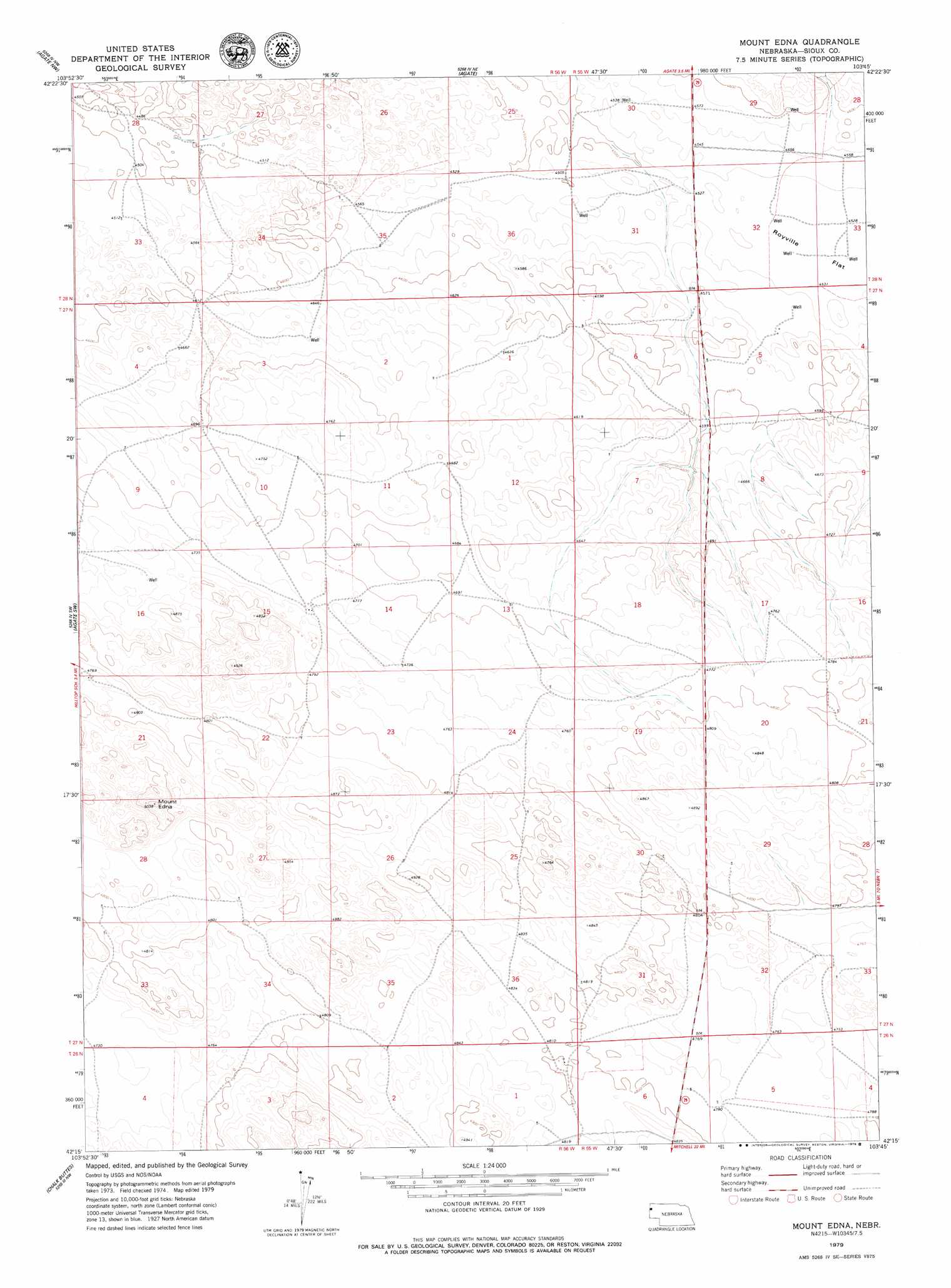
Mount Edna Topo Map Nebraska
To zoom in, hover over the map of Mount Edna
USGS Topo Quad 42103c7 - 1:24,000 scale
| Topo Map Name: | Mount Edna |
| USGS Topo Quad ID: | 42103c7 |
| Print Size: | ca. 21 1/4" wide x 27" high |
| Southeast Coordinates: | 42.25° N latitude / 103.75° W longitude |
| Map Center Coordinates: | 42.3125° N latitude / 103.8125° W longitude |
| U.S. State: | NE |
| Filename: | O42103C7.jpg |
| Download Map JPG Image: | Mount Edna topo map 1:24,000 scale |
| Map Type: | Topographic |
| Topo Series: | 7.5´ |
| Map Scale: | 1:24,000 |
| Source of Map Images: | United States Geological Survey (USGS) |
| Alternate Map Versions: |
Mount Edna NE 1979, updated 1979 Download PDF Buy paper map Mount Edna NE 2011 Download PDF Buy paper map Mount Edna NE 2014 Download PDF Buy paper map |
1:24,000 Topo Quads surrounding Mount Edna
Van Tassell Se |
Harrison Sw |
Harrison Se |
Kyle Creek |
Glen |
Lone Sand Hill |
Agate Nw |
Agate |
Whistle Creek Nw |
Whistle Creek Ne |
Spoon Butte |
Agate Sw |
Mount Edna |
Whistle Creek Sw |
Whistle Creek Se |
Carpenter Ranch |
Chalk Buttes |
Chalk Buttes Ne |
University Lake Nw |
University Lake Ne |
Torrington Se |
Dry Sheep Creek |
Erdman Ranch |
University Lake |
University Lake Se |
> Back to 42103a1 at 1:100,000 scale
> Back to 42102a1 at 1:250,000 scale
> Back to U.S. Topo Maps home
Mount Edna digital topo map on disk
Buy this Mount Edna topo map showing relief, roads, GPS coordinates and other geographical features, as a high-resolution digital map file on DVD:
Eastern Wyoming & Western South Dakota
Buy digital topo maps: Eastern Wyoming & Western South Dakota