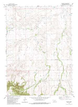
Bodarc Topo Map Nebraska
To zoom in, hover over the map of Bodarc
USGS Topo Quad 42103g7 - 1:24,000 scale
| Topo Map Name: | Bodarc |
| USGS Topo Quad ID: | 42103g7 |
| Print Size: | ca. 21 1/4" wide x 27" high |
| Southeast Coordinates: | 42.75° N latitude / 103.75° W longitude |
| Map Center Coordinates: | 42.8125° N latitude / 103.8125° W longitude |
| U.S. State: | NE |
| Filename: | O42103G7.jpg |
| Download Map JPG Image: | Bodarc topo map 1:24,000 scale |
| Map Type: | Topographic |
| Topo Series: | 7.5´ |
| Map Scale: | 1:24,000 |
| Source of Map Images: | United States Geological Survey (USGS) |
| Alternate Map Versions: |
Bodarc NE 1980, updated 1981 Download PDF Buy paper map Bodarc NE 2011 Download PDF Buy paper map Bodarc NE 2014 Download PDF Buy paper map |
1:24,000 Topo Quads surrounding Bodarc
> Back to 42103e1 at 1:100,000 scale
> Back to 42102a1 at 1:250,000 scale
> Back to U.S. Topo Maps home
Bodarc topo map: Gazetteer
Bodarc: Areas
Lady in the Shoe elevation 1465m 4806′Bodarc: Dams
Andrews Dam elevation 1237m 4058′Bill Coffee Dam Number 1 elevation 1143m 3750′
Crystal Lake Dam elevation 1243m 4078′
Plunkett Dam elevation 1207m 3959′
Spring Creek Dam elevation 1286m 4219′
Zimmerman Dam elevation 1195m 3920′
Bodarc: Forests
Oglala National Grassland elevation 1177m 3861′Bodarc: Reservoirs
Andrews Reservoir elevation 1237m 4058′Bill Coffee Reservoir Number 1 elevation 1143m 3750′
Crystal Lake Reservoir elevation 1243m 4078′
Plunkett Reservoir elevation 1207m 3959′
Spring Creek Reservoir elevation 1286m 4219′
Zimmerman Reservoir elevation 1195m 3920′
Bodarc: Streams
Boggy Creek elevation 1153m 3782′Cedar Creek elevation 1182m 3877′
Dry Boggy Creek elevation 1189m 3900′
East Hat Creek elevation 1249m 4097′
Monroe Creek elevation 1183m 3881′
Prairie Dog Creek elevation 1159m 3802′
Sowbelly Creek elevation 1159m 3802′
Spring Creek elevation 1178m 3864′
Warbonnet Creek elevation 1134m 3720′
West Hat Creek elevation 1248m 4094′
Bodarc: Valleys
Sowbelly Canyon elevation 1286m 4219′Bodarc digital topo map on disk
Buy this Bodarc topo map showing relief, roads, GPS coordinates and other geographical features, as a high-resolution digital map file on DVD:
Eastern Wyoming & Western South Dakota
Buy digital topo maps: Eastern Wyoming & Western South Dakota


