Lone Tree Ranch Topo Map Nebraska
To zoom in, hover over the map of Lone Tree Ranch
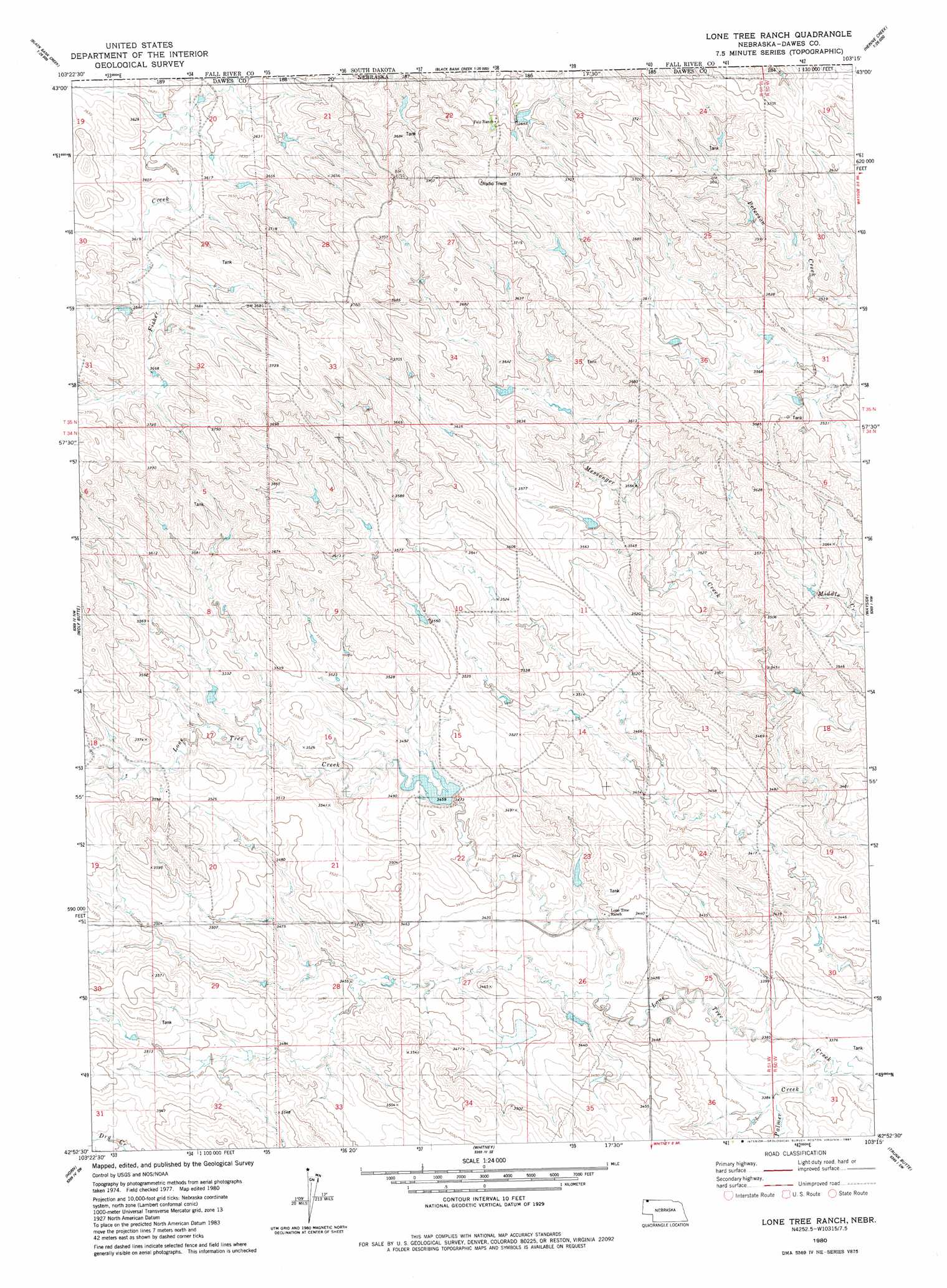
USGS Topo Quad 42103h3 - 1:24,000 scale
| Topo Map Name: | Lone Tree Ranch |
| USGS Topo Quad ID: | 42103h3 |
| Print Size: | ca. 21 1/4" wide x 27" high |
| Southeast Coordinates: | 42.875° N latitude / 103.25° W longitude |
| Map Center Coordinates: | 42.9375° N latitude / 103.3125° W longitude |
| U.S. State: | NE |
| Filename: | O42103H3.jpg |
| Download Map JPG Image: | Lone Tree Ranch topo map 1:24,000 scale |
| Map Type: | Topographic |
| Topo Series: | 7.5´ |
| Map Scale: | 1:24,000 |
| Source of Map Images: | United States Geological Survey (USGS) |
| Alternate Map Versions: |
Lone Tree Ranch NE 1980, updated 1981 Download PDF Buy paper map Lone Tree Ranch NE 2011 Download PDF Buy paper map Lone Tree Ranch NE 2014 Download PDF Buy paper map |
1:24,000 Topo Quads surrounding Lone Tree Ranch
Heppner |
Lone Well Creek West |
Lone Well Creek East |
Oelrichs |
Oelrichs Ne |
Ardmore Se |
Black Banks Creek West |
Black Banks Creek East |
Oelrichs Sw |
Heinne Creek |
Orella |
Wolf Butte |
Lone Tree Ranch |
Wayside |
Bohemian Creek |
Roundtop |
Horn |
Whitney |
Trunk Butte |
Chadron West |
Smiley Canyon |
Crawford |
Crow Butte |
Chimney Butte |
Coffee Mill Butte |
> Back to 42103e1 at 1:100,000 scale
> Back to 42102a1 at 1:250,000 scale
> Back to U.S. Topo Maps home
Lone Tree Ranch topo map: Gazetteer
Lone Tree Ranch: Dams
Bauer Dam elevation 1077m 3533′Lone Tree Dam elevation 1052m 3451′
Lone Tree Ranch: Reservoirs
Bauer Reservoir elevation 1077m 3533′Lone Tree Reservoir elevation 1052m 3451′
Lone Tree Ranch: Streams
Fisher Creek elevation 1105m 3625′Palmer Creek elevation 1030m 3379′
Lone Tree Ranch digital topo map on disk
Buy this Lone Tree Ranch topo map showing relief, roads, GPS coordinates and other geographical features, as a high-resolution digital map file on DVD:
Eastern Wyoming & Western South Dakota
Buy digital topo maps: Eastern Wyoming & Western South Dakota