Montrose Topo Map Nebraska
To zoom in, hover over the map of Montrose
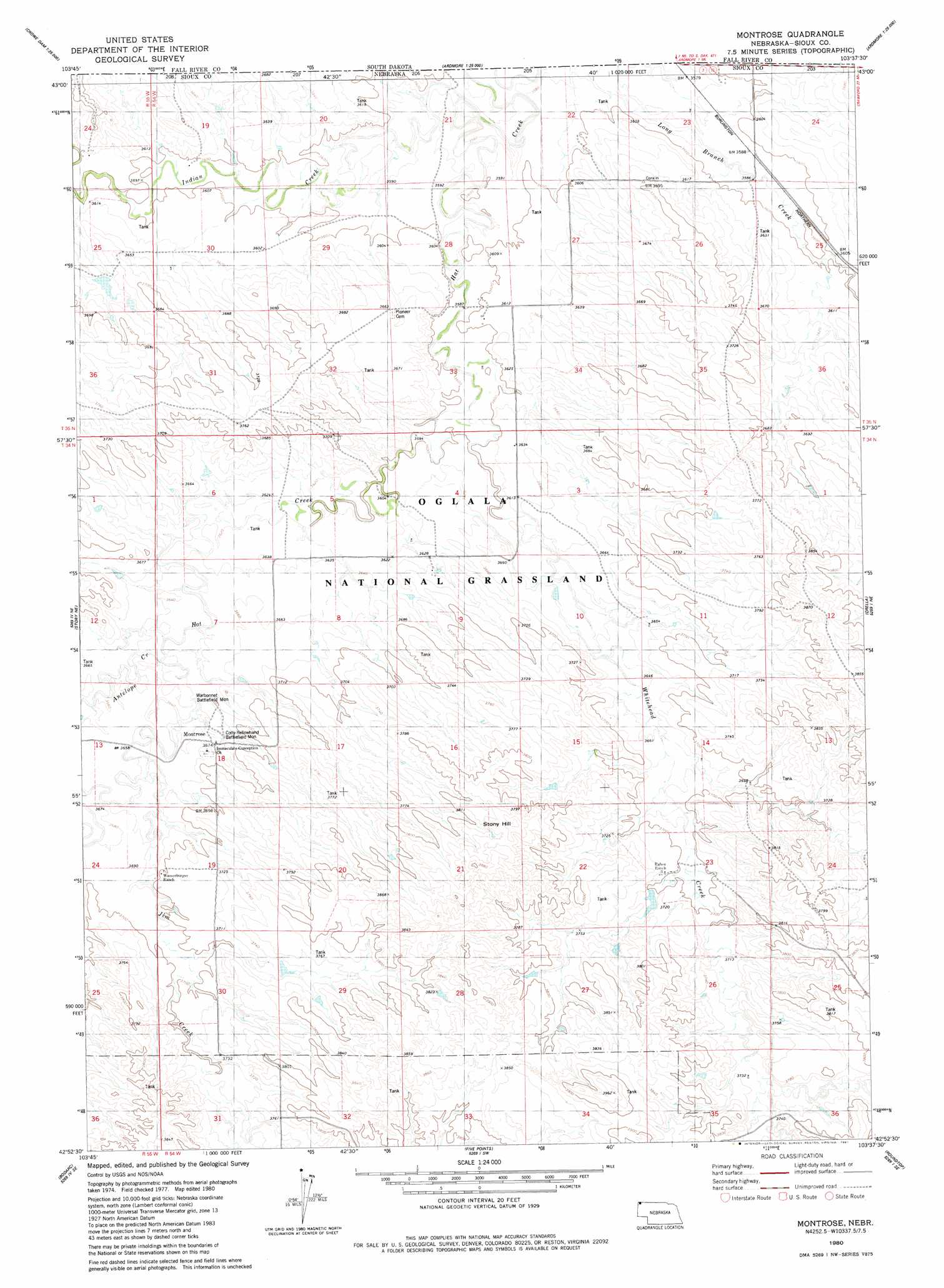
USGS Topo Quad 42103h6 - 1:24,000 scale
| Topo Map Name: | Montrose |
| USGS Topo Quad ID: | 42103h6 |
| Print Size: | ca. 21 1/4" wide x 27" high |
| Southeast Coordinates: | 42.875° N latitude / 103.625° W longitude |
| Map Center Coordinates: | 42.9375° N latitude / 103.6875° W longitude |
| U.S. State: | NE |
| Filename: | O42103H6.jpg |
| Download Map JPG Image: | Montrose topo map 1:24,000 scale |
| Map Type: | Topographic |
| Topo Series: | 7.5´ |
| Map Scale: | 1:24,000 |
| Source of Map Images: | United States Geological Survey (USGS) |
| Alternate Map Versions: |
Montrose NE 1980, updated 1981 Download PDF Buy paper map Montrose NE 2011 Download PDF Buy paper map Montrose NE 2014 Download PDF Buy paper map |
| FStopo: | US Forest Service topo Montrose is available: Download FStopo PDF Download FStopo TIF |
1:24,000 Topo Quads surrounding Montrose
Phister Ranch |
Provo |
Rumford |
Heppner |
Lone Well Creek West |
Wallace Ranch |
Crowe Dam |
Ardmore |
Ardmore Se |
Black Banks Creek West |
Story |
Story Ne |
Montrose |
Orella |
Wolf Butte |
Warbonnet Ranch |
Bodarc |
Five Points |
Roundtop |
Horn |
Harrison West |
Harrison East |
Andrews |
Smiley Canyon |
Crawford |
> Back to 42103e1 at 1:100,000 scale
> Back to 42102a1 at 1:250,000 scale
> Back to U.S. Topo Maps home
Montrose topo map: Gazetteer
Montrose: Dams
Raben Dam Number 2 elevation 1128m 3700′Semroska Dam elevation 1109m 3638′
Wiedenfeld Dam Number 1 elevation 1110m 3641′
Montrose: Parks
Cody-Yellowhand Battlefield elevation 1117m 3664′Cody-Yellowhand Battlefield Monument elevation 1128m 3700′
Warbonnet Battlefield elevation 1121m 3677′
Warbonnet Battlefield Monument elevation 1130m 3707′
Montrose: Populated Places
Montrose elevation 1116m 3661′Montrose: Post Offices
Montrose Post Office (historical) elevation 1116m 3661′Montrose: Reservoirs
Raben Reservoir Number 2 elevation 1128m 3700′Semroska Reservoir elevation 1109m 3638′
Wiedenfeld Reservoir Number 1 elevation 1110m 3641′
Montrose: Streams
Antelope Creek elevation 1107m 3631′Indian Creek elevation 1087m 3566′
Jim Creek elevation 1116m 3661′
Long Branch Creek elevation 1092m 3582′
Whitehead Creek elevation 1093m 3585′
Montrose: Summits
Stony Hill elevation 1184m 3884′Montrose digital topo map on disk
Buy this Montrose topo map showing relief, roads, GPS coordinates and other geographical features, as a high-resolution digital map file on DVD:
Eastern Wyoming & Western South Dakota
Buy digital topo maps: Eastern Wyoming & Western South Dakota