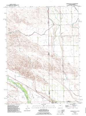
Torrington Se Topo Map Wyoming
To zoom in, hover over the map of Torrington Se
USGS Topo Quad 42104a1 - 1:24,000 scale
| Topo Map Name: | Torrington Se |
| USGS Topo Quad ID: | 42104a1 |
| Print Size: | ca. 21 1/4" wide x 27" high |
| Southeast Coordinates: | 42° N latitude / 104° W longitude |
| Map Center Coordinates: | 42.0625° N latitude / 104.0625° W longitude |
| U.S. States: | WY, NE |
| Filename: | o42104a1.jpg |
| Download Map JPG Image: | Torrington Se topo map 1:24,000 scale |
| Map Type: | Topographic |
| Topo Series: | 7.5´ |
| Map Scale: | 1:24,000 |
| Source of Map Images: | United States Geological Survey (USGS) |
| Alternate Map Versions: |
Torrington SE WY 1963, updated 1965 Download PDF Buy paper map Torrington SE WY 1990, updated 1995 Download PDF Buy paper map Torrington SE WY 2012 Download PDF Buy paper map Torrington SE WY 2015 Download PDF Buy paper map |
1:24,000 Topo Quads surrounding Torrington Se
> Back to 42104a1 at 1:100,000 scale
> Back to 42104a1 at 1:250,000 scale
> Back to U.S. Topo Maps home
Torrington Se topo map: Gazetteer
Torrington Se: Canals
Lateral 7 Main elevation 1272m 4173′Lateral Number 1 elevation 1274m 4179′
Lateral Number 2 elevation 1284m 4212′
Lateral Number 2 elevation 1284m 4212′
Lateral Number 3 elevation 1270m 4166′
Lateral Number 4 elevation 1282m 4206′
Torrington Se: Flats
Hunton Meadows elevation 1233m 4045′Torrington Se: Mines
CCI Pit elevation 1240m 4068′Torrington Se digital topo map on disk
Buy this Torrington Se topo map showing relief, roads, GPS coordinates and other geographical features, as a high-resolution digital map file on DVD:
Eastern Wyoming & Western South Dakota
Buy digital topo maps: Eastern Wyoming & Western South Dakota


