Rock Eagle Topo Map Wyoming
To zoom in, hover over the map of Rock Eagle
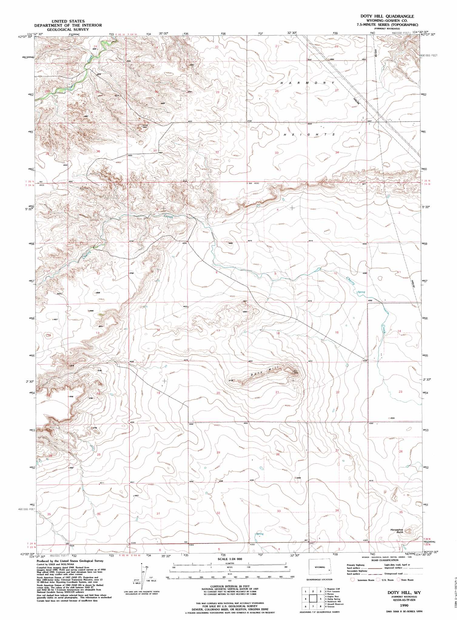
USGS Topo Quad 42104a5 - 1:24,000 scale
| Topo Map Name: | Rock Eagle |
| USGS Topo Quad ID: | 42104a5 |
| Print Size: | ca. 21 1/4" wide x 27" high |
| Southeast Coordinates: | 42° N latitude / 104.5° W longitude |
| Map Center Coordinates: | 42.0625° N latitude / 104.5625° W longitude |
| U.S. State: | WY |
| Filename: | o42104a5.jpg |
| Download Map JPG Image: | Rock Eagle topo map 1:24,000 scale |
| Map Type: | Topographic |
| Topo Series: | 7.5´ |
| Map Scale: | 1:24,000 |
| Source of Map Images: | United States Geological Survey (USGS) |
| Alternate Map Versions: |
Rockeagle WY 1950, updated 1952 Download PDF Buy paper map Rockeagle WY 1950, updated 1973 Download PDF Buy paper map Rockeagle WY 1950, updated 1978 Download PDF Buy paper map Rockeagle WY 1950, updated 1991 Download PDF Buy paper map Rockeagle WY 1950, updated 1993 Download PDF Buy paper map Doty Hill WY 1990, updated 1995 Download PDF Buy paper map Doty Hill WY 2012 Download PDF Buy paper map Doty Hill WY 2015 Download PDF Buy paper map |
1:24,000 Topo Quads surrounding Rock Eagle
Guernsey Reservoir |
Guernsey |
Casebier Hill |
Red Cloud Creek West |
Red Cloud Creek East |
Wheatland Ne |
Register Cliff |
Fort Laramie |
Barnes |
Lingle |
Antelope Gap |
Eagles Nest |
Rock Eagle |
Habig Spring |
Cottier |
Bordeaux |
Dickinson Hill |
Glomill Reservoir |
Veteran |
Yoder |
Chugwater |
Klutz Canyon |
Y B O Ranch |
Needle Rock |
Hawk Springs |
> Back to 42104a1 at 1:100,000 scale
> Back to 42104a1 at 1:250,000 scale
> Back to U.S. Topo Maps home
Rock Eagle topo map: Gazetteer
Rock Eagle: Basins
Goshen Hole elevation 1353m 4438′Rock Eagle: Dams
Long Gulch Dam elevation 1399m 4589′Rock Eagle: Flats
Harmony Heights elevation 1410m 4625′Rock Eagle: Populated Places
Rockeagle elevation 1339m 4393′Rock Eagle: Reservoirs
Long Gulch Reservoir elevation 1399m 4589′Rock Eagle: Summits
Doty Hill elevation 1443m 4734′Horseshoe Butte elevation 1350m 4429′
Rock Eagle digital topo map on disk
Buy this Rock Eagle topo map showing relief, roads, GPS coordinates and other geographical features, as a high-resolution digital map file on DVD:
Eastern Wyoming & Western South Dakota
Buy digital topo maps: Eastern Wyoming & Western South Dakota