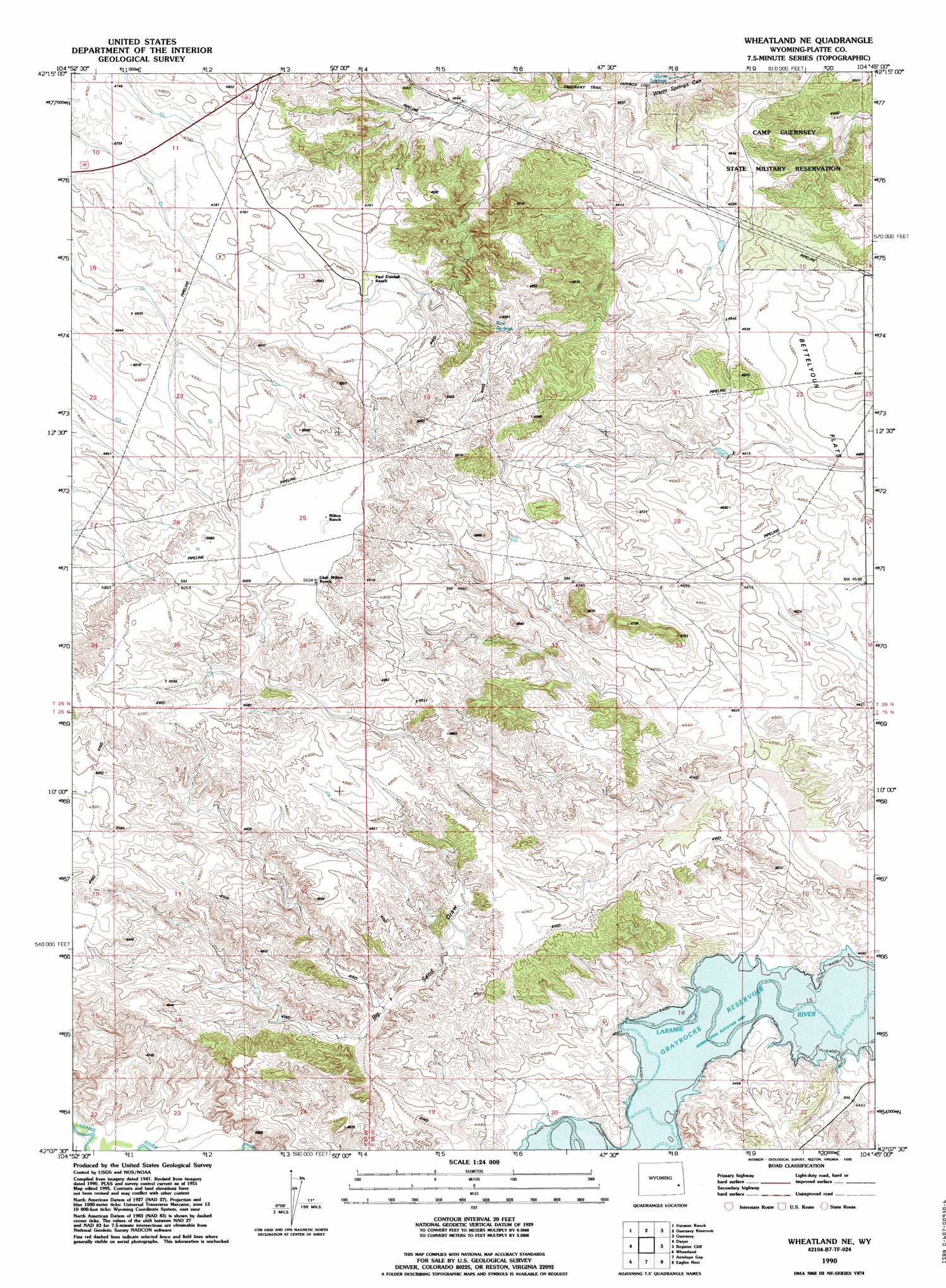
Wheatland Ne Topo Map Wyoming
To zoom in, hover over the map of Wheatland Ne
USGS Topo Quad 42104b7 - 1:24,000 scale
| Topo Map Name: | Wheatland Ne |
| USGS Topo Quad ID: | 42104b7 |
| Print Size: | ca. 21 1/4" wide x 27" high |
| Southeast Coordinates: | 42.125° N latitude / 104.75° W longitude |
| Map Center Coordinates: | 42.1875° N latitude / 104.8125° W longitude |
| U.S. State: | WY |
| Filename: | o42104b7.jpg |
| Download Map JPG Image: | Wheatland Ne topo map 1:24,000 scale |
| Map Type: | Topographic |
| Topo Series: | 7.5´ |
| Map Scale: | 1:24,000 |
| Source of Map Images: | United States Geological Survey (USGS) |
| Alternate Map Versions: |
Wheatland NE WY 1951, updated 1953 Download PDF Buy paper map Wheatland NE WY 1951, updated 1973 Download PDF Buy paper map Wheatland NE WY 1990, updated 1995 Download PDF Buy paper map Wheatland NE WY 2012 Download PDF Buy paper map Wheatland NE WY 2015 Download PDF Buy paper map |
1:24,000 Topo Quads surrounding Wheatland Ne
Sibley Peak |
Cassa |
Haushar Ranch |
Hell Gap |
Moore Spring |
Coleman Butte |
Herman Ranch |
Guernsey Reservoir |
Guernsey |
Casebier Hill |
Lewis Flat |
Dwyer |
Wheatland Ne |
Register Cliff |
Fort Laramie |
Hightower |
Wheatland |
Antelope Gap |
Eagles Nest |
Rock Eagle |
Natwick |
Ferguson Corner |
Bordeaux |
Dickinson Hill |
Glomill Reservoir |
> Back to 42104a1 at 1:100,000 scale
> Back to 42104a1 at 1:250,000 scale
> Back to U.S. Topo Maps home
Wheatland Ne topo map: Gazetteer
Wheatland Ne: Dams
McComb Dam elevation 1400m 4593′Wheatland Ne: Reservoirs
McComb Reservoir elevation 1400m 4593′Wheatland Ne: Springs
Box Springs elevation 1466m 4809′Warm Springs elevation 1351m 4432′
Wheatland Ne digital topo map on disk
Buy this Wheatland Ne topo map showing relief, roads, GPS coordinates and other geographical features, as a high-resolution digital map file on DVD:
Eastern Wyoming & Western South Dakota
Buy digital topo maps: Eastern Wyoming & Western South Dakota