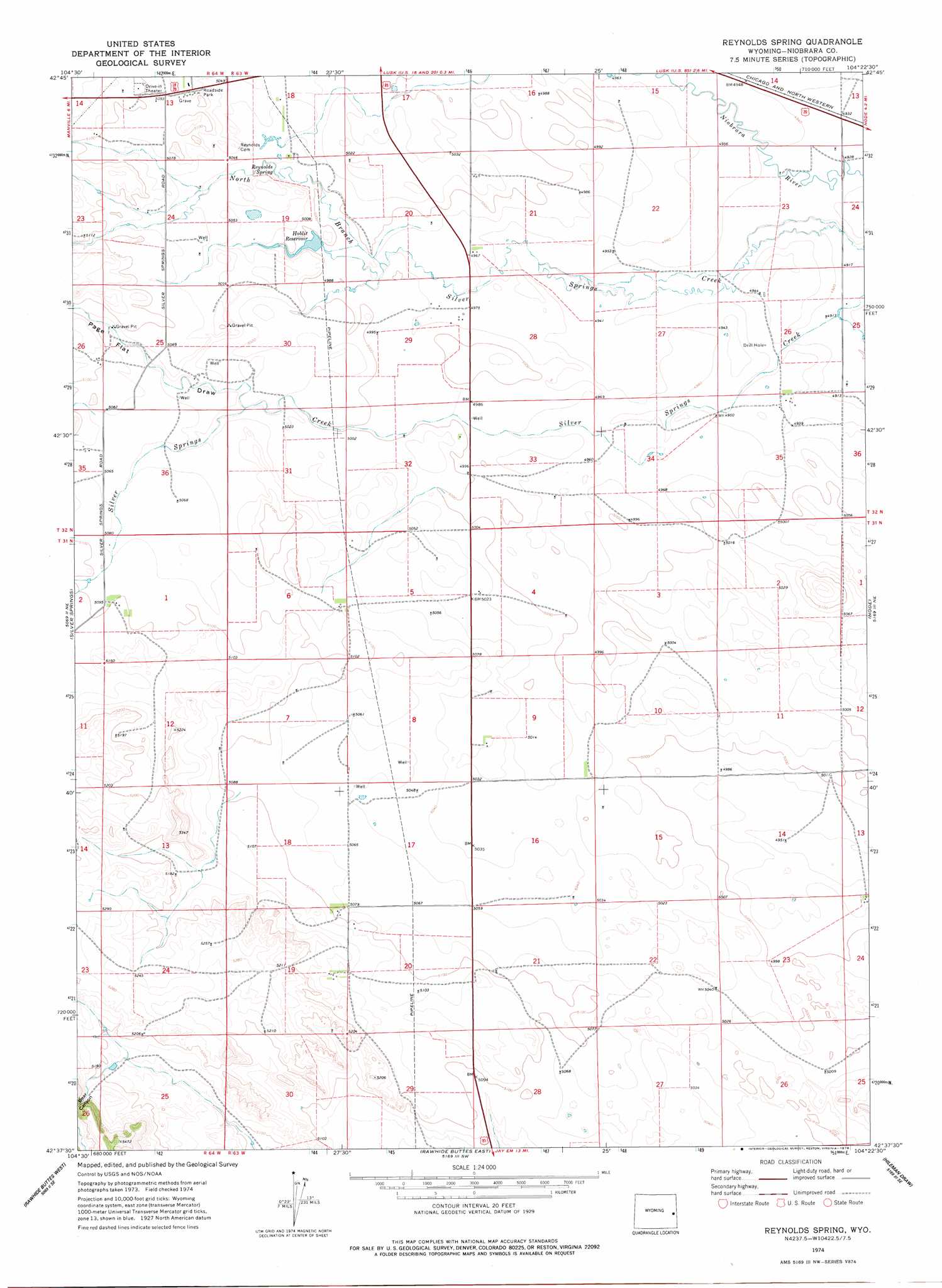
Reynolds Spring Topo Map Wyoming
To zoom in, hover over the map of Reynolds Spring
USGS Topo Quad 42104f4 - 1:24,000 scale
| Topo Map Name: | Reynolds Spring |
| USGS Topo Quad ID: | 42104f4 |
| Print Size: | ca. 21 1/4" wide x 27" high |
| Southeast Coordinates: | 42.625° N latitude / 104.375° W longitude |
| Map Center Coordinates: | 42.6875° N latitude / 104.4375° W longitude |
| U.S. State: | WY |
| Filename: | o42104f4.jpg |
| Download Map JPG Image: | Reynolds Spring topo map 1:24,000 scale |
| Map Type: | Topographic |
| Topo Series: | 7.5´ |
| Map Scale: | 1:24,000 |
| Source of Map Images: | United States Geological Survey (USGS) |
| Alternate Map Versions: |
Reynolds Spring WY 1974, updated 1978 Download PDF Buy paper map Reynolds Spring WY 2012 Download PDF Buy paper map Reynolds Spring WY 2015 Download PDF Buy paper map |
1:24,000 Topo Quads surrounding Reynolds Spring
Flat Top |
Manville Ne |
Hat Rock |
Hat Creek |
Shepherds Point |
Bills Creek |
Manville |
Lusk |
Signature Rock |
Kirtley Sw |
Lone Tree Hill |
Silver Springs |
Reynolds Spring |
Node |
Mcmaster Reservoir |
Meadowdale |
Rawhide Butte West |
Rawhide Buttes East |
Hileman Draw |
Prairie Center |
Hell Gap |
Moore Spring |
Jay Em Nw |
Jay Em |
Spoon Butte Nw |
> Back to 42104e1 at 1:100,000 scale
> Back to 42104a1 at 1:250,000 scale
> Back to U.S. Topo Maps home
Reynolds Spring topo map: Gazetteer
Reynolds Spring: Dams
Hoblit Dam elevation 1524m 5000′Reynolds Spring: Reservoirs
Hoblit Reservoir elevation 1524m 5000′Hoblit Reservoir elevation 1522m 4993′
Reynolds Spring: Springs
Reynolds Spring elevation 1530m 5019′Reynolds Spring: Streams
North Branch Silver Springs Creek elevation 1498m 4914′Reynolds Spring: Valleys
Bear Canyon elevation 1592m 5223′Page Flat Draw elevation 1530m 5019′
Reynolds Spring digital topo map on disk
Buy this Reynolds Spring topo map showing relief, roads, GPS coordinates and other geographical features, as a high-resolution digital map file on DVD:
Eastern Wyoming & Western South Dakota
Buy digital topo maps: Eastern Wyoming & Western South Dakota