Signature Rock Topo Map Wyoming
To zoom in, hover over the map of Signature Rock
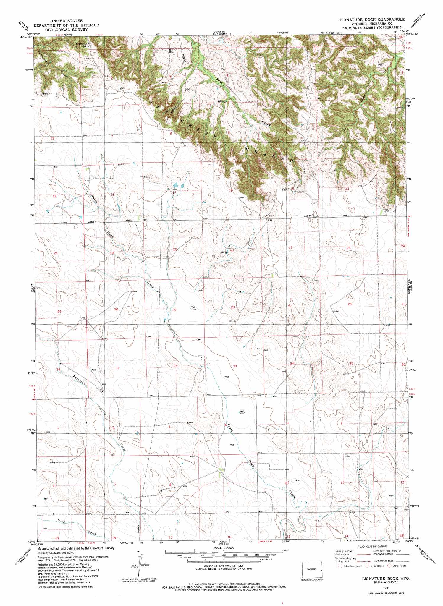
USGS Topo Quad 42104g3 - 1:24,000 scale
| Topo Map Name: | Signature Rock |
| USGS Topo Quad ID: | 42104g3 |
| Print Size: | ca. 21 1/4" wide x 27" high |
| Southeast Coordinates: | 42.75° N latitude / 104.25° W longitude |
| Map Center Coordinates: | 42.8125° N latitude / 104.3125° W longitude |
| U.S. State: | WY |
| Filename: | o42104g3.jpg |
| Download Map JPG Image: | Signature Rock topo map 1:24,000 scale |
| Map Type: | Topographic |
| Topo Series: | 7.5´ |
| Map Scale: | 1:24,000 |
| Source of Map Images: | United States Geological Survey (USGS) |
| Alternate Map Versions: |
Signature Rock WY 1981, updated 1981 Download PDF Buy paper map Signature Rock WY 2012 Download PDF Buy paper map Signature Rock WY 2015 Download PDF Buy paper map |
1:24,000 Topo Quads surrounding Signature Rock
Rabbit Mountains |
Telephone Draw |
Coyote Gap |
South Oat Creek |
Oat Creek |
Manville Ne |
Hat Rock |
Hat Creek |
Shepherds Point |
Sherrill Hills |
Manville |
Lusk |
Signature Rock |
Kirtley Sw |
Kirtley |
Silver Springs |
Reynolds Spring |
Node |
Mcmaster Reservoir |
Van Tassell |
Rawhide Butte West |
Rawhide Buttes East |
Hileman Draw |
Prairie Center |
Van Tassell Se |
> Back to 42104e1 at 1:100,000 scale
> Back to 42104a1 at 1:250,000 scale
> Back to U.S. Topo Maps home
Signature Rock topo map: Gazetteer
Signature Rock: Dams
A L Lind Number 1 Dam elevation 1510m 4954′Signature Rock: Ranges
Hat Creek Breaks elevation 1481m 4858′Signature Rock: Reservoirs
A L Lind Reservoir Number 1 elevation 1510m 4954′Signature Rock: Summits
Signature Rock elevation 1539m 5049′Signature Rock digital topo map on disk
Buy this Signature Rock topo map showing relief, roads, GPS coordinates and other geographical features, as a high-resolution digital map file on DVD:
Eastern Wyoming & Western South Dakota
Buy digital topo maps: Eastern Wyoming & Western South Dakota