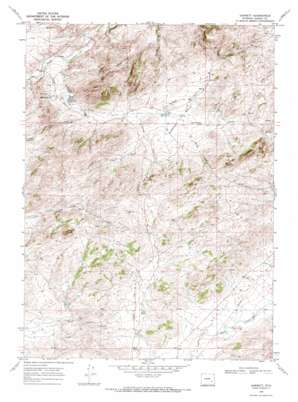
Garrett Topo Map Wyoming
To zoom in, hover over the map of Garrett
USGS Topo Quad 42105a5 - 1:24,000 scale
| Topo Map Name: | Garrett |
| USGS Topo Quad ID: | 42105a5 |
| Print Size: | ca. 21 1/4" wide x 27" high |
| Southeast Coordinates: | 42° N latitude / 105.5° W longitude |
| Map Center Coordinates: | 42.0625° N latitude / 105.5625° W longitude |
| U.S. State: | WY |
| Filename: | o42105a5.jpg |
| Download Map JPG Image: | Garrett topo map 1:24,000 scale |
| Map Type: | Topographic |
| Topo Series: | 7.5´ |
| Map Scale: | 1:24,000 |
| Source of Map Images: | United States Geological Survey (USGS) |
| Alternate Map Versions: |
Garrett WY 1968, updated 1972 Download PDF Buy paper map Garrett WY 2012 Download PDF Buy paper map Garrett WY 2015 Download PDF Buy paper map |
1:24,000 Topo Quads surrounding Garrett
> Back to 42105a1 at 1:100,000 scale
> Back to 42104a1 at 1:250,000 scale
> Back to U.S. Topo Maps home
Garrett topo map: Gazetteer
Garrett: Basins
Antelope Basin elevation 2165m 7103′Garrett: Dams
Duck Creek Number 1 Dam elevation 2232m 7322′M G Dam elevation 2232m 7322′
Sid Number 1 Dam elevation 2177m 7142′
Sturgeon Number 3 Dam elevation 2111m 6925′
Garrett: Mines
Nipper Number One Claim elevation 2192m 7191′Garrett: Reservoirs
Duck Creek Reservoir elevation 2232m 7322′M G Reservoir elevation 2232m 7322′
Sid Number 1 Reservoir elevation 2177m 7142′
Sturgeon Number 3 Reservoir elevation 2111m 6925′
Sturgeon Reservoir Number 1 elevation 2158m 7080′
Sturgeon Reservoir Number 2 elevation 2098m 6883′
Garrett: Springs
Asbestos Spring elevation 2104m 6902′Kite Spring elevation 2165m 7103′
Garrett: Streams
Antelope Creek elevation 2061m 6761′Garlock Creek elevation 2153m 7063′
George Creek elevation 2139m 7017′
North Fork Duck Creek elevation 2163m 7096′
Prager Creek elevation 2161m 7089′
Garrett: Summits
Brandel Mountain elevation 2350m 7709′Pinto Rocks elevation 2424m 7952′
Sellers Mountain elevation 2262m 7421′
Garrett: Valleys
Fallas Draw elevation 2152m 7060′Spring Gulch elevation 2104m 6902′
Wildcat Gulch elevation 2051m 6729′
Willow Gulch elevation 2164m 7099′
Garrett digital topo map on disk
Buy this Garrett topo map showing relief, roads, GPS coordinates and other geographical features, as a high-resolution digital map file on DVD:
Eastern Wyoming & Western South Dakota
Buy digital topo maps: Eastern Wyoming & Western South Dakota


