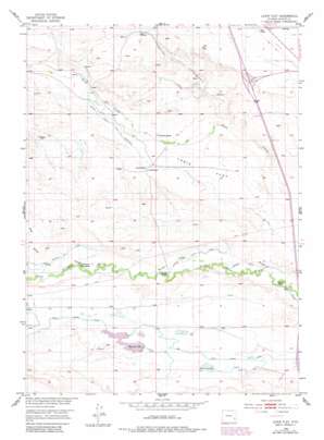
Lewis Flat Topo Map Wyoming
To zoom in, hover over the map of Lewis Flat
USGS Topo Quad 42105b1 - 1:24,000 scale
| Topo Map Name: | Lewis Flat |
| USGS Topo Quad ID: | 42105b1 |
| Print Size: | ca. 21 1/4" wide x 27" high |
| Southeast Coordinates: | 42.125° N latitude / 105° W longitude |
| Map Center Coordinates: | 42.1875° N latitude / 105.0625° W longitude |
| U.S. State: | WY |
| Filename: | o42105b1.jpg |
| Download Map JPG Image: | Lewis Flat topo map 1:24,000 scale |
| Map Type: | Topographic |
| Topo Series: | 7.5´ |
| Map Scale: | 1:24,000 |
| Source of Map Images: | United States Geological Survey (USGS) |
| Alternate Map Versions: |
Lewis Flat WY 1953, updated 1954 Download PDF Buy paper map Lewis Flat WY 1953, updated 1982 Download PDF Buy paper map Lewis Flat WY 2012 Download PDF Buy paper map Lewis Flat WY 2015 Download PDF Buy paper map |
1:24,000 Topo Quads surrounding Lewis Flat
> Back to 42105a1 at 1:100,000 scale
> Back to 42104a1 at 1:250,000 scale
> Back to U.S. Topo Maps home
Lewis Flat topo map: Gazetteer
Lewis Flat: Canals
Ditch Number 1 elevation 1442m 4730′Lowica Ditch Number 2 elevation 1454m 4770′
Mitchell Ditch Number 1 elevation 1395m 4576′
North Laramie Canal elevation 1445m 4740′
North Laramie Ditch Number 3 elevation 1404m 4606′
Lewis Flat: Dams
Loren Ramsey Fish Dam elevation 1471m 4826′N Laramie Land Company Number 1 Dam elevation 1453m 4767′
Lewis Flat: Flats
Lewis Flat elevation 1470m 4822′Lewis Flat: Reservoirs
Loren Ramsey Fish Reservoir elevation 1471m 4826′N Laramie Land Company Number 1 Reservoir elevation 1453m 4767′
Reservoir Number 1 elevation 1452m 4763′
Reservoir Number 2 elevation 1439m 4721′
Lewis Flat: Springs
Mud Springs elevation 1499m 4917′Lewis Flat: Streams
Mud Springs Branch elevation 1447m 4747′Lewis Flat: Valleys
Big Draw elevation 1426m 4678′Lewis Flat digital topo map on disk
Buy this Lewis Flat topo map showing relief, roads, GPS coordinates and other geographical features, as a high-resolution digital map file on DVD:
Eastern Wyoming & Western South Dakota
Buy digital topo maps: Eastern Wyoming & Western South Dakota


