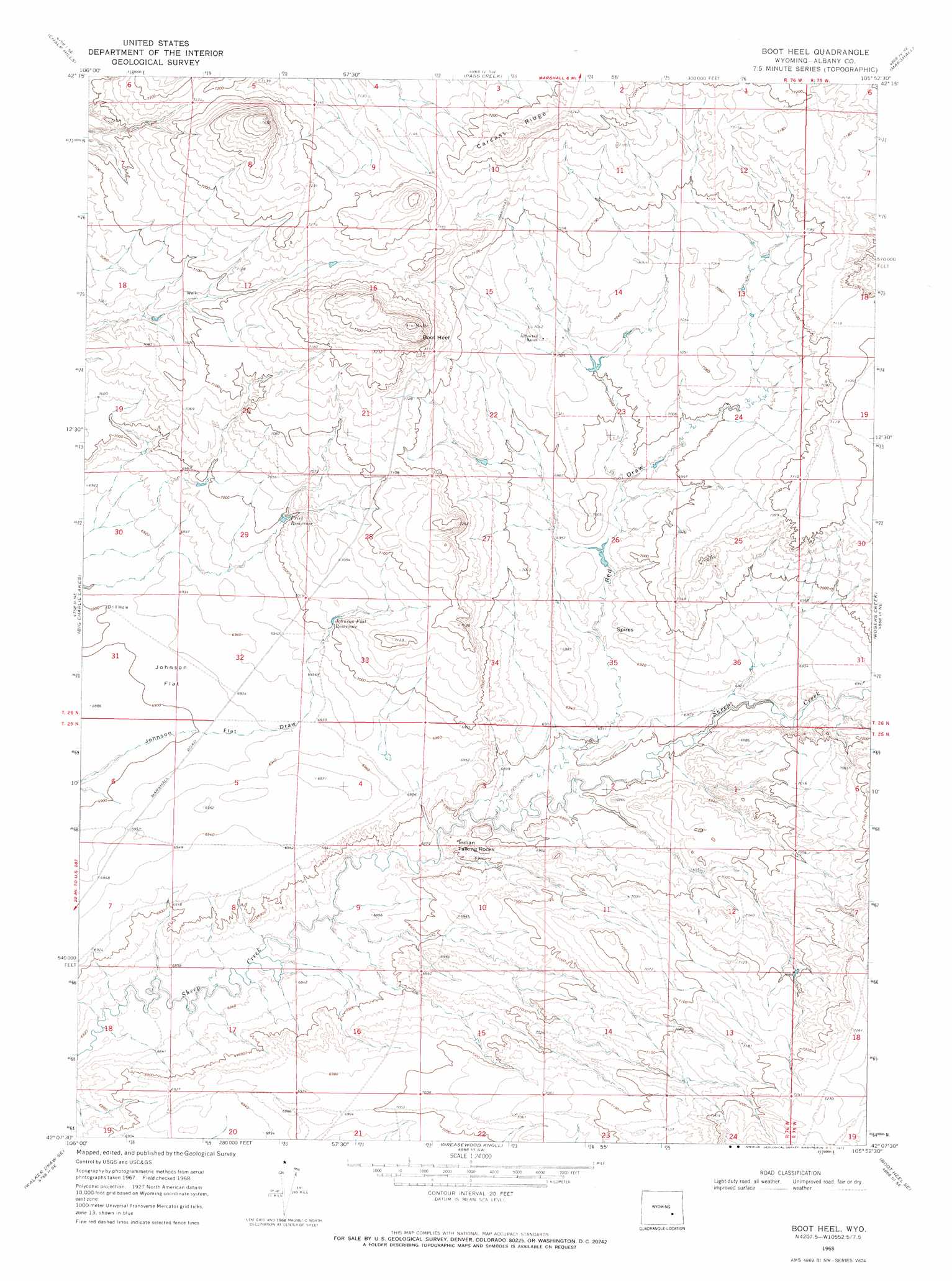
Boot Heel Topo Map Wyoming
To zoom in, hover over the map of Boot Heel
USGS Topo Quad 42105b8 - 1:24,000 scale
| Topo Map Name: | Boot Heel |
| USGS Topo Quad ID: | 42105b8 |
| Print Size: | ca. 21 1/4" wide x 27" high |
| Southeast Coordinates: | 42.125° N latitude / 105.875° W longitude |
| Map Center Coordinates: | 42.1875° N latitude / 105.9375° W longitude |
| U.S. State: | WY |
| Filename: | o42105b8.jpg |
| Download Map JPG Image: | Boot Heel topo map 1:24,000 scale |
| Map Type: | Topographic |
| Topo Series: | 7.5´ |
| Map Scale: | 1:24,000 |
| Source of Map Images: | United States Geological Survey (USGS) |
| Alternate Map Versions: |
Boot Heel WY 1968, updated 1972 Download PDF Buy paper map Boot Heel WY 2012 Download PDF Buy paper map Boot Heel WY 2015 Download PDF Buy paper map |
1:24,000 Topo Quads surrounding Boot Heel
Bates Creek Reservoir |
Squaw Spring |
Rock Creek |
Warbonnett Peak |
School Section Mountain |
Moss Agate Reservoir |
Chalk Hills |
Pass Creek |
Marshall |
Toltec |
Walker Draw Nw |
Big Charlie Lakes |
Boot Heel |
Rogers Creek |
Cottonwood Creek |
T B Ranch |
Walker Draw Se |
Greasewood Knoll |
Boot Heel Se |
Pinto Creek |
Medicine Bow |
Aurora Lake |
Pine Tree Ridge |
Sevenmile Spring |
Ayres Spring |
> Back to 42105a1 at 1:100,000 scale
> Back to 42104a1 at 1:250,000 scale
> Back to U.S. Topo Maps home
Boot Heel topo map: Gazetteer
Boot Heel: Flats
Johnson Flat elevation 2109m 6919′Boot Heel: Mines
Cowboy Claim Number One elevation 2191m 7188′Boot Heel: Reservoirs
Johnson Flat Reservoir elevation 2135m 7004′Priet Reservoir elevation 2134m 7001′
Boot Heel: Ridges
Carcass Ridge elevation 2214m 7263′Boot Heel: Summits
Boot Heel elevation 2254m 7395′Boot Heel: Valleys
Red Draw elevation 2110m 6922′Boot Heel digital topo map on disk
Buy this Boot Heel topo map showing relief, roads, GPS coordinates and other geographical features, as a high-resolution digital map file on DVD:
Eastern Wyoming & Western South Dakota
Buy digital topo maps: Eastern Wyoming & Western South Dakota