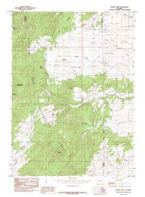
Harris Park Topo Map Wyoming
To zoom in, hover over the map of Harris Park
USGS Topo Quad 42105c3 - 1:24,000 scale
| Topo Map Name: | Harris Park |
| USGS Topo Quad ID: | 42105c3 |
| Print Size: | ca. 21 1/4" wide x 27" high |
| Southeast Coordinates: | 42.25° N latitude / 105.25° W longitude |
| Map Center Coordinates: | 42.3125° N latitude / 105.3125° W longitude |
| U.S. State: | WY |
| Filename: | o42105c3.jpg |
| Download Map JPG Image: | Harris Park topo map 1:24,000 scale |
| Map Type: | Topographic |
| Topo Series: | 7.5´ |
| Map Scale: | 1:24,000 |
| Source of Map Images: | United States Geological Survey (USGS) |
| Alternate Map Versions: |
Harris Park WY 1985, updated 1985 Download PDF Buy paper map Harris Park WY 1992, updated 1996 Download PDF Buy paper map Harris Park WY 2012 Download PDF Buy paper map Harris Park WY 2015 Download PDF Buy paper map |
| FStopo: | US Forest Service topo Harris Park is available: Download FStopo PDF Download FStopo TIF |
1:24,000 Topo Quads surrounding Harris Park
> Back to 42105a1 at 1:100,000 scale
> Back to 42104a1 at 1:250,000 scale
> Back to U.S. Topo Maps home
Harris Park topo map: Gazetteer
Harris Park: Airports
Hagemeisters Twin Pine Ranch Airport elevation 1862m 6108′Harris Park: Flats
Harris Park elevation 1864m 6115′Harris Park: Populated Places
Binford elevation 1934m 6345′Point of Rocks elevation 1844m 6049′
Harris Park: Streams
Fall Creek elevation 1801m 5908′Fall Creek elevation 1801m 5908′
Mill Creek elevation 1693m 5554′
North Cottonwood Creek elevation 1887m 6190′
Preacher Creek elevation 1711m 5613′
Harris Park: Summits
Albany Peak elevation 2324m 7624′Elliott Point elevation 1966m 6450′
Harmon Heights elevation 1982m 6502′
Harris Park digital topo map on disk
Buy this Harris Park topo map showing relief, roads, GPS coordinates and other geographical features, as a high-resolution digital map file on DVD:
Eastern Wyoming & Western South Dakota
Buy digital topo maps: Eastern Wyoming & Western South Dakota


