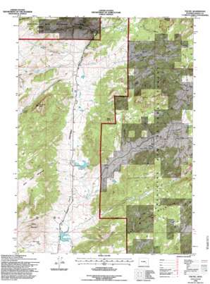
Toltec Topo Map Wyoming
To zoom in, hover over the map of Toltec
USGS Topo Quad 42105c6 - 1:24,000 scale
| Topo Map Name: | Toltec |
| USGS Topo Quad ID: | 42105c6 |
| Print Size: | ca. 21 1/4" wide x 27" high |
| Southeast Coordinates: | 42.25° N latitude / 105.625° W longitude |
| Map Center Coordinates: | 42.3125° N latitude / 105.6875° W longitude |
| U.S. State: | WY |
| Filename: | o42105c6.jpg |
| Download Map JPG Image: | Toltec topo map 1:24,000 scale |
| Map Type: | Topographic |
| Topo Series: | 7.5´ |
| Map Scale: | 1:24,000 |
| Source of Map Images: | United States Geological Survey (USGS) |
| Alternate Map Versions: |
Toltec WY 1964, updated 1967 Download PDF Buy paper map Toltec WY 1964, updated 1985 Download PDF Buy paper map Toltec WY 1992, updated 1996 Download PDF Buy paper map Toltec WY 2012 Download PDF Buy paper map Toltec WY 2015 Download PDF Buy paper map |
| FStopo: | US Forest Service topo Toltec is available: Download FStopo PDF Download FStopo TIF |
1:24,000 Topo Quads surrounding Toltec
> Back to 42105a1 at 1:100,000 scale
> Back to 42104a1 at 1:250,000 scale
> Back to U.S. Topo Maps home
Toltec topo map: Gazetteer
Toltec: Dams
Bar M Number 2 Dam elevation 2500m 8202′Bell and Scranton Number 1 Dam elevation 2305m 7562′
Bell and Scranton Number 1 Dam elevation 2432m 7979′
Kafka Number 1 Dam elevation 2275m 7463′
Phillips Number 1 Dam elevation 2360m 7742′
Toltec: Flats
Fortymile Flat elevation 2330m 7644′Toltec: Gaps
Ellison Pass elevation 2485m 8152′Mule Creek Pass elevation 2323m 7621′
Reed Pass elevation 2393m 7851′
Toltec: Mines
Albany Number One Claim elevation 2499m 8198′Toltec: Populated Places
Reed Place elevation 2292m 7519′Squaw Place elevation 2237m 7339′
Toltec elevation 2322m 7618′
Toltec: Reservoirs
Bar M Number 2 Reservoir elevation 2500m 8202′Bell and Scranton Number 1 Reservoir elevation 2432m 7979′
Bell and Scranton Number 1 Reservoir elevation 2305m 7562′
Eggleston Reservoir elevation 2366m 7762′
Kafka Number 1 Reservoir elevation 2275m 7463′
Phillips Number 1 Reservoir elevation 2360m 7742′
Soldier Creek Reservoir elevation 2306m 7565′
Toltec: Springs
Fortymile Spring elevation 2497m 8192′Soldier Spring elevation 2311m 7582′
Toltec: Streams
Arrowhead Creek elevation 2245m 7365′Beaver Dam Creek elevation 2262m 7421′
Brumley Creek elevation 2286m 7500′
Brush Creek elevation 2293m 7522′
Cold Creek elevation 2322m 7618′
Deer Creek elevation 2303m 7555′
Eggleston Creek elevation 2339m 7673′
Flattop Creek elevation 2362m 7749′
Fortymile Creek elevation 2299m 7542′
Muddy Creek elevation 2305m 7562′
Pole Creek elevation 2263m 7424′
Soldier Creek elevation 2274m 7460′
Stove and Timber Creek elevation 2340m 7677′
Tuttle Creek elevation 2334m 7657′
Toltec: Summits
Blacktail Peak elevation 2572m 8438′Brumley Mountain elevation 2567m 8421′
Buck Point elevation 2512m 8241′
Flattop Mountain elevation 2604m 8543′
Fortymile Peak elevation 2663m 8736′
Smith Mountain elevation 2513m 8244′
Toltec digital topo map on disk
Buy this Toltec topo map showing relief, roads, GPS coordinates and other geographical features, as a high-resolution digital map file on DVD:
Eastern Wyoming & Western South Dakota
Buy digital topo maps: Eastern Wyoming & Western South Dakota


