Pass Creek Topo Map Wyoming
To zoom in, hover over the map of Pass Creek
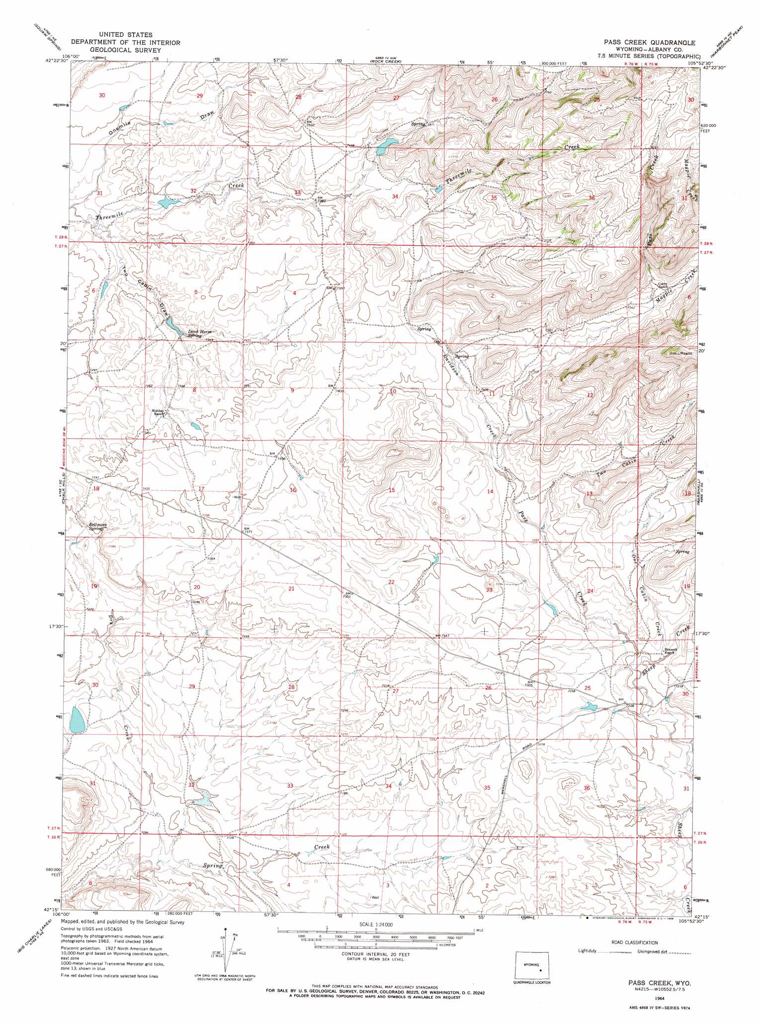
USGS Topo Quad 42105c8 - 1:24,000 scale
| Topo Map Name: | Pass Creek |
| USGS Topo Quad ID: | 42105c8 |
| Print Size: | ca. 21 1/4" wide x 27" high |
| Southeast Coordinates: | 42.25° N latitude / 105.875° W longitude |
| Map Center Coordinates: | 42.3125° N latitude / 105.9375° W longitude |
| U.S. State: | WY |
| Filename: | o42105c8.jpg |
| Download Map JPG Image: | Pass Creek topo map 1:24,000 scale |
| Map Type: | Topographic |
| Topo Series: | 7.5´ |
| Map Scale: | 1:24,000 |
| Source of Map Images: | United States Geological Survey (USGS) |
| Alternate Map Versions: |
Pass Creek WY 1964, updated 1968 Download PDF Buy paper map Pass Creek WY 2012 Download PDF Buy paper map Pass Creek WY 2015 Download PDF Buy paper map |
1:24,000 Topo Quads surrounding Pass Creek
Ice Cave Mountain |
Reno Hill |
Buck Peak |
Buffalo Peak |
Blue Nose Creek |
Bates Creek Reservoir |
Squaw Spring |
Rock Creek |
Warbonnett Peak |
School Section Mountain |
Moss Agate Reservoir |
Chalk Hills |
Pass Creek |
Marshall |
Toltec |
Walker Draw Nw |
Big Charlie Lakes |
Boot Heel |
Rogers Creek |
Cottonwood Creek |
T B Ranch |
Walker Draw Se |
Greasewood Knoll |
Boot Heel Se |
Pinto Creek |
> Back to 42105a1 at 1:100,000 scale
> Back to 42104a1 at 1:250,000 scale
> Back to U.S. Topo Maps home
Pass Creek topo map: Gazetteer
Pass Creek: Springs
Bellmore Spring elevation 2221m 7286′Dead Horse Spring elevation 2229m 7312′
Pass Creek: Streams
Davidson Creek elevation 2223m 7293′Dry Creek elevation 2153m 7063′
Magpie Creek elevation 2301m 7549′
Meadow Creek elevation 2177m 7142′
One Cabin Creek elevation 2196m 7204′
Pass Creek elevation 2190m 7185′
Two Cabin Creek elevation 2212m 7257′
Pass Creek: Valleys
Onemile Draw elevation 2203m 7227′Two Cabin Draw elevation 2207m 7240′
Pass Creek digital topo map on disk
Buy this Pass Creek topo map showing relief, roads, GPS coordinates and other geographical features, as a high-resolution digital map file on DVD:
Eastern Wyoming & Western South Dakota
Buy digital topo maps: Eastern Wyoming & Western South Dakota