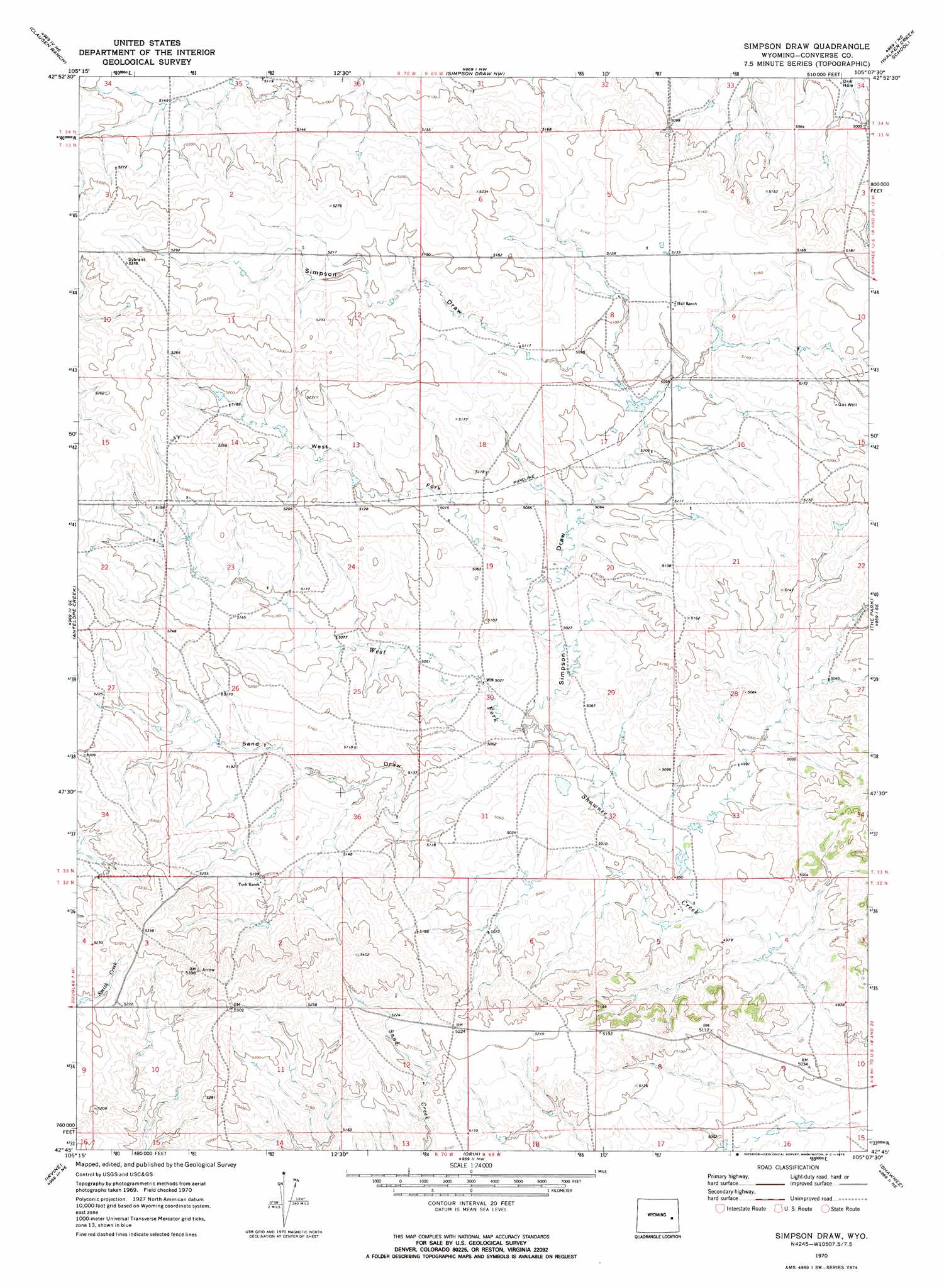
Simpson Draw Topo Map Wyoming
To zoom in, hover over the map of Simpson Draw
USGS Topo Quad 42105g2 - 1:24,000 scale
| Topo Map Name: | Simpson Draw |
| USGS Topo Quad ID: | 42105g2 |
| Print Size: | ca. 21 1/4" wide x 27" high |
| Southeast Coordinates: | 42.75° N latitude / 105.125° W longitude |
| Map Center Coordinates: | 42.8125° N latitude / 105.1875° W longitude |
| U.S. State: | WY |
| Filename: | o42105g2.jpg |
| Download Map JPG Image: | Simpson Draw topo map 1:24,000 scale |
| Map Type: | Topographic |
| Topo Series: | 7.5´ |
| Map Scale: | 1:24,000 |
| Source of Map Images: | United States Geological Survey (USGS) |
| Alternate Map Versions: |
Simpson Draw WY 1970, updated 1973 Download PDF Buy paper map Simpson Draw WY 1970, updated 1973 Download PDF Buy paper map Simpson Draw WY 2012 Download PDF Buy paper map Simpson Draw WY 2015 Download PDF Buy paper map |
1:24,000 Topo Quads surrounding Simpson Draw
Bobby Draw |
Bill Se |
Bill 4 Sw |
Bill 4 Se |
Split Hill Sw |
Sundquist Ranch |
Clausen Ranch |
Simpson Draw Nw |
Walker Creek School |
Lost Springs Nw |
Douglas |
Antelope Creek |
Simpson Draw |
The Park |
Lost Springs |
Chalk Buttes |
Irvine |
Orin |
Shawnee |
Amend Ranch |
Poison Lake |
Dilts Ranch |
Cedar Hill |
Glendo |
Jewel Springs |
> Back to 42105e1 at 1:100,000 scale
> Back to 42104a1 at 1:250,000 scale
> Back to U.S. Topo Maps home
Simpson Draw topo map: Gazetteer
Simpson Draw: Dams
Gillespie Dam elevation 1523m 4996′Simpson Draw: Reservoirs
Gillespie Reservoir elevation 1523m 4996′Simpson Draw: Valleys
Sand Draw elevation 1525m 5003′Simpson Draw elevation 1525m 5003′
West Fork Simpson Draw elevation 1535m 5036′
Simpson Draw digital topo map on disk
Buy this Simpson Draw topo map showing relief, roads, GPS coordinates and other geographical features, as a high-resolution digital map file on DVD:
Eastern Wyoming & Western South Dakota
Buy digital topo maps: Eastern Wyoming & Western South Dakota