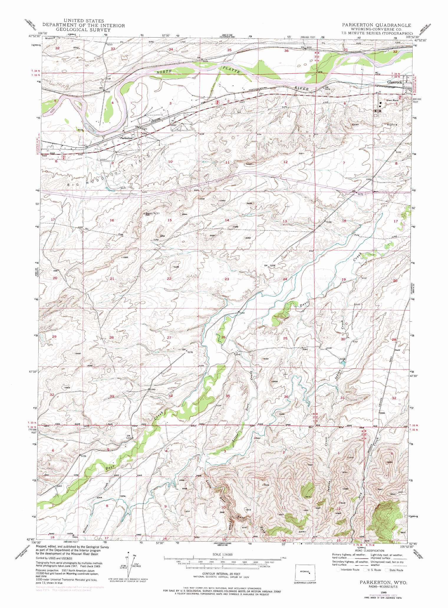
Parkerton Topo Map Wyoming
To zoom in, hover over the map of Parkerton
USGS Topo Quad 42105g8 - 1:24,000 scale
| Topo Map Name: | Parkerton |
| USGS Topo Quad ID: | 42105g8 |
| Print Size: | ca. 21 1/4" wide x 27" high |
| Southeast Coordinates: | 42.75° N latitude / 105.875° W longitude |
| Map Center Coordinates: | 42.8125° N latitude / 105.9375° W longitude |
| U.S. State: | WY |
| Filename: | o42105g8.jpg |
| Download Map JPG Image: | Parkerton topo map 1:24,000 scale |
| Map Type: | Topographic |
| Topo Series: | 7.5´ |
| Map Scale: | 1:24,000 |
| Source of Map Images: | United States Geological Survey (USGS) |
| Alternate Map Versions: |
Parkerton WY 1949, updated 1966 Download PDF Buy paper map Parkerton WY 1949, updated 1977 Download PDF Buy paper map Parkerton WY 1950 Download PDF Buy paper map Parkerton WY 2012 Download PDF Buy paper map Parkerton WY 2015 Download PDF Buy paper map |
1:24,000 Topo Quads surrounding Parkerton
Mckenzie Flat |
Beauchamp Reservoir |
Gumbo Hill |
Coal Hill |
Holdup Hollow |
Pratts Soda Lakes |
Campbell Hill |
Glenrock Nw |
Hylton Ranch |
Leuenberger Ranch |
Brookhurst |
Lockett |
Parkerton |
Glenrock |
Careyhurst |
Otter Creek |
Banner Mountain |
Protsmans Knob |
Root Creek |
Hermit Rock |
Ice Cave Mountain |
Reno Hill |
Buck Peak |
Buffalo Peak |
Blue Nose Creek |
> Back to 42105e1 at 1:100,000 scale
> Back to 42104a1 at 1:250,000 scale
> Back to U.S. Topo Maps home
Parkerton topo map: Gazetteer
Parkerton: Mines
Mormon Canyon Mine elevation 1878m 6161′Pittman Pit elevation 1618m 5308′
Parkerton: Oilfields
Big Muddy Oil Field elevation 1562m 5124′Parkerton: Pillars
Glen Rock elevation 1549m 5082′Parkerton: Populated Places
Parkerton elevation 1533m 5029′Parkerton: Streams
East Fork Little Deer Creek elevation 1698m 5570′Indian Creek elevation 1548m 5078′
Little Deer Creek elevation 1566m 5137′
Willow Creek elevation 1606m 5269′
Parkerton digital topo map on disk
Buy this Parkerton topo map showing relief, roads, GPS coordinates and other geographical features, as a high-resolution digital map file on DVD:
Eastern Wyoming & Western South Dakota
Buy digital topo maps: Eastern Wyoming & Western South Dakota