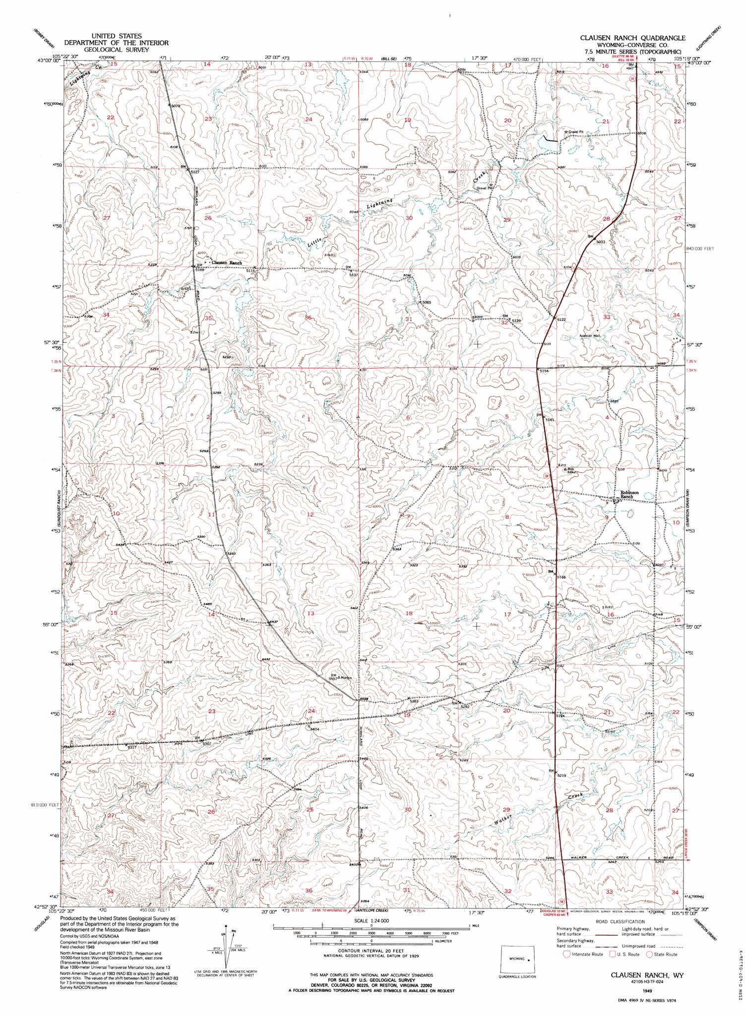
Clausen Ranch Topo Map Wyoming
To zoom in, hover over the map of Clausen Ranch
USGS Topo Quad 42105h3 - 1:24,000 scale
| Topo Map Name: | Clausen Ranch |
| USGS Topo Quad ID: | 42105h3 |
| Print Size: | ca. 21 1/4" wide x 27" high |
| Southeast Coordinates: | 42.875° N latitude / 105.25° W longitude |
| Map Center Coordinates: | 42.9375° N latitude / 105.3125° W longitude |
| U.S. State: | WY |
| Filename: | o42105h3.jpg |
| Download Map JPG Image: | Clausen Ranch topo map 1:24,000 scale |
| Map Type: | Topographic |
| Topo Series: | 7.5´ |
| Map Scale: | 1:24,000 |
| Source of Map Images: | United States Geological Survey (USGS) |
| Alternate Map Versions: |
Clausen Ranch WY 1949, updated 1977 Download PDF Buy paper map Clausen Ranch WY 1949, updated 1995 Download PDF Buy paper map Clausen Ranch WY 1950 Download PDF Buy paper map Clausen Ranch WY 2012 Download PDF Buy paper map Clausen Ranch WY 2015 Download PDF Buy paper map |
1:24,000 Topo Quads surrounding Clausen Ranch
Red Hill |
Patsy Draw |
Bill |
Bill 4 Nw |
Bill 4 Ne |
Whipple Hollow |
Bobby Draw |
Bill Se |
Bill 4 Sw |
Bill 4 Se |
Gilbert Lake |
Sundquist Ranch |
Clausen Ranch |
Simpson Draw Nw |
Walker Creek School |
Orpha |
Douglas |
Antelope Creek |
Simpson Draw |
The Park |
La Prele Reservoir |
Chalk Buttes |
Irvine |
Orin |
Shawnee |
> Back to 42105e1 at 1:100,000 scale
> Back to 42104a1 at 1:250,000 scale
> Back to U.S. Topo Maps home
Clausen Ranch topo map: Gazetteer
Clausen Ranch: Dams
Number 1 Dam elevation 1516m 4973′Witt Number 1 Dam elevation 1501m 4924′
Clausen Ranch: Reservoirs
Number 1 Reservoir elevation 1516m 4973′Witt Number 1 Reservoir elevation 1501m 4924′
Clausen Ranch digital topo map on disk
Buy this Clausen Ranch topo map showing relief, roads, GPS coordinates and other geographical features, as a high-resolution digital map file on DVD:
Eastern Wyoming & Western South Dakota
Buy digital topo maps: Eastern Wyoming & Western South Dakota