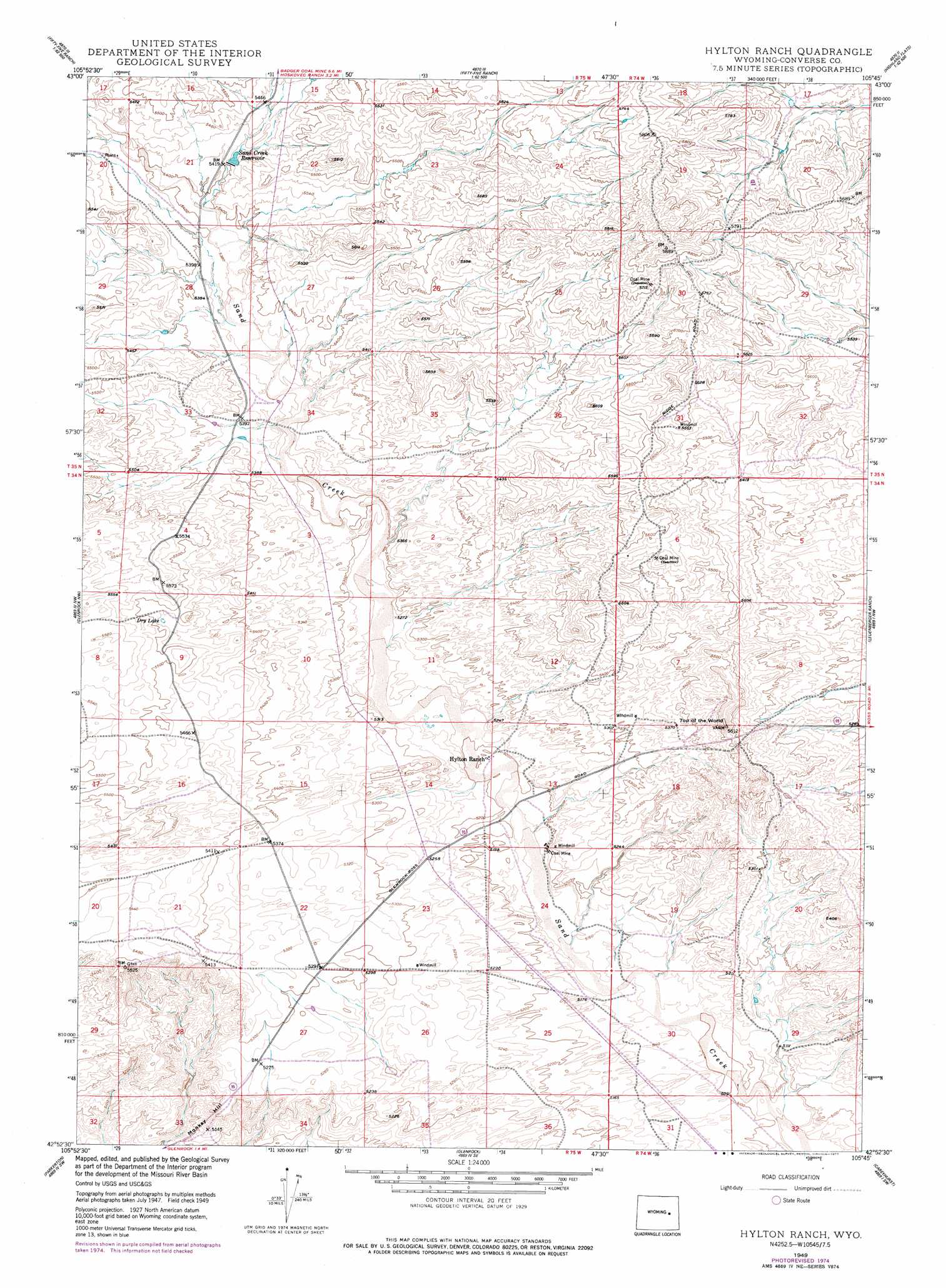
Hylton Ranch Topo Map Wyoming
To zoom in, hover over the map of Hylton Ranch
USGS Topo Quad 42105h7 - 1:24,000 scale
| Topo Map Name: | Hylton Ranch |
| USGS Topo Quad ID: | 42105h7 |
| Print Size: | ca. 21 1/4" wide x 27" high |
| Southeast Coordinates: | 42.875° N latitude / 105.75° W longitude |
| Map Center Coordinates: | 42.9375° N latitude / 105.8125° W longitude |
| U.S. State: | WY |
| Filename: | o42105h7.jpg |
| Download Map JPG Image: | Hylton Ranch topo map 1:24,000 scale |
| Map Type: | Topographic |
| Topo Series: | 7.5´ |
| Map Scale: | 1:24,000 |
| Source of Map Images: | United States Geological Survey (USGS) |
| Alternate Map Versions: |
Hylton Ranch WY 1949, updated 1977 Download PDF Buy paper map Hylton Ranch WY 1950 Download PDF Buy paper map Hylton Ranch WY 1950 Download PDF Buy paper map Hylton Ranch WY 2012 Download PDF Buy paper map Hylton Ranch WY 2015 Download PDF Buy paper map |
1:24,000 Topo Quads surrounding Hylton Ranch
Seven L Creek East |
Fly Draw |
South Fork Reservoir |
Suicide Hill |
Red Hill |
Beauchamp Reservoir |
Gumbo Hill |
Coal Hill |
Holdup Hollow |
Whipple Hollow |
Campbell Hill |
Glenrock Nw |
Hylton Ranch |
Leuenberger Ranch |
Gilbert Lake |
Lockett |
Parkerton |
Glenrock |
Careyhurst |
Orpha |
Banner Mountain |
Protsmans Knob |
Root Creek |
Hermit Rock |
La Prele Reservoir |
> Back to 42105e1 at 1:100,000 scale
> Back to 42104a1 at 1:250,000 scale
> Back to U.S. Topo Maps home
Hylton Ranch topo map: Gazetteer
Hylton Ranch: Dams
Sand Creek Dam elevation 1657m 5436′Hylton Ranch: Lakes
Dry Lake elevation 1667m 5469′Hylton Ranch: Mines
Irvine Pit elevation 1605m 5265′Hylton Ranch: Populated Places
Rolling Hills elevation 1632m 5354′Hylton Ranch: Reservoirs
Sand Creek Reservoir elevation 1657m 5436′Sand Creek Reservoir elevation 1651m 5416′
Hylton Ranch: Slopes
Monkey Hill elevation 1572m 5157′Hylton Ranch: Summits
Top of the World elevation 1686m 5531′Hylton Ranch digital topo map on disk
Buy this Hylton Ranch topo map showing relief, roads, GPS coordinates and other geographical features, as a high-resolution digital map file on DVD:
Eastern Wyoming & Western South Dakota
Buy digital topo maps: Eastern Wyoming & Western South Dakota