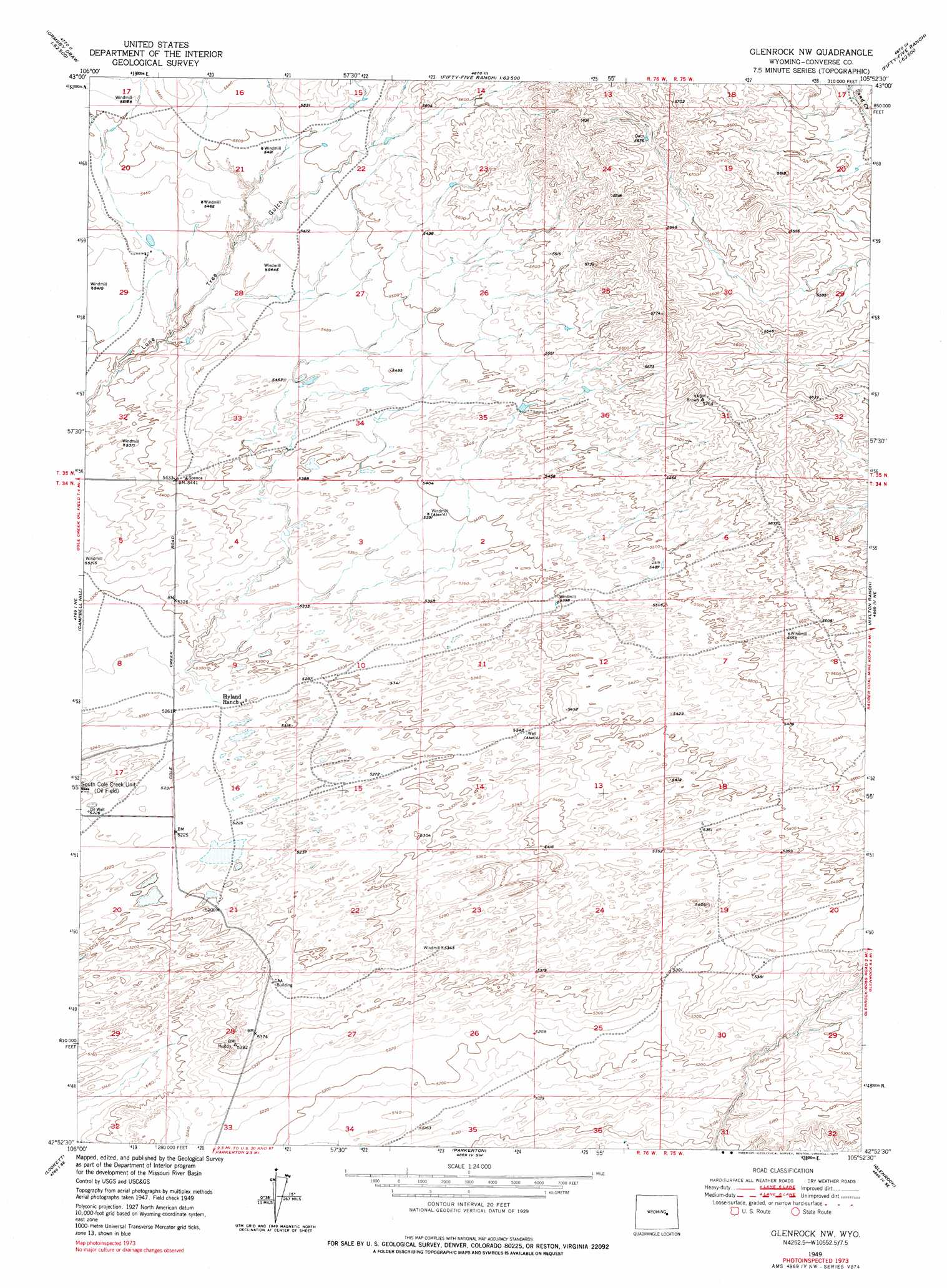
Glenrock Nw Topo Map Wyoming
To zoom in, hover over the map of Glenrock Nw
USGS Topo Quad 42105h8 - 1:24,000 scale
| Topo Map Name: | Glenrock Nw |
| USGS Topo Quad ID: | 42105h8 |
| Print Size: | ca. 21 1/4" wide x 27" high |
| Southeast Coordinates: | 42.875° N latitude / 105.875° W longitude |
| Map Center Coordinates: | 42.9375° N latitude / 105.9375° W longitude |
| U.S. State: | WY |
| Filename: | o42105h8.jpg |
| Download Map JPG Image: | Glenrock Nw topo map 1:24,000 scale |
| Map Type: | Topographic |
| Topo Series: | 7.5´ |
| Map Scale: | 1:24,000 |
| Source of Map Images: | United States Geological Survey (USGS) |
| Alternate Map Versions: |
Glenrock NW WY 1949, updated 1973 Download PDF Buy paper map Glenrock NW WY 1949, updated 1977 Download PDF Buy paper map Glenrock NW WY 1950 Download PDF Buy paper map Glenrock NW WY 2012 Download PDF Buy paper map Glenrock NW WY 2015 Download PDF Buy paper map |
1:24,000 Topo Quads surrounding Glenrock Nw
Seven L Creek West |
Seven L Creek East |
Fly Draw |
South Fork Reservoir |
Suicide Hill |
Mckenzie Flat |
Beauchamp Reservoir |
Gumbo Hill |
Coal Hill |
Holdup Hollow |
Pratts Soda Lakes |
Campbell Hill |
Glenrock Nw |
Hylton Ranch |
Leuenberger Ranch |
Brookhurst |
Lockett |
Parkerton |
Glenrock |
Careyhurst |
Otter Creek |
Banner Mountain |
Protsmans Knob |
Root Creek |
Hermit Rock |
> Back to 42105e1 at 1:100,000 scale
> Back to 42104a1 at 1:250,000 scale
> Back to U.S. Topo Maps home
Glenrock Nw topo map: Gazetteer
Glenrock Nw: Dams
Baker Stock Dam elevation 1665m 5462′East Dam elevation 1674m 5492′
Lulu Dam elevation 1662m 5452′
V-Two Dam elevation 1730m 5675′
West Dam elevation 1671m 5482′
Glenrock Nw: Mines
Valentine Pit elevation 1573m 5160′Glenrock Nw: Oilfields
South Cole Creek Unit elevation 1604m 5262′Glenrock Nw: Reservoirs
Baker Stock Reservoir elevation 1665m 5462′East Reservoir elevation 1674m 5492′
Lulu Reservoir elevation 1662m 5452′
V-Two Reservoir elevation 1730m 5675′
West Reservoir elevation 1671m 5482′
Glenrock Nw digital topo map on disk
Buy this Glenrock Nw topo map showing relief, roads, GPS coordinates and other geographical features, as a high-resolution digital map file on DVD:
Eastern Wyoming & Western South Dakota
Buy digital topo maps: Eastern Wyoming & Western South Dakota