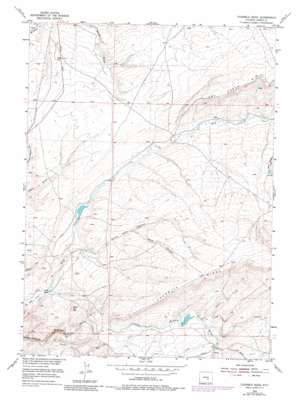
Fourmile Ridge Topo Map Wyoming
To zoom in, hover over the map of Fourmile Ridge
USGS Topo Quad 42106c6 - 1:24,000 scale
| Topo Map Name: | Fourmile Ridge |
| USGS Topo Quad ID: | 42106c6 |
| Print Size: | ca. 21 1/4" wide x 27" high |
| Southeast Coordinates: | 42.25° N latitude / 106.625° W longitude |
| Map Center Coordinates: | 42.3125° N latitude / 106.6875° W longitude |
| U.S. State: | WY |
| Filename: | o42106c6.jpg |
| Download Map JPG Image: | Fourmile Ridge topo map 1:24,000 scale |
| Map Type: | Topographic |
| Topo Series: | 7.5´ |
| Map Scale: | 1:24,000 |
| Source of Map Images: | United States Geological Survey (USGS) |
| Alternate Map Versions: |
Fourmile Ridge WY 1953, updated 1955 Download PDF Buy paper map Fourmile Ridge WY 1953, updated 1973 Download PDF Buy paper map Fourmile Ridge WY 1953, updated 1983 Download PDF Buy paper map Fourmile Ridge WY 2012 Download PDF Buy paper map Fourmile Ridge WY 2015 Download PDF Buy paper map |
1:24,000 Topo Quads surrounding Fourmile Ridge
> Back to 42106a1 at 1:100,000 scale
> Back to 42106a1 at 1:250,000 scale
> Back to U.S. Topo Maps home
Fourmile Ridge topo map: Gazetteer
Fourmile Ridge: Dams
Irene Dam elevation 2084m 6837′Fourmile Ridge: Mines
Elk Number One Claim elevation 2107m 6912′Fourmile Ridge: Reservoirs
Irene Reservoir elevation 2084m 6837′Fourmile Ridge: Ridges
Fourmile Ridge elevation 2225m 7299′Fourmile Ridge: Streams
Alkali Creek elevation 2097m 6879′Cave Creek elevation 2109m 6919′
Middle Fork Sage Creek elevation 1938m 6358′
South Fork Sage Creek elevation 1937m 6354′
Spring Creek elevation 2110m 6922′
Fourmile Ridge: Summits
Mine Hill elevation 2081m 6827′Fourmile Ridge: Valleys
North Wolf Canyon elevation 2029m 6656′Wolf Canyon elevation 2098m 6883′
Fourmile Ridge digital topo map on disk
Buy this Fourmile Ridge topo map showing relief, roads, GPS coordinates and other geographical features, as a high-resolution digital map file on DVD:
Eastern Wyoming & Western South Dakota
Buy digital topo maps: Eastern Wyoming & Western South Dakota


