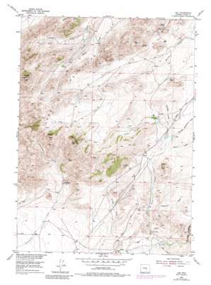
Leo Topo Map Wyoming
To zoom in, hover over the map of Leo
USGS Topo Quad 42106c7 - 1:24,000 scale
| Topo Map Name: | Leo |
| USGS Topo Quad ID: | 42106c7 |
| Print Size: | ca. 21 1/4" wide x 27" high |
| Southeast Coordinates: | 42.25° N latitude / 106.75° W longitude |
| Map Center Coordinates: | 42.3125° N latitude / 106.8125° W longitude |
| U.S. State: | WY |
| Filename: | o42106c7.jpg |
| Download Map JPG Image: | Leo topo map 1:24,000 scale |
| Map Type: | Topographic |
| Topo Series: | 7.5´ |
| Map Scale: | 1:24,000 |
| Source of Map Images: | United States Geological Survey (USGS) |
| Alternate Map Versions: |
Leo WY 1953, updated 1955 Download PDF Buy paper map Leo WY 1953, updated 1971 Download PDF Buy paper map Leo WY 1953, updated 1983 Download PDF Buy paper map Leo WY 2012 Download PDF Buy paper map Leo WY 2015 Download PDF Buy paper map |
1:24,000 Topo Quads surrounding Leo
> Back to 42106a1 at 1:100,000 scale
> Back to 42106a1 at 1:250,000 scale
> Back to U.S. Topo Maps home
Leo topo map: Gazetteer
Leo: Dams
Cardinell Number 2 Dam elevation 2168m 7112′Indian Creek Dam elevation 2050m 6725′
Irene Number 2 Dam elevation 1930m 6332′
Leo: Mines
Becky Lynn Claim elevation 1964m 6443′Big Bug Claim elevation 2056m 6745′
Canyon Claims Number One elevation 2351m 7713′
Chim Claims elevation 2245m 7365′
Doozle Number Three Mine elevation 1957m 6420′
Hard Head Mine elevation 1813m 5948′
Heath Peak Claim Number One elevation 2326m 7631′
Heath Peak Claims Number Three elevation 1967m 6453′
Heath Peak Claims Number Two elevation 2252m 7388′
Little Man Mine elevation 2344m 7690′
Omega Claim Group Mine elevation 2244m 7362′
Prospect Incline Mine elevation 2120m 6955′
Terry Dean Claims elevation 2185m 7168′
Leo: Populated Places
Leo elevation 1851m 6072′Leo: Ranges
Pedro Mountains elevation 2381m 7811′Leo: Reservoirs
Cardinell Number 2 Reservoir elevation 2168m 7112′Indian Creek Reservoir elevation 2050m 6725′
Irene Number 2 Reservoir elevation 1930m 6332′
Leo: Springs
Iron Springs elevation 1995m 6545′Leo: Streams
Dry Creek elevation 1920m 6299′Indian Springs Creek elevation 1869m 6131′
Leo: Summits
Dome Rock elevation 2161m 7089′Heaths Peak elevation 2467m 8093′
Pyramid Peak elevation 2497m 8192′
The Chimneys elevation 2481m 8139′
Leo: Valleys
Bunker Draw elevation 1850m 6069′Dry Creek Canyon elevation 1918m 6292′
Galusha Draw elevation 2055m 6742′
McFade Waterhole Draw elevation 2038m 6686′
Pistol Draw elevation 1990m 6528′
Reno Draw elevation 2024m 6640′
Sneftens Draw elevation 1943m 6374′
Tin Can Draw elevation 1889m 6197′
Leo digital topo map on disk
Buy this Leo topo map showing relief, roads, GPS coordinates and other geographical features, as a high-resolution digital map file on DVD:
Eastern Wyoming & Western South Dakota
Buy digital topo maps: Eastern Wyoming & Western South Dakota


