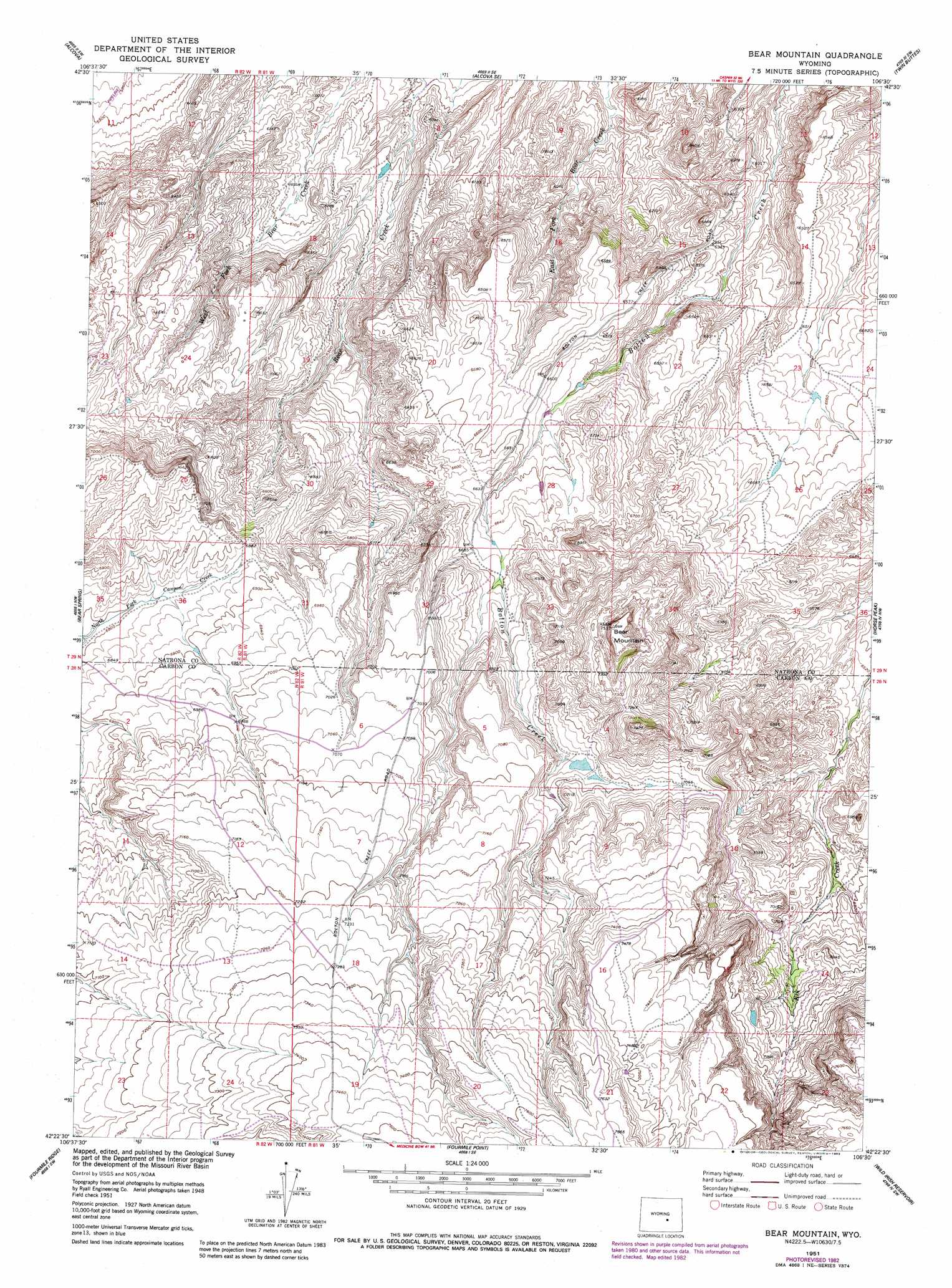
Bear Mountain Topo Map Wyoming
To zoom in, hover over the map of Bear Mountain
USGS Topo Quad 42106d5 - 1:24,000 scale
| Topo Map Name: | Bear Mountain |
| USGS Topo Quad ID: | 42106d5 |
| Print Size: | ca. 21 1/4" wide x 27" high |
| Southeast Coordinates: | 42.375° N latitude / 106.5° W longitude |
| Map Center Coordinates: | 42.4375° N latitude / 106.5625° W longitude |
| U.S. State: | WY |
| Filename: | o42106d5.jpg |
| Download Map JPG Image: | Bear Mountain topo map 1:24,000 scale |
| Map Type: | Topographic |
| Topo Series: | 7.5´ |
| Map Scale: | 1:24,000 |
| Source of Map Images: | United States Geological Survey (USGS) |
| Alternate Map Versions: |
Bear Mountain WY 1951, updated 1953 Download PDF Buy paper map Bear Mountain WY 1951, updated 1978 Download PDF Buy paper map Bear Mountain WY 1951, updated 1983 Download PDF Buy paper map Bear Mountain WY 2012 Download PDF Buy paper map Bear Mountain WY 2015 Download PDF Buy paper map |
1:24,000 Topo Quads surrounding Bear Mountain
Benton Basin Ne |
Clarkson Hill |
Bessemer Mountain |
Freeland |
Crimson Dawn |
Benton Basin |
Alcova |
Alcova Se |
Twin Buttes |
Sheep Creek |
Pathfinder Dam |
Bear Spring |
Bear Mountain |
Horse Peak |
Mud Springs |
Leo |
Fourmile Ridge |
Fourmile Point |
Wild Irish Reservoir |
Measel Spring Reservoir |
Seminoe Dam Ne |
Beaver Creek |
The Q Ranch |
Pine Hill |
Cameron Creek |
> Back to 42106a1 at 1:100,000 scale
> Back to 42106a1 at 1:250,000 scale
> Back to U.S. Topo Maps home
Bear Mountain topo map: Gazetteer
Bear Mountain: Dams
Cook Dam elevation 1980m 6496′Bear Mountain: Reservoirs
Cook Reservoir elevation 1980m 6496′Bear Mountain: Streams
Poison Spring Creek elevation 1810m 5938′Bear Mountain: Summits
Bear Mountain elevation 2280m 7480′Bear Mountain digital topo map on disk
Buy this Bear Mountain topo map showing relief, roads, GPS coordinates and other geographical features, as a high-resolution digital map file on DVD:
Eastern Wyoming & Western South Dakota
Buy digital topo maps: Eastern Wyoming & Western South Dakota