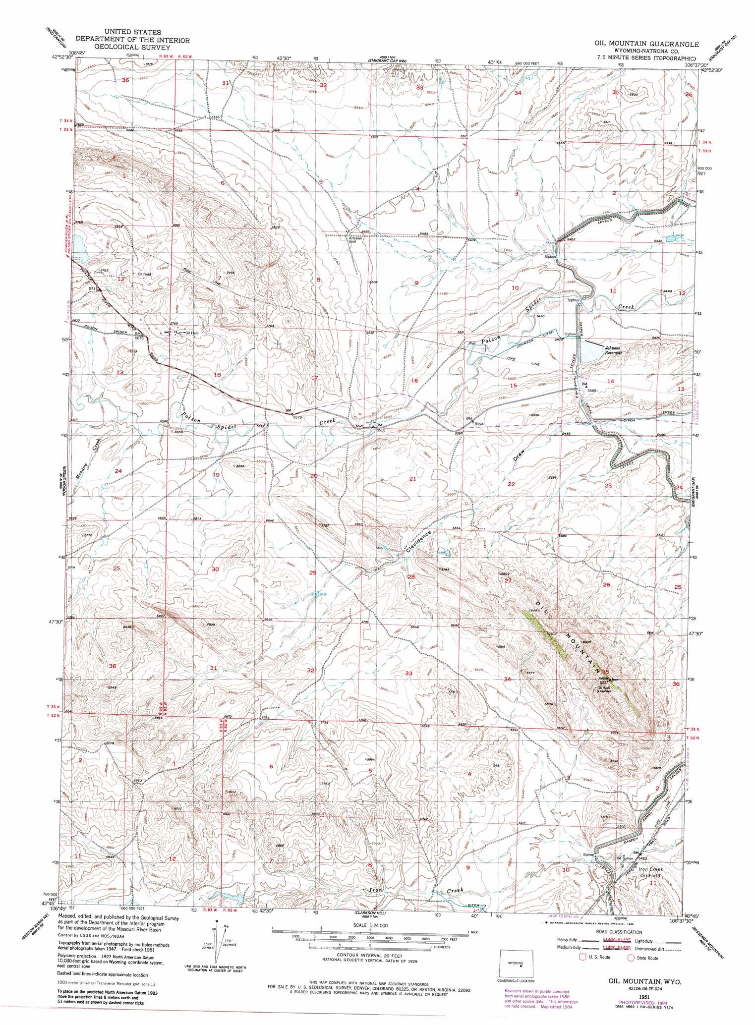
Oil Mountain Topo Map Wyoming
To zoom in, hover over the map of Oil Mountain
USGS Topo Quad 42106g6 - 1:24,000 scale
| Topo Map Name: | Oil Mountain |
| USGS Topo Quad ID: | 42106g6 |
| Print Size: | ca. 21 1/4" wide x 27" high |
| Southeast Coordinates: | 42.75° N latitude / 106.625° W longitude |
| Map Center Coordinates: | 42.8125° N latitude / 106.6875° W longitude |
| U.S. State: | WY |
| Filename: | o42106g6.jpg |
| Download Map JPG Image: | Oil Mountain topo map 1:24,000 scale |
| Map Type: | Topographic |
| Topo Series: | 7.5´ |
| Map Scale: | 1:24,000 |
| Source of Map Images: | United States Geological Survey (USGS) |
| Alternate Map Versions: |
Oil Mountain WY 1951, updated 1952 Download PDF Buy paper map Oil Mountain WY 1951, updated 1971 Download PDF Buy paper map Oil Mountain WY 1951, updated 1985 Download PDF Buy paper map Oil Mountain WY 2012 Download PDF Buy paper map Oil Mountain WY 2015 Download PDF Buy paper map |
1:24,000 Topo Quads surrounding Oil Mountain
Powder River |
Natrona |
Burlington Lake |
Smith Flats |
Illco |
Square Top Butte |
Reid Canyon |
Emigrant Gap Nw |
Emigrant Gap Ne |
Bishop |
Pine Mountain Sw |
Poison Spider |
Oil Mountain |
Emigrant Gap |
Goose Egg |
Mccleary Reservoir |
Benton Basin Ne |
Clarkson Hill |
Bessemer Mountain |
Freeland |
Benton Basin Sw |
Benton Basin |
Alcova |
Alcova Se |
Twin Buttes |
> Back to 42106e1 at 1:100,000 scale
> Back to 42106a1 at 1:250,000 scale
> Back to U.S. Topo Maps home
Oil Mountain topo map: Gazetteer
Oil Mountain: Canals
Johnson Ditch elevation 1672m 5485′Oil Mountain: Dams
Blue Bank Dam elevation 1681m 5515′Oral Dam elevation 1668m 5472′
Oil Mountain: Oilfields
Iron Creek Oil Field elevation 1671m 5482′Oil Mountain: Reservoirs
Blue Bank Reservoir elevation 1681m 5515′Johnson Reservoir elevation 1666m 5465′
Oral Reservoir elevation 1668m 5472′
Oil Mountain: Streams
Meadow Creek elevation 1708m 5603′Oil Mountain: Summits
Oil Mountain elevation 1807m 5928′Oil Mountain: Tunnels
Tunnel Number 5 elevation 1697m 5567′Oil Mountain digital topo map on disk
Buy this Oil Mountain topo map showing relief, roads, GPS coordinates and other geographical features, as a high-resolution digital map file on DVD:
Eastern Wyoming & Western South Dakota
Buy digital topo maps: Eastern Wyoming & Western South Dakota