Battle Spring Topo Map Wyoming
To zoom in, hover over the map of Battle Spring
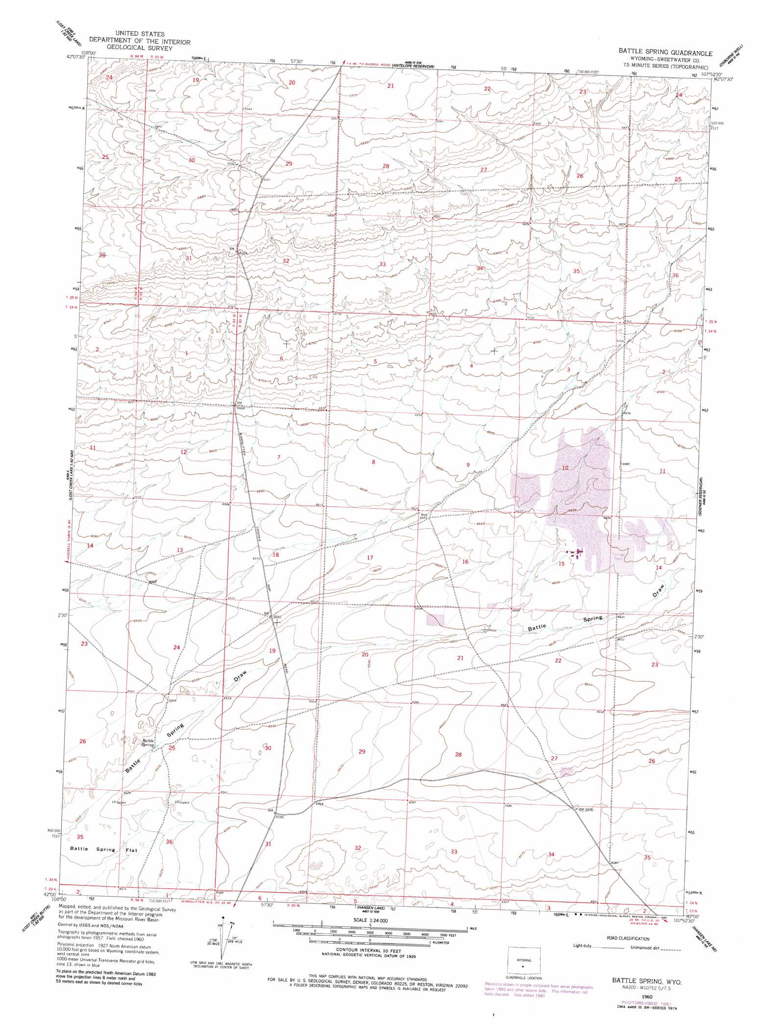
USGS Topo Quad 42107a8 - 1:24,000 scale
| Topo Map Name: | Battle Spring |
| USGS Topo Quad ID: | 42107a8 |
| Print Size: | ca. 21 1/4" wide x 27" high |
| Southeast Coordinates: | 42° N latitude / 107.875° W longitude |
| Map Center Coordinates: | 42.0625° N latitude / 107.9375° W longitude |
| U.S. State: | WY |
| Filename: | o42107a8.jpg |
| Download Map JPG Image: | Battle Spring topo map 1:24,000 scale |
| Map Type: | Topographic |
| Topo Series: | 7.5´ |
| Map Scale: | 1:24,000 |
| Source of Map Images: | United States Geological Survey (USGS) |
| Alternate Map Versions: |
Battle Spring WY 1960, updated 1962 Download PDF Buy paper map Battle Spring WY 1960, updated 1982 Download PDF Buy paper map Battle Spring WY 2012 Download PDF Buy paper map Battle Spring WY 2015 Download PDF Buy paper map |
1:24,000 Topo Quads surrounding Battle Spring
Olson Springs |
Lost Creek Reservoir |
Brenton Springs |
Crooks Peak |
Sagebrush Park |
Cyclone Draw |
Osborne Draw |
Antelope Reservoir |
Osborne Well |
Hadsell Spring |
Lost Creek Lake |
Eagles Nest Draw |
Battle Spring |
Sooner Reservoir |
Chicken Spring |
Lost Creek Butte Nw |
Lost Creek Butte |
Hansen Lake |
Hansen Lake Ne |
Larsen Knoll |
Lost Creek Butte Sw |
Dennison Cap |
Monument Lake |
Ruby Knolls |
Jawbone Ranch |
> Back to 42107a1 at 1:100,000 scale
> Back to 42106a1 at 1:250,000 scale
> Back to U.S. Topo Maps home
Battle Spring topo map: Gazetteer
Battle Spring: Mines
State School Number One Mine elevation 1992m 6535′Sweetwater Uranium Project Mine elevation 2022m 6633′
Battle Spring: Springs
Battle Spring elevation 1990m 6528′Battle Spring digital topo map on disk
Buy this Battle Spring topo map showing relief, roads, GPS coordinates and other geographical features, as a high-resolution digital map file on DVD:
Eastern Wyoming & Western South Dakota
Buy digital topo maps: Eastern Wyoming & Western South Dakota