Bairoil Topo Map Wyoming
To zoom in, hover over the map of Bairoil
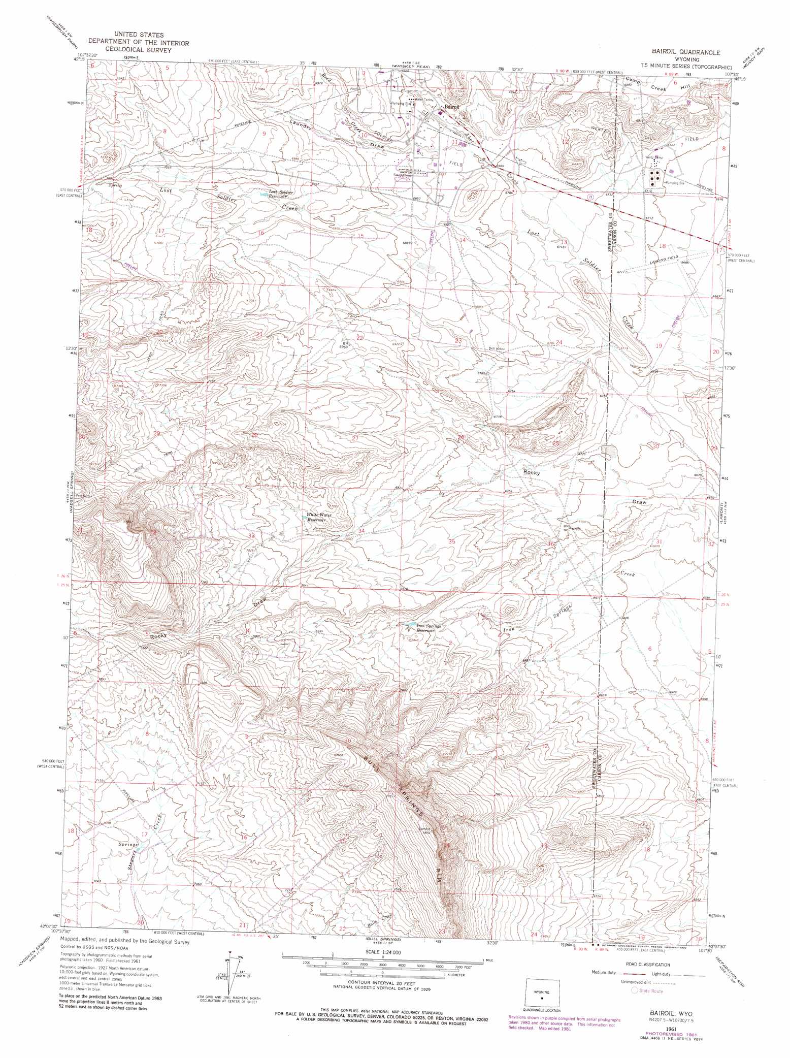
USGS Topo Quad 42107b5 - 1:24,000 scale
| Topo Map Name: | Bairoil |
| USGS Topo Quad ID: | 42107b5 |
| Print Size: | ca. 21 1/4" wide x 27" high |
| Southeast Coordinates: | 42.125° N latitude / 107.5° W longitude |
| Map Center Coordinates: | 42.1875° N latitude / 107.5625° W longitude |
| U.S. State: | WY |
| Filename: | o42107b5.jpg |
| Download Map JPG Image: | Bairoil topo map 1:24,000 scale |
| Map Type: | Topographic |
| Topo Series: | 7.5´ |
| Map Scale: | 1:24,000 |
| Source of Map Images: | United States Geological Survey (USGS) |
| Alternate Map Versions: |
Bairoil WY 1961, updated 1966 Download PDF Buy paper map Bairoil WY 1961, updated 1982 Download PDF Buy paper map Bairoil WY 2012 Download PDF Buy paper map Bairoil WY 2015 Download PDF Buy paper map |
1:24,000 Topo Quads surrounding Bairoil
Jeffrey City |
Split Rock Nw |
Split Rock |
Bucklin Reservoirs |
Savage Peak |
Crooks Peak |
Sagebrush Park |
Whiskey Peak |
Muddy Gap |
Youngs Pass |
Osborne Well |
Hadsell Spring |
Bairoil |
Lamont |
Lamont Ne |
Sooner Reservoir |
Chicken Spring |
Bull Spring |
Separation Rim |
Boggy Meadows |
Hansen Lake Ne |
Larsen Knoll |
Buck Draw |
Shamrock Hills |
Rendle Hill |
> Back to 42107a1 at 1:100,000 scale
> Back to 42106a1 at 1:250,000 scale
> Back to U.S. Topo Maps home
Bairoil topo map: Gazetteer
Bairoil: Oilfields
Lost Soldier Oil Field elevation 2091m 6860′Wertz Oil Field elevation 2100m 6889′
Bairoil: Populated Places
Bairoil elevation 2096m 6876′Bairoil: Reservoirs
Iron Springs Reservoir elevation 2082m 6830′Lost Soldier Reservoir elevation 2121m 6958′
White Water Reservoir elevation 2116m 6942′
Bairoil: Streams
Abel Creek elevation 2054m 6738′Reed Creek elevation 2077m 6814′
Bairoil: Valleys
Laundry Draw elevation 2154m 7066′Bairoil digital topo map on disk
Buy this Bairoil topo map showing relief, roads, GPS coordinates and other geographical features, as a high-resolution digital map file on DVD:
Eastern Wyoming & Western South Dakota
Buy digital topo maps: Eastern Wyoming & Western South Dakota