Antelope Reservoir Topo Map Wyoming
To zoom in, hover over the map of Antelope Reservoir
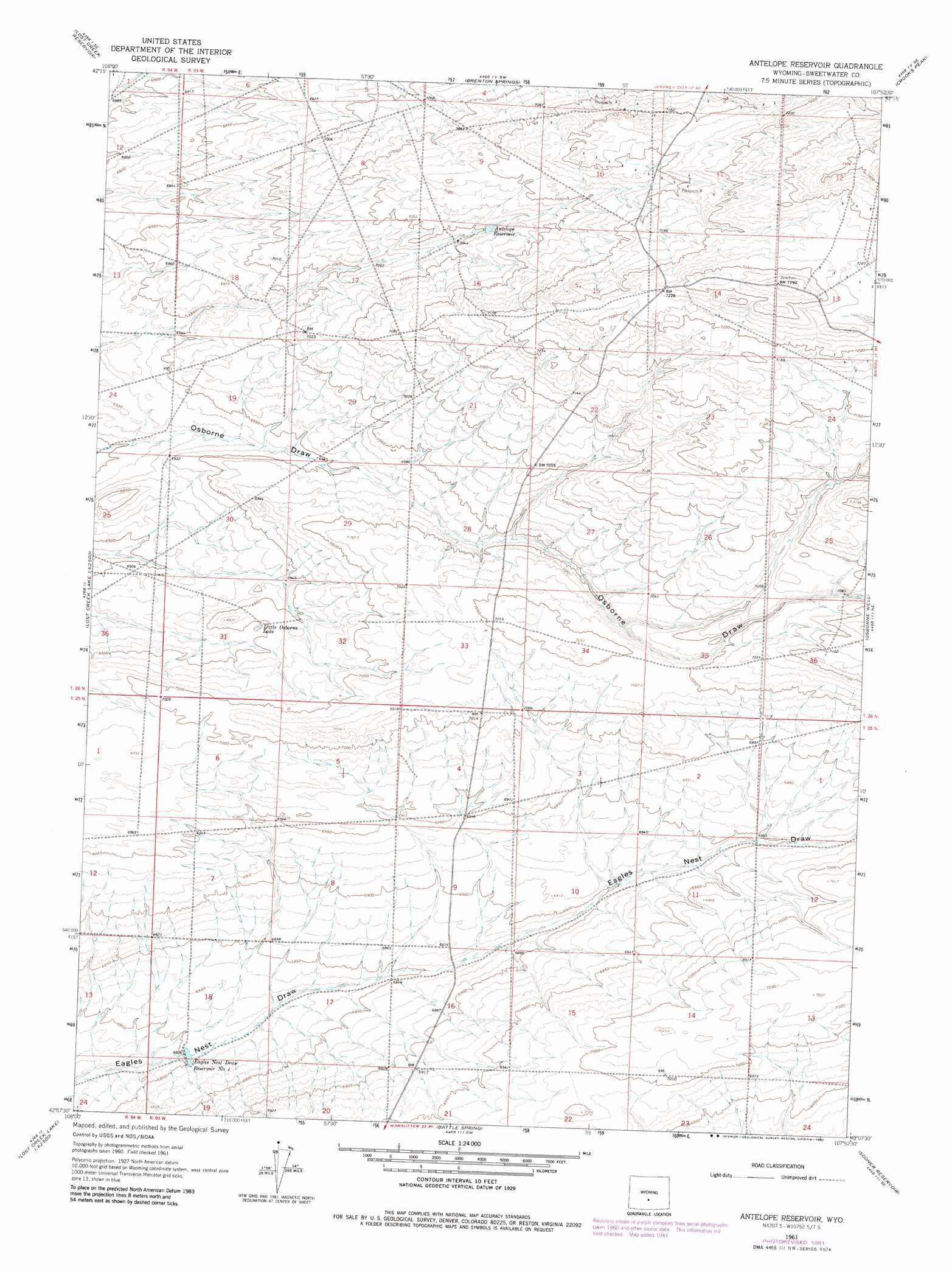
USGS Topo Quad 42107b8 - 1:24,000 scale
| Topo Map Name: | Antelope Reservoir |
| USGS Topo Quad ID: | 42107b8 |
| Print Size: | ca. 21 1/4" wide x 27" high |
| Southeast Coordinates: | 42.125° N latitude / 107.875° W longitude |
| Map Center Coordinates: | 42.1875° N latitude / 107.9375° W longitude |
| U.S. State: | WY |
| Filename: | o42107b8.jpg |
| Download Map JPG Image: | Antelope Reservoir topo map 1:24,000 scale |
| Map Type: | Topographic |
| Topo Series: | 7.5´ |
| Map Scale: | 1:24,000 |
| Source of Map Images: | United States Geological Survey (USGS) |
| Alternate Map Versions: |
Antelope Reservoir WY 1961, updated 1964 Download PDF Buy paper map Antelope Reservoir WY 1961, updated 1982 Download PDF Buy paper map Antelope Reservoir WY 2012 Download PDF Buy paper map Antelope Reservoir WY 2015 Download PDF Buy paper map |
1:24,000 Topo Quads surrounding Antelope Reservoir
Happy Spring |
Soap Holes |
Crooks Mountain |
Jeffrey City |
Split Rock Nw |
Olson Springs |
Lost Creek Reservoir |
Brenton Springs |
Crooks Peak |
Sagebrush Park |
Cyclone Draw |
Osborne Draw |
Antelope Reservoir |
Osborne Well |
Hadsell Spring |
Lost Creek Lake |
Eagles Nest Draw |
Battle Spring |
Sooner Reservoir |
Chicken Spring |
Lost Creek Butte Nw |
Lost Creek Butte |
Hansen Lake |
Hansen Lake Ne |
Larsen Knoll |
> Back to 42107a1 at 1:100,000 scale
> Back to 42106a1 at 1:250,000 scale
> Back to U.S. Topo Maps home
Antelope Reservoir topo map: Gazetteer
Antelope Reservoir: Dams
Eagle Nest Draw Reservoir Number 1 Dam elevation 2071m 6794′Antelope Reservoir: Lakes
Little Osborne Lake elevation 2117m 6945′Antelope Reservoir: Reservoirs
Antelope Reservoir elevation 2157m 7076′Eagle Nest Draw Reservoir Number 1 elevation 2071m 6794′
Eagles Nest Draw Reservoir Number 1 elevation 2071m 6794′
Antelope Reservoir digital topo map on disk
Buy this Antelope Reservoir topo map showing relief, roads, GPS coordinates and other geographical features, as a high-resolution digital map file on DVD:
Eastern Wyoming & Western South Dakota
Buy digital topo maps: Eastern Wyoming & Western South Dakota