Buzzard Ranch Topo Map Wyoming
To zoom in, hover over the map of Buzzard Ranch
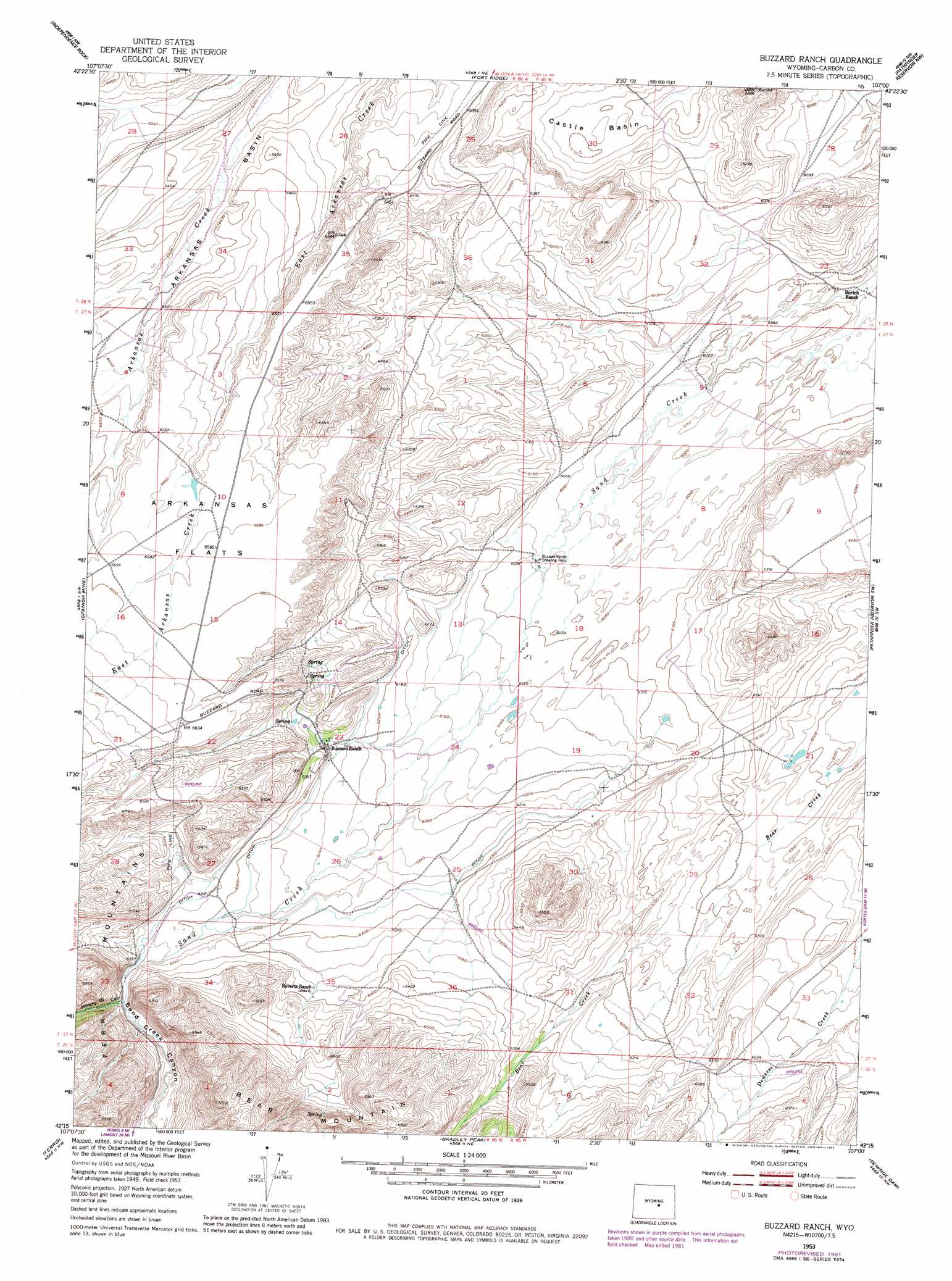
USGS Topo Quad 42107c1 - 1:24,000 scale
| Topo Map Name: | Buzzard Ranch |
| USGS Topo Quad ID: | 42107c1 |
| Print Size: | ca. 21 1/4" wide x 27" high |
| Southeast Coordinates: | 42.25° N latitude / 107° W longitude |
| Map Center Coordinates: | 42.3125° N latitude / 107.0625° W longitude |
| U.S. State: | WY |
| Filename: | o42107c1.jpg |
| Download Map JPG Image: | Buzzard Ranch topo map 1:24,000 scale |
| Map Type: | Topographic |
| Topo Series: | 7.5´ |
| Map Scale: | 1:24,000 |
| Source of Map Images: | United States Geological Survey (USGS) |
| Alternate Map Versions: |
Buzzard Ranch WY 1953, updated 1955 Download PDF Buy paper map Buzzard Ranch WY 1953, updated 1973 Download PDF Buy paper map Buzzard Ranch WY 1953, updated 1983 Download PDF Buy paper map Buzzard Ranch WY 2012 Download PDF Buy paper map Buzzard Ranch WY 2015 Download PDF Buy paper map |
1:24,000 Topo Quads surrounding Buzzard Ranch
Miller Spring |
Beulah Belle Lake |
Sanford Ranch |
Benton Basin Sw |
Benton Basin |
Savage Peak |
Independence Rock |
Fort Ridge |
Pathfinder Reservoir Nw |
Pathfinder Dam |
Youngs Pass |
Spanish Mine |
Buzzard Ranch |
Pathfinder Reservoir Sw |
Leo |
Lamont Ne |
Ferris |
Bradley Peak |
Seminoe Dam |
Seminoe Dam Ne |
Boggy Meadows |
Riddle Cut |
Wild Horse Mountain |
Seminoe Dam Sw |
Seminoe Dam Se |
> Back to 42107a1 at 1:100,000 scale
> Back to 42106a1 at 1:250,000 scale
> Back to U.S. Topo Maps home
Buzzard Ranch topo map: Gazetteer
Buzzard Ranch: Basins
Arkansas Basin elevation 1952m 6404′Castle Basin elevation 1861m 6105′
Buzzard Ranch: Valleys
Miners Canyon elevation 1946m 6384′Sand Creek Canyon elevation 1932m 6338′
Buzzard Ranch digital topo map on disk
Buy this Buzzard Ranch topo map showing relief, roads, GPS coordinates and other geographical features, as a high-resolution digital map file on DVD:
Eastern Wyoming & Western South Dakota
Buy digital topo maps: Eastern Wyoming & Western South Dakota