Muddy Gap Topo Map Wyoming
To zoom in, hover over the map of Muddy Gap
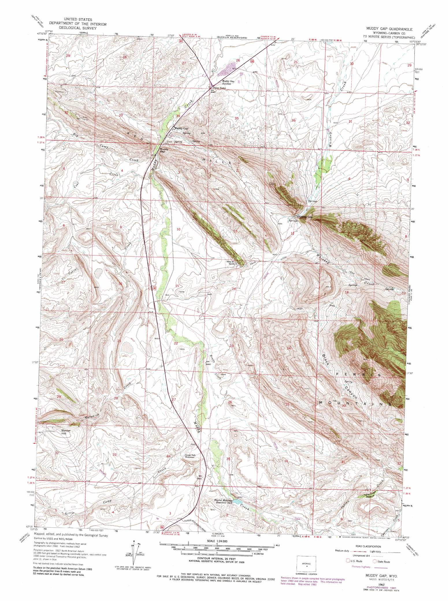
USGS Topo Quad 42107c4 - 1:24,000 scale
| Topo Map Name: | Muddy Gap |
| USGS Topo Quad ID: | 42107c4 |
| Print Size: | ca. 21 1/4" wide x 27" high |
| Southeast Coordinates: | 42.25° N latitude / 107.375° W longitude |
| Map Center Coordinates: | 42.3125° N latitude / 107.4375° W longitude |
| U.S. State: | WY |
| Filename: | o42107c4.jpg |
| Download Map JPG Image: | Muddy Gap topo map 1:24,000 scale |
| Map Type: | Topographic |
| Topo Series: | 7.5´ |
| Map Scale: | 1:24,000 |
| Source of Map Images: | United States Geological Survey (USGS) |
| Alternate Map Versions: |
Muddy Gap WY 1962, updated 1964 Download PDF Buy paper map Muddy Gap WY 1962, updated 1982 Download PDF Buy paper map Muddy Gap WY 2012 Download PDF Buy paper map Muddy Gap WY 2015 Download PDF Buy paper map |
1:24,000 Topo Quads surrounding Muddy Gap
Black Rock Gap |
Lankin Dome |
Lone Mountain |
Miller Spring |
Beulah Belle Lake |
Split Rock Nw |
Split Rock |
Bucklin Reservoirs |
Savage Peak |
Independence Rock |
Sagebrush Park |
Whiskey Peak |
Muddy Gap |
Youngs Pass |
Spanish Mine |
Hadsell Spring |
Bairoil |
Lamont |
Lamont Ne |
Ferris |
Chicken Spring |
Bull Spring |
Separation Rim |
Boggy Meadows |
Riddle Cut |
> Back to 42107a1 at 1:100,000 scale
> Back to 42106a1 at 1:250,000 scale
> Back to U.S. Topo Maps home
Muddy Gap topo map: Gazetteer
Muddy Gap: Dams
Hannah Mahoney Number 1 Dam elevation 2046m 6712′Hannah Mahoney Number 2 Dam elevation 2019m 6624′
Muddy Gap: Flats
Indian Creek Meadow elevation 2115m 6938′Muddy Gap: Gaps
Muddy Gap elevation 1918m 6292′Whiskey Gap elevation 1993m 6538′
Muddy Gap: Mines
Ferris Mountains Mine elevation 1935m 6348′Jennie Claim Number One Mine elevation 2070m 6791′
Muddy Gap: Populated Places
Muddy Gap elevation 1925m 6315′Three Forks elevation 1913m 6276′
Muddy Gap: Reservoirs
Hanna Mahoney Reservoir Number 2 elevation 2015m 6610′Hannah Mahoney Number 1 Reservoir elevation 2046m 6712′
Hannah Mahoney Number 2 Reservoir elevation 2019m 6624′
Muddy Gap: Streams
Big Camp Creek elevation 1920m 6299′Brady Creek elevation 1964m 6443′
Coal Creek elevation 1922m 6305′
Corral Creek elevation 1933m 6341′
Indian Creek elevation 2046m 6712′
Little Camp Creek elevation 1982m 6502′
Murphree Creek elevation 1952m 6404′
Muddy Gap: Summits
Bunker Hill elevation 2143m 7030′Muddy Gap: Valleys
Black Canyon elevation 2109m 6919′Muddy Gap digital topo map on disk
Buy this Muddy Gap topo map showing relief, roads, GPS coordinates and other geographical features, as a high-resolution digital map file on DVD:
Eastern Wyoming & Western South Dakota
Buy digital topo maps: Eastern Wyoming & Western South Dakota