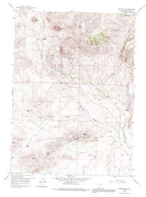
Barlow Gap Topo Map Wyoming
To zoom in, hover over the map of Barlow Gap
USGS Topo Quad 42107f3 - 1:24,000 scale
| Topo Map Name: | Barlow Gap |
| USGS Topo Quad ID: | 42107f3 |
| Print Size: | ca. 21 1/4" wide x 27" high |
| Southeast Coordinates: | 42.625° N latitude / 107.25° W longitude |
| Map Center Coordinates: | 42.6875° N latitude / 107.3125° W longitude |
| U.S. State: | WY |
| Filename: | o42107f3.jpg |
| Download Map JPG Image: | Barlow Gap topo map 1:24,000 scale |
| Map Type: | Topographic |
| Topo Series: | 7.5´ |
| Map Scale: | 1:24,000 |
| Source of Map Images: | United States Geological Survey (USGS) |
| Alternate Map Versions: |
Barlow Gap WY 1959, updated 1961 Download PDF Buy paper map Barlow Gap WY 1959, updated 1974 Download PDF Buy paper map Barlow Gap WY 1959, updated 1991 Download PDF Buy paper map Barlow Gap WY 2012 Download PDF Buy paper map Barlow Gap WY 2015 Download PDF Buy paper map |
1:24,000 Topo Quads surrounding Barlow Gap
> Back to 42107e1 at 1:100,000 scale
> Back to 42106a1 at 1:250,000 scale
> Back to U.S. Topo Maps home
Barlow Gap topo map: Gazetteer
Barlow Gap: Gaps
Barlow Gap elevation 2114m 6935′Crilly Gap elevation 2090m 6856′
Barlow Gap: Lakes
The Dry Lake elevation 1998m 6555′Barlow Gap: Mines
Goat Mountain Area Mine elevation 2213m 7260′Barlow Gap: Springs
Barlow Springs elevation 2106m 6909′Barlow Gap: Streams
U T Creek elevation 1999m 6558′Barlow Gap: Summits
Bald Mountain elevation 2258m 7408′Goat Mountain elevation 2429m 7969′
Barlow Gap: Valleys
Barlow Springs Draw elevation 2012m 6601′Greasewood Draw elevation 1965m 6446′
McDougal Gulch elevation 2043m 6702′
Barlow Gap digital topo map on disk
Buy this Barlow Gap topo map showing relief, roads, GPS coordinates and other geographical features, as a high-resolution digital map file on DVD:
Eastern Wyoming & Western South Dakota
Buy digital topo maps: Eastern Wyoming & Western South Dakota


