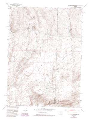
Mcintosh Meadows Topo Map Wyoming
To zoom in, hover over the map of Mcintosh Meadows
USGS Topo Quad 42107f5 - 1:24,000 scale
| Topo Map Name: | Mcintosh Meadows |
| USGS Topo Quad ID: | 42107f5 |
| Print Size: | ca. 21 1/4" wide x 27" high |
| Southeast Coordinates: | 42.625° N latitude / 107.5° W longitude |
| Map Center Coordinates: | 42.6875° N latitude / 107.5625° W longitude |
| U.S. State: | WY |
| Filename: | o42107f5.jpg |
| Download Map JPG Image: | Mcintosh Meadows topo map 1:24,000 scale |
| Map Type: | Topographic |
| Topo Series: | 7.5´ |
| Map Scale: | 1:24,000 |
| Source of Map Images: | United States Geological Survey (USGS) |
| Alternate Map Versions: |
Mc Intosh Meadows WY 1952, updated 1969 Download PDF Buy paper map Mc Intosh Meadows WY 1952, updated 1985 Download PDF Buy paper map McIntosh Meadows WY 1952, updated 1985 Download PDF Buy paper map McIntosh Meadows WY 2012 Download PDF Buy paper map McIntosh Meadows WY 2015 Download PDF Buy paper map |
1:24,000 Topo Quads surrounding Mcintosh Meadows
> Back to 42107e1 at 1:100,000 scale
> Back to 42106a1 at 1:250,000 scale
> Back to U.S. Topo Maps home
Mcintosh Meadows topo map: Gazetteer
Mcintosh Meadows: Flats
Agate Flats elevation 2080m 6824′McIntosh Meadows elevation 2056m 6745′
Mcintosh Meadows: Gaps
Dirty Gap elevation 2113m 6932′Mcintosh Meadows: Mines
Bus Rus Mine elevation 2165m 7103′Cotton Ferguson Mine elevation 2167m 7109′
D-One Mine elevation 2165m 7103′
Mcintosh Meadows: Springs
Big Diamond Spring elevation 2126m 6975′Cold Spring elevation 2073m 6801′
East Diamond Springs elevation 2134m 7001′
Lamoreaux Cabin Springs elevation 2148m 7047′
Middle Diamond Spring elevation 2125m 6971′
West Diamond Spring elevation 2127m 6978′
Mcintosh Meadows: Summits
West Sage Hen Rocks elevation 2144m 7034′Mcintosh Meadows: Valleys
Big Diamond Springs Draw elevation 2061m 6761′East Diamond Springs Draw elevation 2067m 6781′
Middle Diamond Springs Draw elevation 2061m 6761′
Mcintosh Meadows digital topo map on disk
Buy this Mcintosh Meadows topo map showing relief, roads, GPS coordinates and other geographical features, as a high-resolution digital map file on DVD:
Eastern Wyoming & Western South Dakota
Buy digital topo maps: Eastern Wyoming & Western South Dakota


