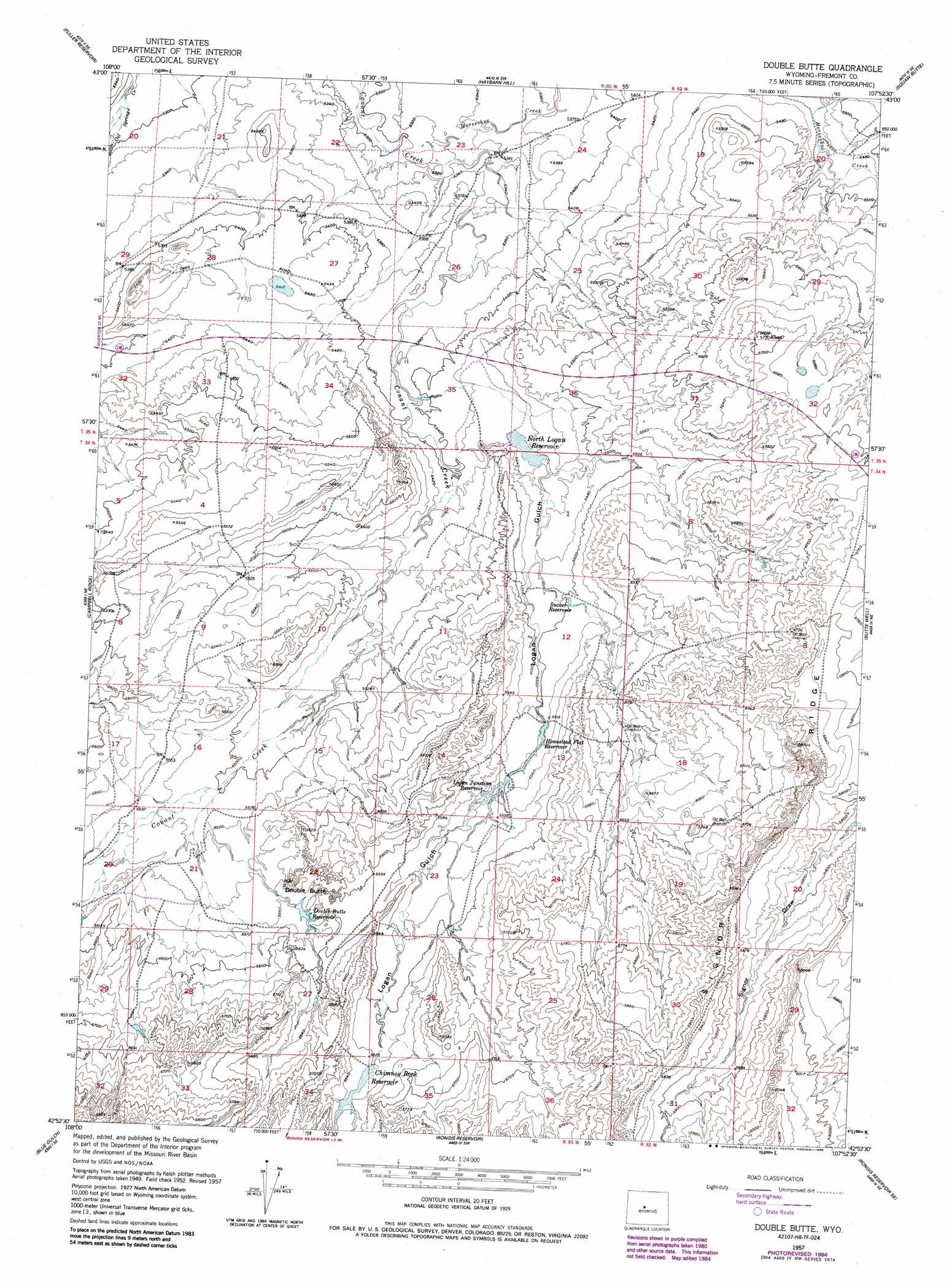
Double Butte Topo Map Wyoming
To zoom in, hover over the map of Double Butte
USGS Topo Quad 42107h8 - 1:24,000 scale
| Topo Map Name: | Double Butte |
| USGS Topo Quad ID: | 42107h8 |
| Print Size: | ca. 21 1/4" wide x 27" high |
| Southeast Coordinates: | 42.875° N latitude / 107.875° W longitude |
| Map Center Coordinates: | 42.9375° N latitude / 107.9375° W longitude |
| U.S. State: | WY |
| Filename: | o42107h8.jpg |
| Download Map JPG Image: | Double Butte topo map 1:24,000 scale |
| Map Type: | Topographic |
| Topo Series: | 7.5´ |
| Map Scale: | 1:24,000 |
| Source of Map Images: | United States Geological Survey (USGS) |
| Alternate Map Versions: |
Double Butte WY 1952, updated 1953 Download PDF Buy paper map Double Butte WY 1957, updated 1958 Download PDF Buy paper map Double Butte WY 1957, updated 1985 Download PDF Buy paper map Double Butte WY 2012 Download PDF Buy paper map Double Butte WY 2015 Download PDF Buy paper map |
1:24,000 Topo Quads surrounding Double Butte
Hidden Valley |
Shoshoni |
Ocla Draw |
Squaw Butte Ne |
Moneta |
Indian Butte |
Fuller Reservoir |
Haybarn Hill |
Squaw Butte |
Seventy One Reservoir |
Alkali Butte |
Campbell Ridge |
Double Butte |
Butte Well |
Love Ranch |
Sand Draw |
Blue Gulch |
Rongis Reservoir |
Rongis Reservoir Se |
Puddle Springs |
Dishpan Butte |
Elkhorn Springs |
Tin Cup Mountain |
Muskrat Basin |
Coyote Springs |
> Back to 42107e1 at 1:100,000 scale
> Back to 42106a1 at 1:250,000 scale
> Back to U.S. Topo Maps home
Double Butte topo map: Gazetteer
Double Butte: Reservoirs
Chimney Rock Reservoir elevation 1710m 5610′Double Butte Reservoir elevation 1696m 5564′
Homestead Flat Reservoir elevation 1683m 5521′
Logan Junction Reservoir elevation 1678m 5505′
North Logan Reservoir elevation 1655m 5429′
Sucker Reservoir elevation 1679m 5508′
Double Butte: Streams
Horseshoe Creek elevation 1618m 5308′Double Butte: Summits
Double Butte elevation 1691m 5547′Double Butte: Valleys
Logan Gulch elevation 1643m 5390′Double Butte digital topo map on disk
Buy this Double Butte topo map showing relief, roads, GPS coordinates and other geographical features, as a high-resolution digital map file on DVD:
Eastern Wyoming & Western South Dakota
Buy digital topo maps: Eastern Wyoming & Western South Dakota