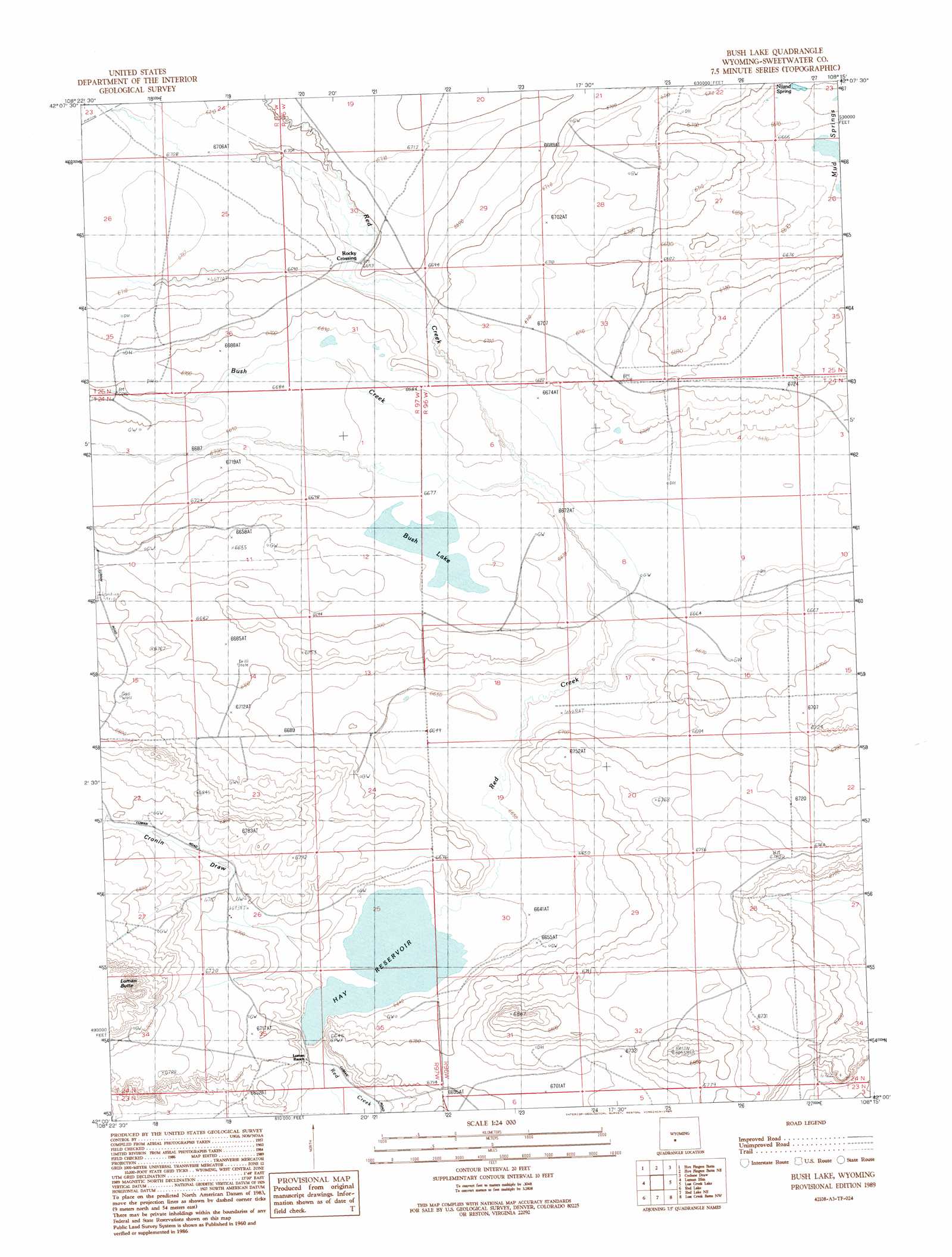
Bush Lake Topo Map Wyoming
To zoom in, hover over the map of Bush Lake
USGS Topo Quad 42108a3 - 1:24,000 scale
| Topo Map Name: | Bush Lake |
| USGS Topo Quad ID: | 42108a3 |
| Print Size: | ca. 21 1/4" wide x 27" high |
| Southeast Coordinates: | 42° N latitude / 108.25° W longitude |
| Map Center Coordinates: | 42.0625° N latitude / 108.3125° W longitude |
| U.S. State: | WY |
| Filename: | o42108a3.jpg |
| Download Map JPG Image: | Bush Lake topo map 1:24,000 scale |
| Map Type: | Topographic |
| Topo Series: | 7.5´ |
| Map Scale: | 1:24,000 |
| Source of Map Images: | United States Geological Survey (USGS) |
| Alternate Map Versions: |
Bush Lake WY 1989, updated 1989 Download PDF Buy paper map Bush Lake WY 2012 Download PDF Buy paper map Bush Lake WY 2015 Download PDF Buy paper map |
1:24,000 Topo Quads surrounding Bush Lake
Circle Bar Lake |
Picket Lake |
Sulphur Bar Spring |
Olson Springs |
Lost Creek Reservoir |
John Hay Reservoir |
Five Fingers Butte |
Five Fingers Butte Ne |
Cyclone Draw |
Osborne Draw |
Buffalo Hump Basin |
Luman Rim |
Bush Lake |
Lost Creek Lake |
Eagles Nest Draw |
Black Rock Flat East |
Red Lake |
Red Lake Ne |
Lost Creek Butte Nw |
Lost Creek Butte |
Twelvemile Well |
Red Lake Sw |
Red Lake Se |
Lost Creek Butte Sw |
Dennison Cap |
> Back to 42108a1 at 1:100,000 scale
> Back to 42108a1 at 1:250,000 scale
> Back to U.S. Topo Maps home
Bush Lake topo map: Gazetteer
Bush Lake: Dams
Hay Dam elevation 2023m 6637′Bush Lake: Lakes
Bush Lake elevation 2037m 6683′Bush Lake: Populated Places
Rocky Crossing elevation 2041m 6696′Bush Lake: Reservoirs
Hay Reservoir elevation 2023m 6637′Hay Reservoir elevation 2025m 6643′
Bush Lake: Springs
Niland Spring elevation 2031m 6663′Bush Lake: Streams
Bush Creek elevation 2034m 6673′Bush Lake: Valleys
Cronin Draw elevation 2025m 6643′Bush Lake digital topo map on disk
Buy this Bush Lake topo map showing relief, roads, GPS coordinates and other geographical features, as a high-resolution digital map file on DVD: