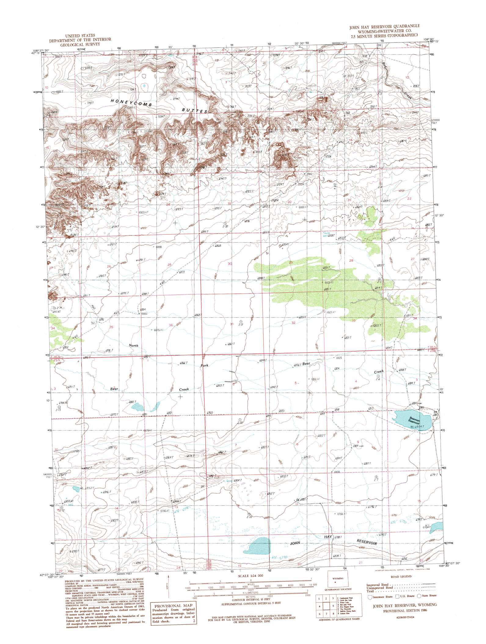
John Hay Reservoir Topo Map Wyoming
To zoom in, hover over the map of John Hay Reservoir
USGS Topo Quad 42108b5 - 1:24,000 scale
| Topo Map Name: | John Hay Reservoir |
| USGS Topo Quad ID: | 42108b5 |
| Print Size: | ca. 21 1/4" wide x 27" high |
| Southeast Coordinates: | 42.125° N latitude / 108.5° W longitude |
| Map Center Coordinates: | 42.1875° N latitude / 108.5625° W longitude |
| U.S. State: | WY |
| Filename: | o42108b5.jpg |
| Download Map JPG Image: | John Hay Reservoir topo map 1:24,000 scale |
| Map Type: | Topographic |
| Topo Series: | 7.5´ |
| Map Scale: | 1:24,000 |
| Source of Map Images: | United States Geological Survey (USGS) |
| Alternate Map Versions: |
John Hay Reservoir WY 1986, updated 1986 Download PDF Buy paper map John Hay Reservoir WY 2012 Download PDF Buy paper map John Hay Reservoir WY 2015 Download PDF Buy paper map |
1:24,000 Topo Quads surrounding John Hay Reservoir
South Pass City |
Atlantic City |
Radium Springs |
Lewiston Lakes |
Barras Springs |
Dickie Springs |
Continental Peak |
Circle Bar Lake |
Picket Lake |
Sulphur Bar Spring |
Joe Hay Rim |
Bob Jack Well |
John Hay Reservoir |
Five Fingers Butte |
Five Fingers Butte Ne |
Freighter Gap |
The Pinnacles |
Buffalo Hump Basin |
Luman Rim |
Bush Lake |
Black Rock North |
Black Rock Flat West |
Black Rock Flat East |
Red Lake |
Red Lake Ne |
> Back to 42108a1 at 1:100,000 scale
> Back to 42108a1 at 1:250,000 scale
> Back to U.S. Topo Maps home
John Hay Reservoir topo map: Gazetteer
John Hay Reservoir: Dams
Brannan Number 1 Dam elevation 2097m 6879′John Hay Reservoir: Ranges
Honeycomb Buttes elevation 2239m 7345′John Hay Reservoir: Reservoirs
Brannan Number 1 Reservoir elevation 2097m 6879′Brannan Reservoir elevation 2075m 6807′
John Hay Reservoir: Streams
North Fork Bear Creek elevation 2084m 6837′John Hay Reservoir digital topo map on disk
Buy this John Hay Reservoir topo map showing relief, roads, GPS coordinates and other geographical features, as a high-resolution digital map file on DVD: