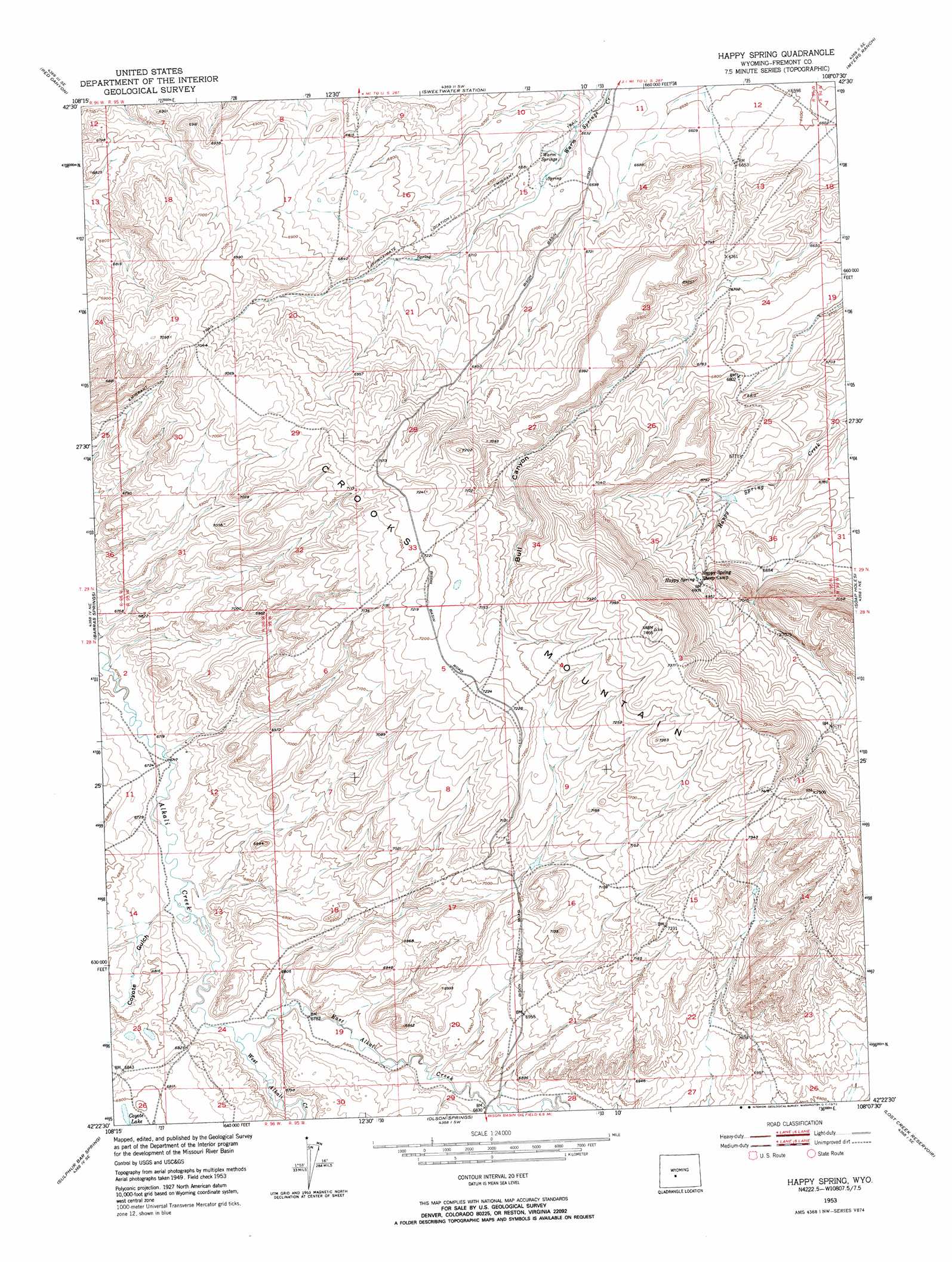
Happy Spring Topo Map Wyoming
To zoom in, hover over the map of Happy Spring
USGS Topo Quad 42108d2 - 1:24,000 scale
| Topo Map Name: | Happy Spring |
| USGS Topo Quad ID: | 42108d2 |
| Print Size: | ca. 21 1/4" wide x 27" high |
| Southeast Coordinates: | 42.375° N latitude / 108.125° W longitude |
| Map Center Coordinates: | 42.4375° N latitude / 108.1875° W longitude |
| U.S. State: | WY |
| Filename: | o42108d2.jpg |
| Download Map JPG Image: | Happy Spring topo map 1:24,000 scale |
| Map Type: | Topographic |
| Topo Series: | 7.5´ |
| Map Scale: | 1:24,000 |
| Source of Map Images: | United States Geological Survey (USGS) |
| Alternate Map Versions: |
Happy Spring WY 1953, updated 1954 Download PDF Buy paper map Happy Spring WY 1953, updated 1972 Download PDF Buy paper map Happy Spring WY 2012 Download PDF Buy paper map Happy Spring WY 2015 Download PDF Buy paper map |
1:24,000 Topo Quads surrounding Happy Spring
Del Monte Ridge |
Yellowstone Ranch |
Dishpan Butte |
Elkhorn Springs |
Tin Cup Mountain |
Schoettlin Mountain |
Red Canyon |
Sweetwater Station |
Myers Ranch |
Graham Ranch |
Lewiston Lakes |
Barras Springs |
Happy Spring |
Soap Holes |
Crooks Mountain |
Picket Lake |
Sulphur Bar Spring |
Olson Springs |
Lost Creek Reservoir |
Brenton Springs |
Five Fingers Butte |
Five Fingers Butte Ne |
Cyclone Draw |
Osborne Draw |
Antelope Reservoir |
> Back to 42108a1 at 1:100,000 scale
> Back to 42108a1 at 1:250,000 scale
> Back to U.S. Topo Maps home
Happy Spring topo map: Gazetteer
Happy Spring: Lakes
Coyote Lake elevation 2076m 6811′Happy Spring: Springs
Happy Spring elevation 2108m 6916′Warm Springs elevation 2029m 6656′
Happy Spring: Streams
East Alkali Creek elevation 2058m 6751′West Alkali Creek elevation 2060m 6758′
Happy Spring: Valleys
Coyote Gulch elevation 2055m 6742′Happy Spring digital topo map on disk
Buy this Happy Spring topo map showing relief, roads, GPS coordinates and other geographical features, as a high-resolution digital map file on DVD: