Sweetwater Station Topo Map Wyoming
To zoom in, hover over the map of Sweetwater Station
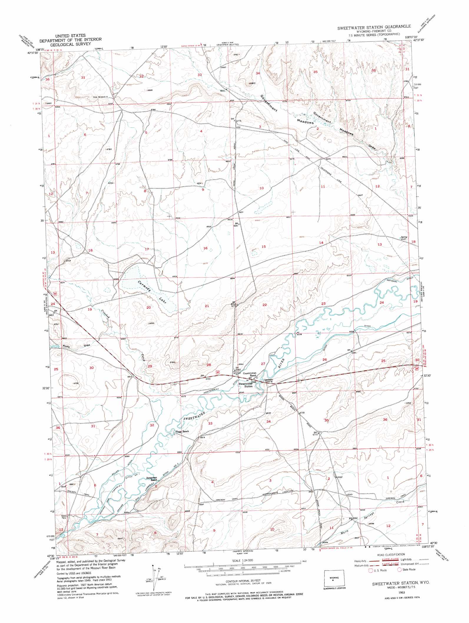
USGS Topo Quad 42108e2 - 1:24,000 scale
| Topo Map Name: | Sweetwater Station |
| USGS Topo Quad ID: | 42108e2 |
| Print Size: | ca. 21 1/4" wide x 27" high |
| Southeast Coordinates: | 42.5° N latitude / 108.125° W longitude |
| Map Center Coordinates: | 42.5625° N latitude / 108.1875° W longitude |
| U.S. State: | WY |
| Filename: | o42108e2.jpg |
| Download Map JPG Image: | Sweetwater Station topo map 1:24,000 scale |
| Map Type: | Topographic |
| Topo Series: | 7.5´ |
| Map Scale: | 1:24,000 |
| Source of Map Images: | United States Geological Survey (USGS) |
| Alternate Map Versions: |
Sweetwater Station WY 1953, updated 1954 Download PDF Buy paper map Sweetwater Station WY 1953, updated 1976 Download PDF Buy paper map Sweetwater Station WY 2012 Download PDF Buy paper map Sweetwater Station WY 2015 Download PDF Buy paper map |
1:24,000 Topo Quads surrounding Sweetwater Station
Ninemile Hill |
Bringolf Ranch |
Sand Draw |
Blue Gulch |
Rongis Reservoir |
Del Monte Ridge |
Yellowstone Ranch |
Dishpan Butte |
Elkhorn Springs |
Tin Cup Mountain |
Schoettlin Mountain |
Red Canyon |
Sweetwater Station |
Myers Ranch |
Graham Ranch |
Lewiston Lakes |
Barras Springs |
Happy Spring |
Soap Holes |
Crooks Mountain |
Picket Lake |
Sulphur Bar Spring |
Olson Springs |
Lost Creek Reservoir |
Brenton Springs |
> Back to 42108e1 at 1:100,000 scale
> Back to 42108a1 at 1:250,000 scale
> Back to U.S. Topo Maps home
Sweetwater Station topo map: Gazetteer
Sweetwater Station: Canals
Graham and Farmsley Ditch Number 1 elevation 2007m 6584′Graham and Farmsley Ditch Number 2 elevation 2006m 6581′
Independent Ditch elevation 1999m 6558′
Miller Ditch elevation 2007m 6584′
National Ditch elevation 1986m 6515′
Sweetwater Station: Flats
Government Meadows elevation 2019m 6624′Sweetwater Station: Lakes
Carmody Lake elevation 2011m 6597′Sweetwater Station: Populated Places
Sweetwater Crossing elevation 1996m 6548′Sweetwater Station elevation 1996m 6548′
Sweetwater Station: Streams
Antelope Creek elevation 2018m 6620′Crooked Creek elevation 2000m 6561′
Sweetwater Station: Valleys
Rocky Draw elevation 2012m 6601′Sweetwater Station digital topo map on disk
Buy this Sweetwater Station topo map showing relief, roads, GPS coordinates and other geographical features, as a high-resolution digital map file on DVD: