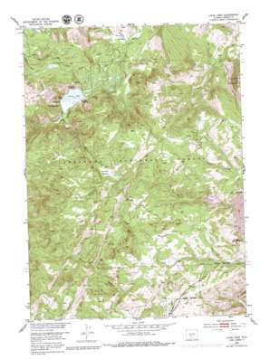
Louis Lake Topo Map Wyoming
To zoom in, hover over the map of Louis Lake
USGS Topo Quad 42108e7 - 1:24,000 scale
| Topo Map Name: | Louis Lake |
| USGS Topo Quad ID: | 42108e7 |
| Print Size: | ca. 21 1/4" wide x 27" high |
| Southeast Coordinates: | 42.5° N latitude / 108.75° W longitude |
| Map Center Coordinates: | 42.5625° N latitude / 108.8125° W longitude |
| U.S. State: | WY |
| Filename: | o42108e7.jpg |
| Download Map JPG Image: | Louis Lake topo map 1:24,000 scale |
| Map Type: | Topographic |
| Topo Series: | 7.5´ |
| Map Scale: | 1:24,000 |
| Source of Map Images: | United States Geological Survey (USGS) |
| Alternate Map Versions: |
Louis Lake WY 1953, updated 1955 Download PDF Buy paper map Louis Lake WY 1953, updated 1962 Download PDF Buy paper map Louis Lake WY 1953, updated 1979 Download PDF Buy paper map Louis Lake WY 1991, updated 1997 Download PDF Buy paper map Louis Lake WY 2012 Download PDF Buy paper map Louis Lake WY 2015 Download PDF Buy paper map |
| FStopo: | US Forest Service topo Louis Lake is available: Download FStopo PDF Download FStopo TIF |
1:24,000 Topo Quads surrounding Louis Lake
> Back to 42108e1 at 1:100,000 scale
> Back to 42108a1 at 1:250,000 scale
> Back to U.S. Topo Maps home
Louis Lake topo map: Gazetteer
Louis Lake: Basins
Maxon Basin elevation 2487m 8159′Louis Lake: Cliffs
Sherwood Point elevation 2531m 8303′Louis Lake: Dams
Upper Rock Creek Dam elevation 2555m 8382′Louis Lake: Flats
Grannier Meadow elevation 2694m 8838′Louis Lake: Lakes
Louis Lake elevation 2611m 8566′Louis Lake: Mines
Abernathy Claim elevation 2723m 8933′Atlantic City Iron Mine elevation 2523m 8277′
Rock Creek Placers Mine elevation 2570m 8431′
Louis Lake: Reservoirs
Upper Rock Creek Reservoir elevation 2555m 8382′Louis Lake: Streams
Atlantic Creek elevation 2685m 8809′Hidden Creek elevation 2501m 8205′
Little Rock Creek elevation 2673m 8769′
Louis Creek elevation 2490m 8169′
Louis Lake: Trails
Louis Lake Trail elevation 2844m 9330′Shoshone Stock Driveway elevation 2524m 8280′
Louis Lake digital topo map on disk
Buy this Louis Lake topo map showing relief, roads, GPS coordinates and other geographical features, as a high-resolution digital map file on DVD:


