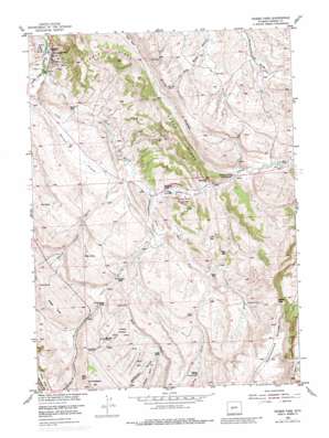
Weiser Pass Topo Map Wyoming
To zoom in, hover over the map of Weiser Pass
USGS Topo Quad 42108f5 - 1:24,000 scale
| Topo Map Name: | Weiser Pass |
| USGS Topo Quad ID: | 42108f5 |
| Print Size: | ca. 21 1/4" wide x 27" high |
| Southeast Coordinates: | 42.625° N latitude / 108.5° W longitude |
| Map Center Coordinates: | 42.6875° N latitude / 108.5625° W longitude |
| U.S. State: | WY |
| Filename: | o42108f5.jpg |
| Download Map JPG Image: | Weiser Pass topo map 1:24,000 scale |
| Map Type: | Topographic |
| Topo Series: | 7.5´ |
| Map Scale: | 1:24,000 |
| Source of Map Images: | United States Geological Survey (USGS) |
| Alternate Map Versions: |
Weiser Pass WY 1953, updated 1955 Download PDF Buy paper map Weiser Pass WY 1953, updated 1964 Download PDF Buy paper map Weiser Pass WY 1953, updated 1979 Download PDF Buy paper map Weiser Pass WY 1953, updated 1983 Download PDF Buy paper map Weiser Pass WY 2012 Download PDF Buy paper map Weiser Pass WY 2015 Download PDF Buy paper map |
1:24,000 Topo Quads surrounding Weiser Pass
> Back to 42108e1 at 1:100,000 scale
> Back to 42108a1 at 1:250,000 scale
> Back to U.S. Topo Maps home
Weiser Pass topo map: Gazetteer
Weiser Pass: Dams
Johnson Dam elevation 1783m 5849′Weiser Pass: Flats
Hofftowe Meadows elevation 1796m 5892′Onion Flats elevation 1668m 5472′
Weiser Pass: Gaps
Weiser Pass elevation 1947m 6387′Weiser Pass: Mines
Dallas Anticline Number One Mine elevation 1823m 5980′Derby Anticline Mine elevation 1801m 5908′
Weiser Pass: Oilfields
Dallas Oil Field elevation 1642m 5387′Derby Dome Oil Field elevation 1725m 5659′
Weiser Pass: Populated Places
Kotey Place elevation 1659m 5442′Weiser Pass: Reservoirs
Carr Reservoir elevation 1787m 5862′Johnson Reservoir elevation 1783m 5849′
Weiser Pass: Ridges
Cedar Ridge elevation 1845m 6053′Cottonwood Divide elevation 1996m 6548′
Weiser Pass: Springs
Barrel Spring elevation 1911m 6269′Big Spring elevation 1758m 5767′
Chimney Spring elevation 1876m 6154′
Chubby Spring elevation 1831m 6007′
Coal Mine Spring elevation 1790m 5872′
Commissary Spring elevation 1960m 6430′
Critnan Springs elevation 1896m 6220′
Hidden Spring elevation 1785m 5856′
Johnny Spring elevation 1732m 5682′
Mud Spring elevation 1755m 5757′
Pipe Springs elevation 1769m 5803′
Weiser Pass: Streams
Cottonwood Creek elevation 1695m 5561′Critnan Creek elevation 1771m 5810′
East Fork Cottonwood Creek elevation 1712m 5616′
Twin Creek elevation 1640m 5380′
Weiser Creek elevation 1724m 5656′
West Fork Cottonwood Creek elevation 1712m 5616′
Weiser Pass: Summits
Weiser Knoll elevation 2005m 6578′Weiser Pass: Valleys
Devils Canyon elevation 1697m 5567′McCullen Gulch elevation 1821m 5974′
Murphy Gulch elevation 1845m 6053′
Weiser Pass digital topo map on disk
Buy this Weiser Pass topo map showing relief, roads, GPS coordinates and other geographical features, as a high-resolution digital map file on DVD:


