Blue Gulch Topo Map Wyoming
To zoom in, hover over the map of Blue Gulch
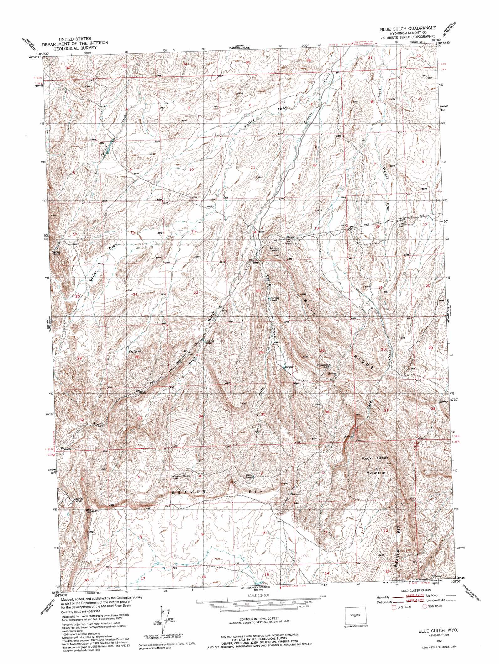
USGS Topo Quad 42108g1 - 1:24,000 scale
| Topo Map Name: | Blue Gulch |
| USGS Topo Quad ID: | 42108g1 |
| Print Size: | ca. 21 1/4" wide x 27" high |
| Southeast Coordinates: | 42.75° N latitude / 108° W longitude |
| Map Center Coordinates: | 42.8125° N latitude / 108.0625° W longitude |
| U.S. State: | WY |
| Filename: | o42108g1.jpg |
| Download Map JPG Image: | Blue Gulch topo map 1:24,000 scale |
| Map Type: | Topographic |
| Topo Series: | 7.5´ |
| Map Scale: | 1:24,000 |
| Source of Map Images: | United States Geological Survey (USGS) |
| Alternate Map Versions: |
Blue Gulch WY 1953, updated 1954 Download PDF Buy paper map Blue Gulch WY 1953, updated 1954 Download PDF Buy paper map Blue Gulch WY 1953, updated 1991 Download PDF Buy paper map Blue Gulch WY 2012 Download PDF Buy paper map Blue Gulch WY 2015 Download PDF Buy paper map |
1:24,000 Topo Quads surrounding Blue Gulch
Riverton East |
Indian Butte |
Fuller Reservoir |
Haybarn Hill |
Squaw Butte |
Arapahoe Ne |
Alkali Butte |
Campbell Ridge |
Double Butte |
Butte Well |
Bringolf Ranch |
Sand Draw |
Blue Gulch |
Rongis Reservoir |
Rongis Reservoir Se |
Yellowstone Ranch |
Dishpan Butte |
Elkhorn Springs |
Tin Cup Mountain |
Muskrat Basin |
Red Canyon |
Sweetwater Station |
Myers Ranch |
Graham Ranch |
Stampede Meadow |
> Back to 42108e1 at 1:100,000 scale
> Back to 42108a1 at 1:250,000 scale
> Back to U.S. Topo Maps home
Blue Gulch topo map: Gazetteer
Blue Gulch: Mines
Alkali Butte Mine elevation 1799m 5902′Cocharn Mine elevation 2154m 7066′
Connant Creek Mine elevation 1795m 5889′
Coohow Number One Mine elevation 2076m 6811′
Groveland Number One Mine elevation 2052m 6732′
Nose Number One and Butch Number Two Mine elevation 2079m 6820′
Oil Mountain Number One Mine elevation 1837m 6026′
Strubel Number Fourteen-A Mine elevation 2112m 6929′
Blue Gulch: Ridges
Blue Ridge elevation 1932m 6338′Blue Gulch: Springs
Cogswell Spring elevation 2055m 6742′Keg Spring elevation 1847m 6059′
Moone Spring elevation 2072m 6797′
Pipe Spring elevation 1878m 6161′
Blue Gulch: Streams
Moone Creek elevation 1877m 6158′Blue Gulch: Summits
Rock Creek Mountain elevation 2172m 7125′Blue Gulch: Valleys
Blue Gulch elevation 1777m 5830′Boiler Draw elevation 1731m 5679′
Walker Draw elevation 1735m 5692′
Blue Gulch digital topo map on disk
Buy this Blue Gulch topo map showing relief, roads, GPS coordinates and other geographical features, as a high-resolution digital map file on DVD: