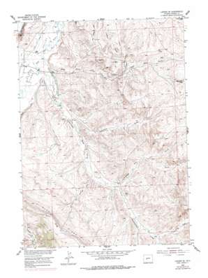
Lander Se Topo Map Wyoming
To zoom in, hover over the map of Lander Se
USGS Topo Quad 42108g5 - 1:24,000 scale
| Topo Map Name: | Lander Se |
| USGS Topo Quad ID: | 42108g5 |
| Print Size: | ca. 21 1/4" wide x 27" high |
| Southeast Coordinates: | 42.75° N latitude / 108.5° W longitude |
| Map Center Coordinates: | 42.8125° N latitude / 108.5625° W longitude |
| U.S. State: | WY |
| Filename: | o42108g5.jpg |
| Download Map JPG Image: | Lander Se topo map 1:24,000 scale |
| Map Type: | Topographic |
| Topo Series: | 7.5´ |
| Map Scale: | 1:24,000 |
| Source of Map Images: | United States Geological Survey (USGS) |
| Alternate Map Versions: |
Lander SE WY 1952, updated 1954 Download PDF Buy paper map Lander SE WY 1952, updated 1956 Download PDF Buy paper map Lander SE WY 1952, updated 1956 Download PDF Buy paper map Lander SE WY 1952, updated 1979 Download PDF Buy paper map Lander SE WY 1952, updated 1986 Download PDF Buy paper map Lander SE WY 2012 Download PDF Buy paper map Lander SE WY 2015 Download PDF Buy paper map |
1:24,000 Topo Quads surrounding Lander Se
> Back to 42108e1 at 1:100,000 scale
> Back to 42108a1 at 1:250,000 scale
> Back to U.S. Topo Maps home
Lander Se topo map: Gazetteer
Lander Se: Canals
Grant Young Ditch elevation 1580m 5183′Lyons Ditch elevation 1584m 5196′
Millard Ditch elevation 1598m 5242′
Lander Se: Mines
Bachelor Mine elevation 1614m 5295′Brower Mine elevation 1635m 5364′
Dickinson Mine elevation 1601m 5252′
Dunne Mine elevation 1670m 5479′
George Mine elevation 1670m 5479′
Hudson Number Two Mine elevation 1670m 5479′
Poposia Mine elevation 1671m 5482′
Williams Mine elevation 1660m 5446′
Lander Se: Summits
Monument Butte elevation 1747m 5731′Lander Se: Valleys
Ballenger Draw elevation 1642m 5387′Carr Springs Draw elevation 1626m 5334′
Coal Mine Draw elevation 1570m 5150′
Coal Mine Gulch elevation 1673m 5488′
Fivemile Draw elevation 1739m 5705′
Government Draw elevation 1572m 5157′
Monument Draw elevation 1598m 5242′
North Fork Ballenger Draw elevation 1675m 5495′
South Fork Ballenger Draw elevation 1675m 5495′
Lander Se digital topo map on disk
Buy this Lander Se topo map showing relief, roads, GPS coordinates and other geographical features, as a high-resolution digital map file on DVD:


