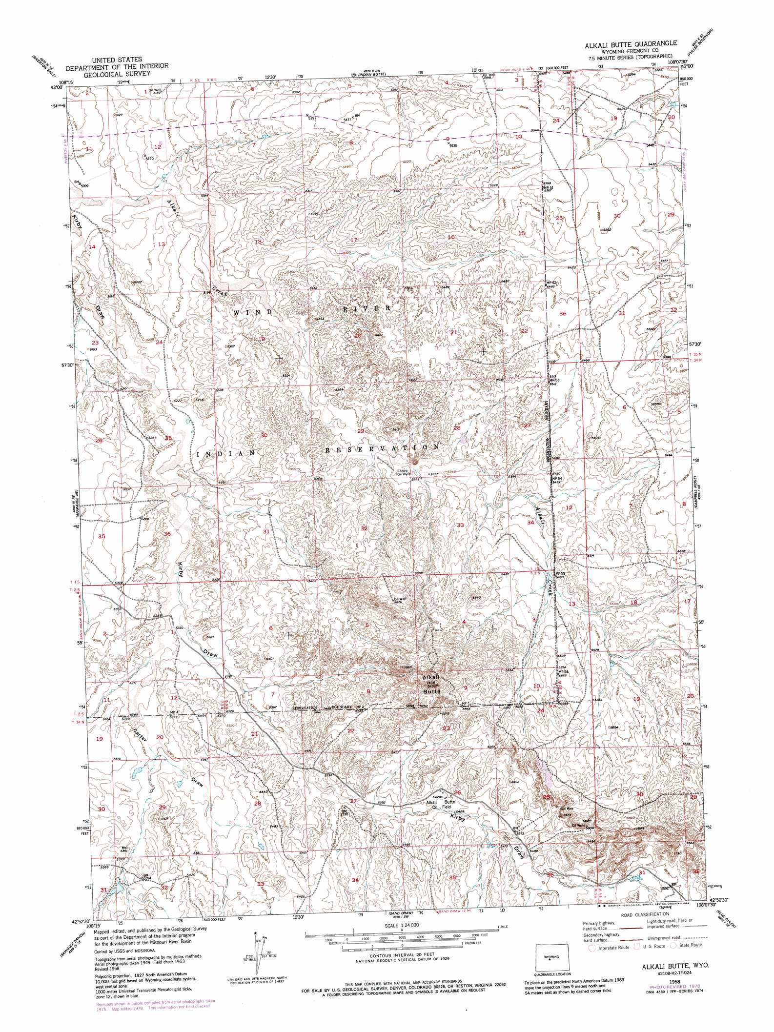
Alkali Butte Topo Map Wyoming
To zoom in, hover over the map of Alkali Butte
USGS Topo Quad 42108h2 - 1:24,000 scale
| Topo Map Name: | Alkali Butte |
| USGS Topo Quad ID: | 42108h2 |
| Print Size: | ca. 21 1/4" wide x 27" high |
| Southeast Coordinates: | 42.875° N latitude / 108.125° W longitude |
| Map Center Coordinates: | 42.9375° N latitude / 108.1875° W longitude |
| U.S. State: | WY |
| Filename: | o42108h2.jpg |
| Download Map JPG Image: | Alkali Butte topo map 1:24,000 scale |
| Map Type: | Topographic |
| Topo Series: | 7.5´ |
| Map Scale: | 1:24,000 |
| Source of Map Images: | United States Geological Survey (USGS) |
| Alternate Map Versions: |
Alkali Butte WY 1958, updated 1984 Download PDF Buy paper map Alkali Butte WY 2012 Download PDF Buy paper map Alkali Butte WY 2015 Download PDF Buy paper map |
1:24,000 Topo Quads surrounding Alkali Butte
Lost Wells Butte |
Riverton Ne |
Hidden Valley |
Shoshoni |
Ocla Draw |
Riverton West |
Riverton East |
Indian Butte |
Fuller Reservoir |
Haybarn Hill |
Arapahoe |
Arapahoe Ne |
Alkali Butte |
Campbell Ridge |
Double Butte |
Ninemile Hill |
Bringolf Ranch |
Sand Draw |
Blue Gulch |
Rongis Reservoir |
Del Monte Ridge |
Yellowstone Ranch |
Dishpan Butte |
Elkhorn Springs |
Tin Cup Mountain |
> Back to 42108e1 at 1:100,000 scale
> Back to 42108a1 at 1:250,000 scale
> Back to U.S. Topo Maps home
Alkali Butte topo map: Gazetteer
Alkali Butte: Mines
Bell Mine elevation 1694m 5557′Hunt Mine elevation 1658m 5439′
Little Signor Mine elevation 1742m 5715′
Signor Mine elevation 1750m 5741′
Alkali Butte: Oilfields
Alkali Butte Oil Field elevation 1655m 5429′Alkali Butte: Streams
Alkali Creek elevation 1549m 5082′Alkali Butte: Summits
Alkali Butte elevation 1796m 5892′Alkali Butte: Valleys
Carter Draw elevation 1610m 5282′Alkali Butte digital topo map on disk
Buy this Alkali Butte topo map showing relief, roads, GPS coordinates and other geographical features, as a high-resolution digital map file on DVD: