Arapahoe Topo Map Wyoming
To zoom in, hover over the map of Arapahoe
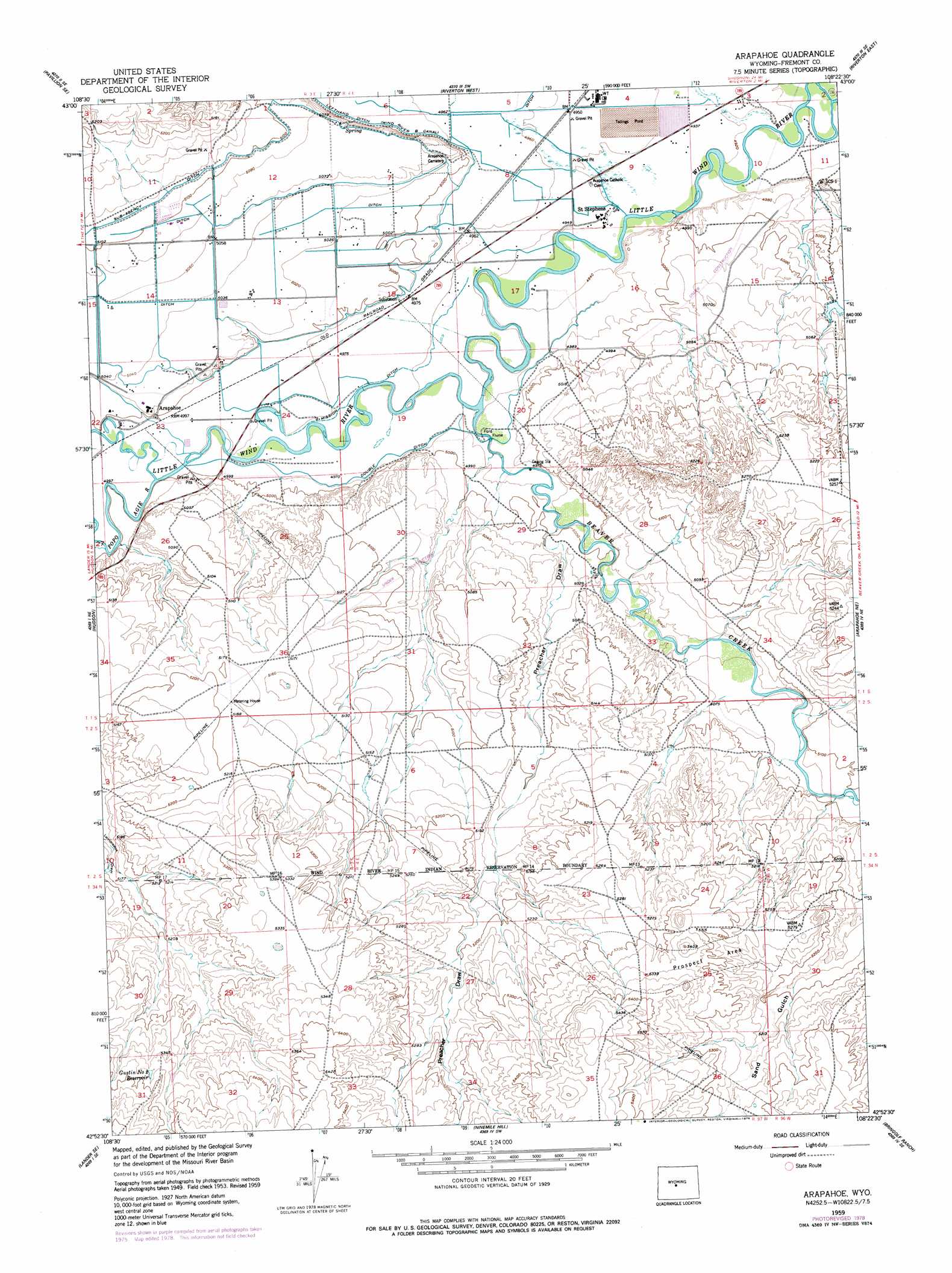
USGS Topo Quad 42108h4 - 1:24,000 scale
| Topo Map Name: | Arapahoe |
| USGS Topo Quad ID: | 42108h4 |
| Print Size: | ca. 21 1/4" wide x 27" high |
| Southeast Coordinates: | 42.875° N latitude / 108.375° W longitude |
| Map Center Coordinates: | 42.9375° N latitude / 108.4375° W longitude |
| U.S. State: | WY |
| Filename: | o42108h4.jpg |
| Download Map JPG Image: | Arapahoe topo map 1:24,000 scale |
| Map Type: | Topographic |
| Topo Series: | 7.5´ |
| Map Scale: | 1:24,000 |
| Source of Map Images: | United States Geological Survey (USGS) |
| Alternate Map Versions: |
Arapahoe WY 1953, updated 1954 Download PDF Buy paper map Arapahoe WY 1959, updated 1961 Download PDF Buy paper map Arapahoe WY 1959, updated 1979 Download PDF Buy paper map Arapahoe WY 2012 Download PDF Buy paper map Arapahoe WY 2015 Download PDF Buy paper map |
1:24,000 Topo Quads surrounding Arapahoe
Pavillion |
Ocean Lake |
Lost Wells Butte |
Riverton Ne |
Hidden Valley |
Mule Butte |
Pavillion Se |
Riverton West |
Riverton East |
Indian Butte |
Lander Nw |
Hudson |
Arapahoe |
Arapahoe Ne |
Alkali Butte |
Lander |
Lander Se |
Ninemile Hill |
Bringolf Ranch |
Sand Draw |
Wolf Point |
Weiser Pass |
Del Monte Ridge |
Yellowstone Ranch |
Dishpan Butte |
> Back to 42108e1 at 1:100,000 scale
> Back to 42108a1 at 1:250,000 scale
> Back to U.S. Topo Maps home
Arapahoe topo map: Gazetteer
Arapahoe: Canals
Double Ditch elevation 1518m 4980′Lefthand Ditch elevation 1524m 5000′
Mission Ditch elevation 1513m 4963′
Sub-Agency Ditch elevation 1560m 5118′
Arapahoe: Populated Places
Arapahoe elevation 1526m 5006′Saint Stephens elevation 1506m 4940′
Arapahoe: Reservoirs
Gustin Number 2 Reservoir elevation 1638m 5374′Arapahoe: Streams
Beaver Creek elevation 1511m 4957′Popo Agie River elevation 1524m 5000′
Arapahoe: Valleys
Preacher Draw elevation 1518m 4980′Arapahoe digital topo map on disk
Buy this Arapahoe topo map showing relief, roads, GPS coordinates and other geographical features, as a high-resolution digital map file on DVD: