Wind River Topo Map Wyoming
To zoom in, hover over the map of Wind River
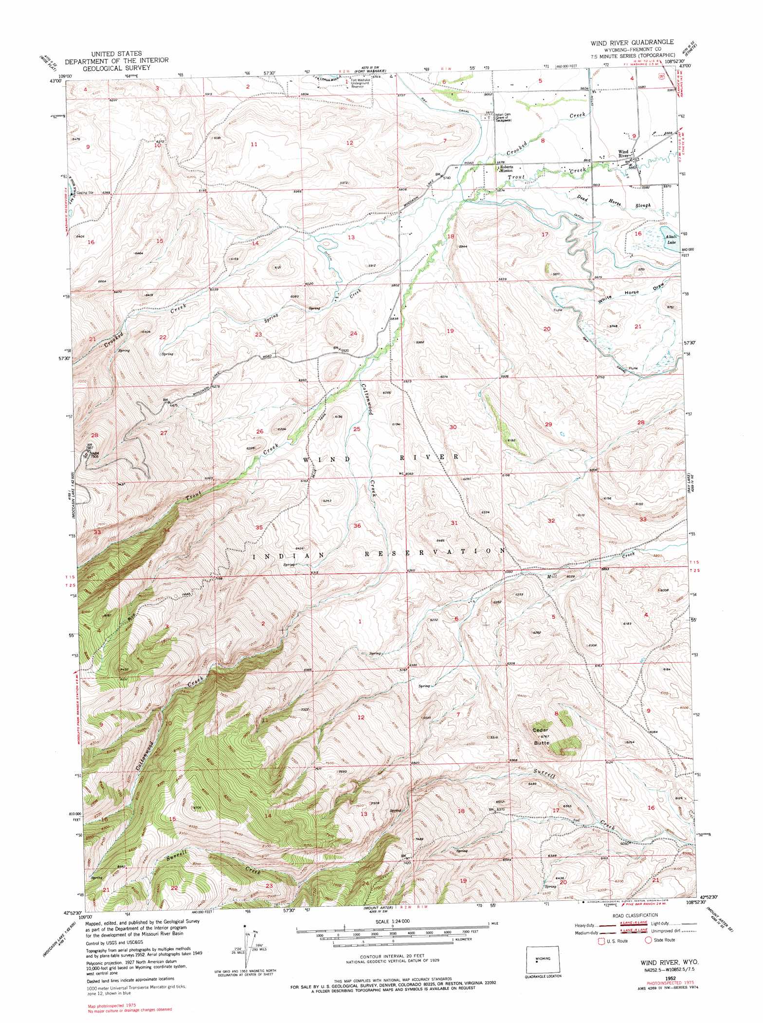
USGS Topo Quad 42108h8 - 1:24,000 scale
| Topo Map Name: | Wind River |
| USGS Topo Quad ID: | 42108h8 |
| Print Size: | ca. 21 1/4" wide x 27" high |
| Southeast Coordinates: | 42.875° N latitude / 108.875° W longitude |
| Map Center Coordinates: | 42.9375° N latitude / 108.9375° W longitude |
| U.S. State: | WY |
| Filename: | o42108h8.jpg |
| Download Map JPG Image: | Wind River topo map 1:24,000 scale |
| Map Type: | Topographic |
| Topo Series: | 7.5´ |
| Map Scale: | 1:24,000 |
| Source of Map Images: | United States Geological Survey (USGS) |
| Alternate Map Versions: |
Wind River WY 1952, updated 1954 Download PDF Buy paper map Wind River WY 1952, updated 1970 Download PDF Buy paper map Wind River WY 1952, updated 1978 Download PDF Buy paper map Wind River WY 2012 Download PDF Buy paper map Wind River WY 2015 Download PDF Buy paper map |
1:24,000 Topo Quads surrounding Wind River
Bull Lake West |
Bull Lake East |
Argo Butte |
Morton |
Pavillion |
Saint Lawrence Basin |
Wise Flat |
Fort Washakie |
Ethete |
Mule Butte |
Washakie Park |
Moccasin Lake |
Wind River |
Ray Lake |
Lander Nw |
Lizard Head Peak |
Dickinson Park |
Mount Arter |
Mount Arter Se |
Lander |
Temple Peak |
Sweetwater Gap |
Cony Mountain |
Fossil Hill |
Wolf Point |
> Back to 42108e1 at 1:100,000 scale
> Back to 42108a1 at 1:250,000 scale
> Back to U.S. Topo Maps home
Wind River topo map: Gazetteer
Wind River: Lakes
Alkali Lake elevation 1694m 5557′Wind River: Mines
North Fork Canyon Number One Mine elevation 2044m 6706′Wind River Mountain Front Number One Mine elevation 2500m 8202′
Wind River: Populated Places
Wind River elevation 1704m 5590′Wind River: Reservoirs
Fort Washakie Underground Reservoir elevation 1754m 5754′Wind River: Streams
Cottonwood Creek elevation 1785m 5856′Spring Creek elevation 1739m 5705′
Wind River: Summits
Cedar Butte elevation 2063m 6768′Wind River: Trails
Blue Trail elevation 2371m 7778′Wind River digital topo map on disk
Buy this Wind River topo map showing relief, roads, GPS coordinates and other geographical features, as a high-resolution digital map file on DVD: