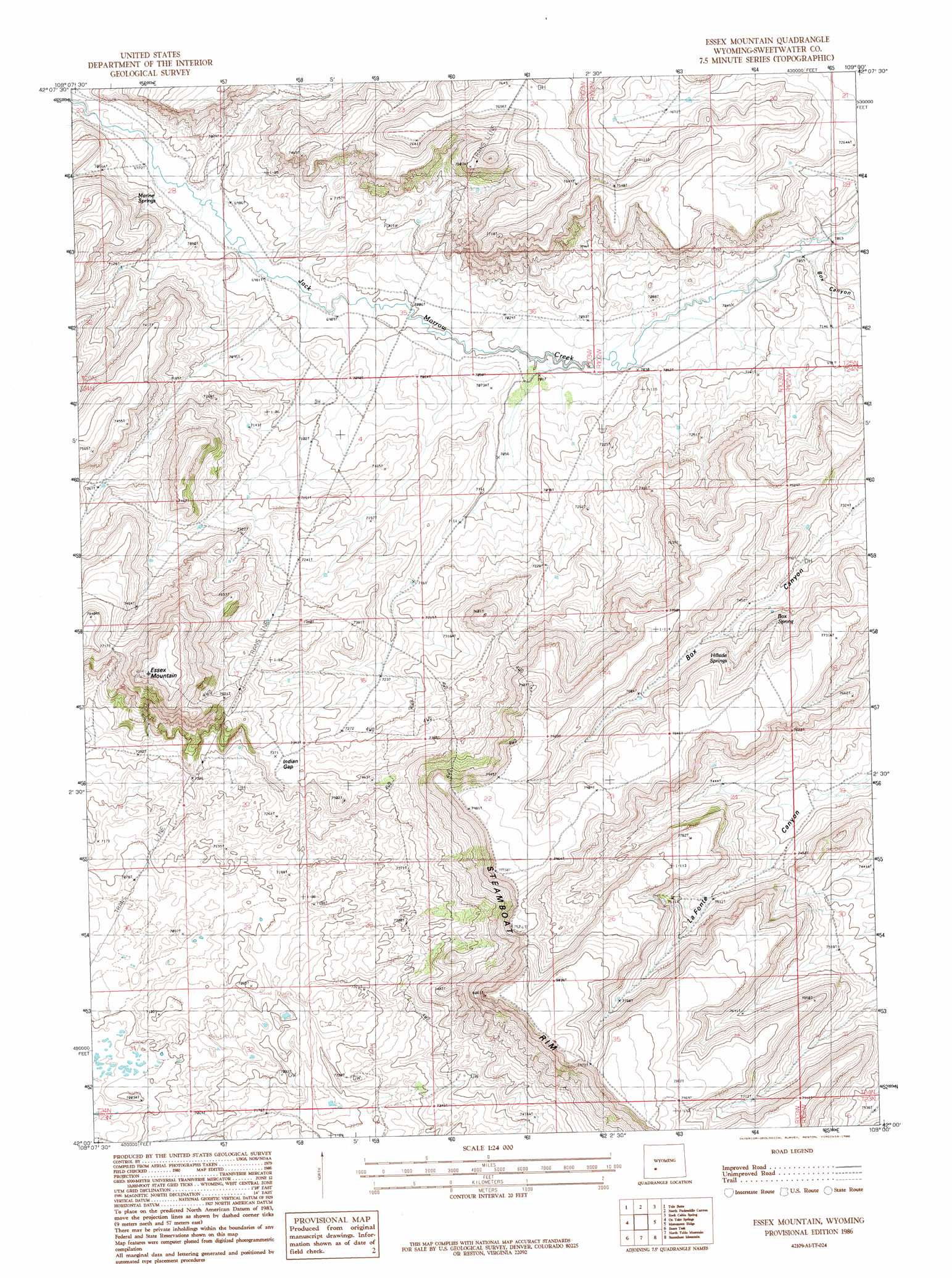
Essex Mountain Topo Map Wyoming
To zoom in, hover over the map of Essex Mountain
USGS Topo Quad 42109a1 - 1:24,000 scale
| Topo Map Name: | Essex Mountain |
| USGS Topo Quad ID: | 42109a1 |
| Print Size: | ca. 21 1/4" wide x 27" high |
| Southeast Coordinates: | 42° N latitude / 109° W longitude |
| Map Center Coordinates: | 42.0625° N latitude / 109.0625° W longitude |
| U.S. State: | WY |
| Filename: | o42109a1.jpg |
| Download Map JPG Image: | Essex Mountain topo map 1:24,000 scale |
| Map Type: | Topographic |
| Topo Series: | 7.5´ |
| Map Scale: | 1:24,000 |
| Source of Map Images: | United States Geological Survey (USGS) |
| Alternate Map Versions: |
Essex Mountain WY 1986, updated 1986 Download PDF Buy paper map Essex Mountain WY 2012 Download PDF Buy paper map Essex Mountain WY 2015 Download PDF Buy paper map |
1:24,000 Topo Quads surrounding Essex Mountain
Big Sandy Reservoir Se |
Parting Of The Ways |
Hay Meadow Reservoir |
Pacific Springs |
Dickie Springs |
Eden Reservoir East |
Tule Butte |
North Packsaddle Canyon |
Rock Cabin Spring |
Joe Hay Rim |
Fifteenmile Spring |
Ox Yoke Springs |
Essex Mountain |
Monument Ridge |
Freighter Gap |
White Rocks |
Boars Tusk |
North Table Mountain |
Steamboat Mountain |
Black Rock North |
Clay Buttes Se |
Boars Tusk Sw |
Deer Butte |
South Superior |
Black Rock South |
> Back to 42109a1 at 1:100,000 scale
> Back to 42108a1 at 1:250,000 scale
> Back to U.S. Topo Maps home
Essex Mountain topo map: Gazetteer
Essex Mountain: Cliffs
Steamboat Rim elevation 2432m 7979′Essex Mountain: Gaps
Indian Gap elevation 2249m 7378′Essex Mountain: Springs
Box Spring elevation 2302m 7552′Hillside Springs elevation 2313m 7588′
Marine Spring elevation 2146m 7040′
Essex Mountain: Summits
Essex Mountain elevation 2441m 8008′Essex Mountain: Valleys
Box Canyon elevation 2156m 7073′Essex Mountain digital topo map on disk
Buy this Essex Mountain topo map showing relief, roads, GPS coordinates and other geographical features, as a high-resolution digital map file on DVD: