Farson Topo Map Wyoming
To zoom in, hover over the map of Farson
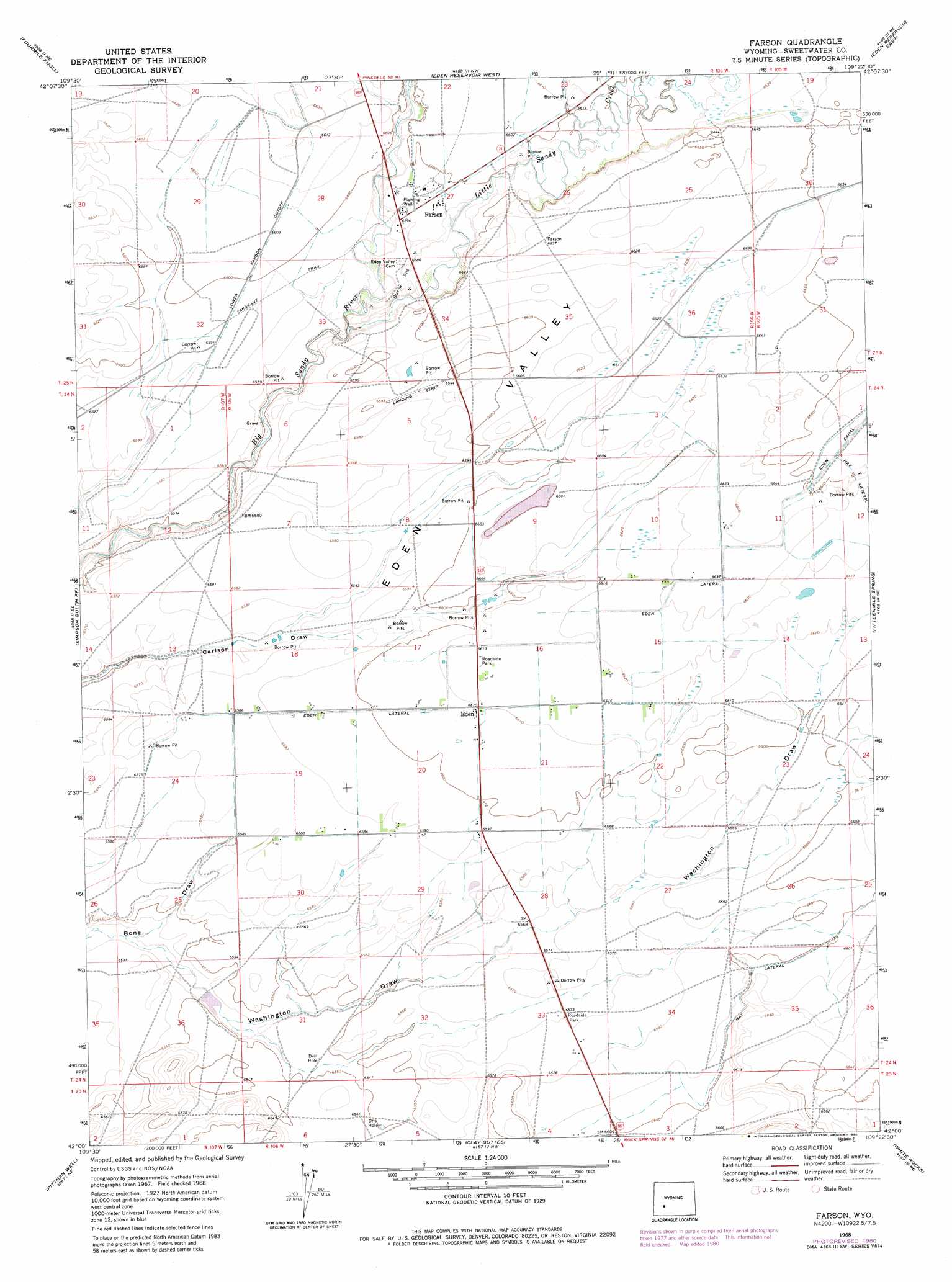
USGS Topo Quad 42109a4 - 1:24,000 scale
| Topo Map Name: | Farson |
| USGS Topo Quad ID: | 42109a4 |
| Print Size: | ca. 21 1/4" wide x 27" high |
| Southeast Coordinates: | 42° N latitude / 109.375° W longitude |
| Map Center Coordinates: | 42.0625° N latitude / 109.4375° W longitude |
| U.S. State: | WY |
| Filename: | o42109a4.jpg |
| Download Map JPG Image: | Farson topo map 1:24,000 scale |
| Map Type: | Topographic |
| Topo Series: | 7.5´ |
| Map Scale: | 1:24,000 |
| Source of Map Images: | United States Geological Survey (USGS) |
| Alternate Map Versions: |
Farson WY 1968, updated 1971 Download PDF Buy paper map Farson WY 1968, updated 1980 Download PDF Buy paper map Farson WY 2012 Download PDF Buy paper map Farson WY 2015 Download PDF Buy paper map |
1:24,000 Topo Quads surrounding Farson
Teakettle Butte |
Juel Spring |
Big Sandy Reservoir |
Big Sandy Reservoir Se |
Parting Of The Ways |
Twelvemile Knoll |
Fourmile Knoll |
Eden Reservoir West |
Eden Reservoir East |
Tule Butte |
Simpson Gulch Sw |
Simpson Gulch Se |
Farson |
Fifteenmile Spring |
Ox Yoke Springs |
Gasson Bridge |
Pittman Well |
Clay Buttes |
White Rocks |
Boars Tusk |
Big Island Bridge |
Chrisman Ranch |
Clay Buttes Sw |
Clay Buttes Se |
Boars Tusk Sw |
> Back to 42109a1 at 1:100,000 scale
> Back to 42108a1 at 1:250,000 scale
> Back to U.S. Topo Maps home
Farson topo map: Gazetteer
Farson: Canals
Eden Lateral elevation 2018m 6620′Farson: Mines
State Highway Department Mine elevation 2022m 6633′Farson: Populated Places
Eden elevation 2016m 6614′Farson elevation 2010m 6594′
Farson: Streams
Little Sandy Creek elevation 1998m 6555′Farson: Valleys
Eden Valley elevation 2008m 6587′Washington Draw elevation 1991m 6532′
Farson digital topo map on disk
Buy this Farson topo map showing relief, roads, GPS coordinates and other geographical features, as a high-resolution digital map file on DVD: