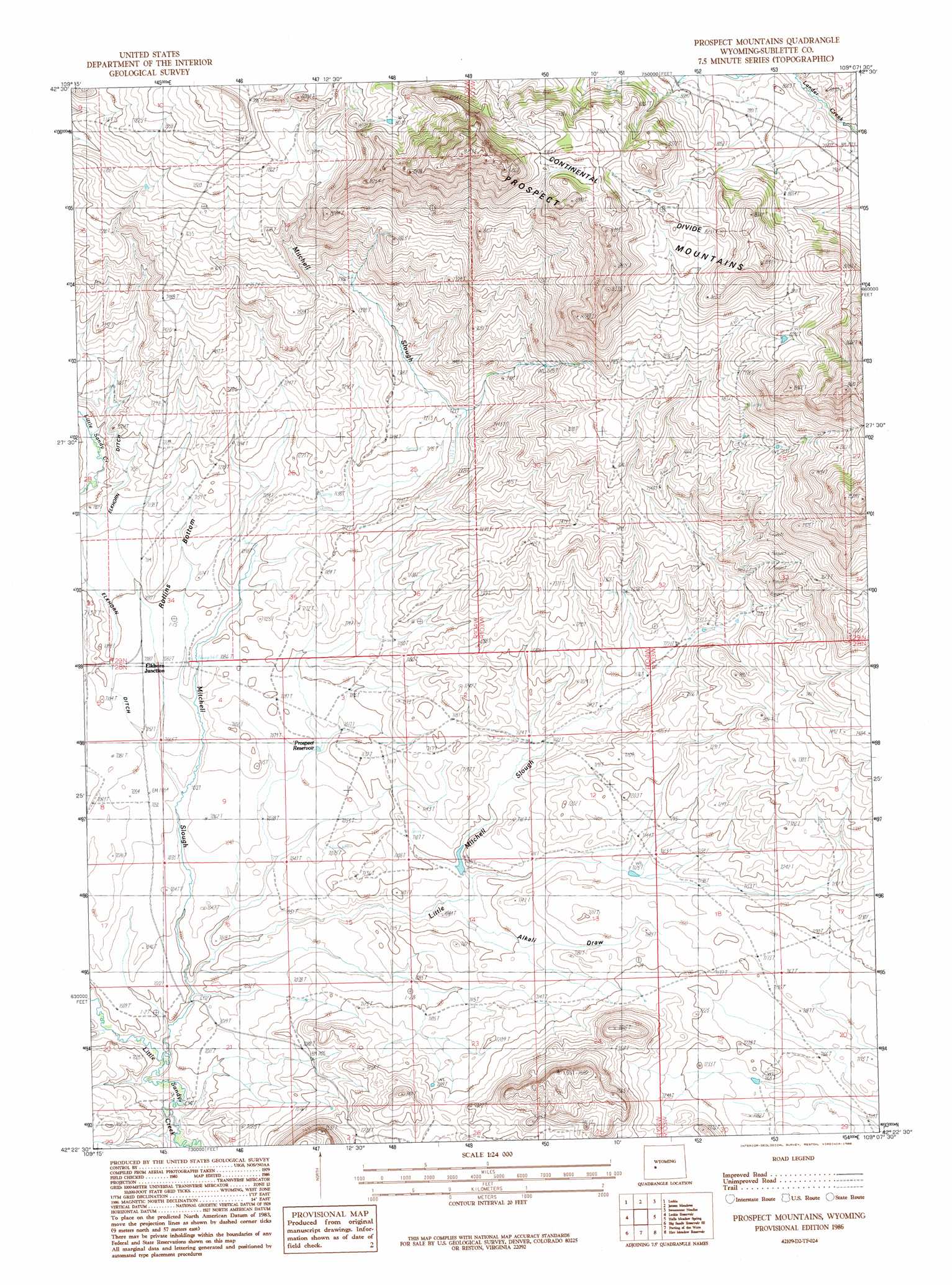
Prospect Mountains Topo Map Wyoming
To zoom in, hover over the map of Prospect Mountains
USGS Topo Quad 42109d2 - 1:24,000 scale
| Topo Map Name: | Prospect Mountains |
| USGS Topo Quad ID: | 42109d2 |
| Print Size: | ca. 21 1/4" wide x 27" high |
| Southeast Coordinates: | 42.375° N latitude / 109.125° W longitude |
| Map Center Coordinates: | 42.4375° N latitude / 109.1875° W longitude |
| U.S. State: | WY |
| Filename: | o42109d2.jpg |
| Download Map JPG Image: | Prospect Mountains topo map 1:24,000 scale |
| Map Type: | Topographic |
| Topo Series: | 7.5´ |
| Map Scale: | 1:24,000 |
| Source of Map Images: | United States Geological Survey (USGS) |
| Alternate Map Versions: |
Prospect Mountains WY 1986, updated 1986 Download PDF Buy paper map Prospect Mountains WY 2012 Download PDF Buy paper map Prospect Mountains WY 2015 Download PDF Buy paper map |
1:24,000 Topo Quads surrounding Prospect Mountains
Pocket Creek Lake |
Big Sandy Opening |
Temple Peak |
Sweetwater Gap |
Cony Mountain |
Leckie Sw |
Leckie |
Jensen Meadows |
Sweetwater Needles |
Christina Lake |
Tabernacle Butte |
Leckie Reservoir |
Prospect Mountains |
Halls Meadow Spring |
Anderson Ridge |
Big Sandy Reservoir |
Big Sandy Reservoir Se |
Parting Of The Ways |
Hay Meadow Reservoir |
Pacific Springs |
Eden Reservoir West |
Eden Reservoir East |
Tule Butte |
North Packsaddle Canyon |
Rock Cabin Spring |
> Back to 42109a1 at 1:100,000 scale
> Back to 42108a1 at 1:250,000 scale
> Back to U.S. Topo Maps home
Prospect Mountains topo map: Gazetteer
Prospect Mountains: Bends
Rollins Bottom elevation 2180m 7152′Prospect Mountains: Dams
Prospect Number 1 Dam elevation 2158m 7080′Prospect Mountains: Populated Places
Elkhorn Junction elevation 2160m 7086′Prospect Mountains: Post Offices
Elkhorn Post Office (historical) elevation 2160m 7086′Prospect Mountains: Ranges
Prospect Mountains elevation 2511m 8238′Prospect Mountains: Reservoirs
Prospect Number 1 Reservoir elevation 2158m 7080′Prospect Reservoir elevation 2156m 7073′
Prospect Mountains: Streams
Little Mitchell Slough elevation 2129m 6984′Mitchell Slough elevation 2120m 6955′
Prospect Mountains: Valleys
Alkali Draw elevation 2155m 7070′Prospect Mountains digital topo map on disk
Buy this Prospect Mountains topo map showing relief, roads, GPS coordinates and other geographical features, as a high-resolution digital map file on DVD: